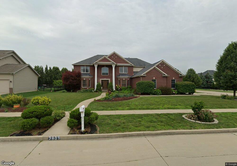
2901 Degarmo Dr Bloomington, IL 61704
Hedgewood NeighborhoodEstimated Value: $542,000 - $645,000
5
Beds
5
Baths
5,615
Sq Ft
$106/Sq Ft
Est. Value
About This Home
This home is located at 2901 Degarmo Dr, Bloomington, IL 61704 and is currently estimated at $597,591, approximately $106 per square foot. 2901 Degarmo Dr is a home located in McLean County with nearby schools including Northpoint Elementary School, Kingsley Junior High School, and Normal Community High School.
Ownership History
Date
Name
Owned For
Owner Type
Purchase Details
Closed on
Dec 9, 2008
Sold by
Armstrong Builders Inc
Bought by
Gupta Nalin K and Aggarwal Neha
Current Estimated Value
Home Financials for this Owner
Home Financials are based on the most recent Mortgage that was taken out on this home.
Original Mortgage
$400,000
Interest Rate
6.19%
Purchase Details
Closed on
Jun 4, 2008
Sold by
Park Ii Llc
Bought by
Armstrong Builders Inc
Create a Home Valuation Report for This Property
The Home Valuation Report is an in-depth analysis detailing your home's value as well as a comparison with similar homes in the area
Home Values in the Area
Average Home Value in this Area
Purchase History
| Date | Buyer | Sale Price | Title Company |
|---|---|---|---|
| Gupta Nalin K | $500,000 | None Available | |
| Armstrong Builders Inc | $70,000 | None Available |
Source: Public Records
Mortgage History
| Date | Status | Borrower | Loan Amount |
|---|---|---|---|
| Closed | Gupta Nalin K | $400,000 |
Source: Public Records
Tax History
| Year | Tax Paid | Tax Assessment Tax Assessment Total Assessment is a certain percentage of the fair market value that is determined by local assessors to be the total taxable value of land and additions on the property. | Land | Improvement |
|---|---|---|---|---|
| 2024 | $14,304 | $207,054 | $28,881 | $178,173 |
| 2022 | $14,304 | $167,886 | $23,418 | $144,468 |
| 2021 | $13,755 | $159,843 | $22,296 | $137,547 |
| 2020 | $13,772 | $159,843 | $22,296 | $137,547 |
| 2019 | $13,325 | $159,843 | $22,296 | $137,547 |
| 2018 | $13,312 | $159,843 | $22,296 | $137,547 |
| 2017 | $12,772 | $159,843 | $22,296 | $137,547 |
| 2016 | $12,567 | $157,792 | $22,010 | $135,782 |
| 2015 | $12,395 | $155,706 | $21,719 | $133,987 |
| 2014 | $12,145 | $154,327 | $21,719 | $132,608 |
| 2013 | -- | $154,327 | $21,719 | $132,608 |
Source: Public Records
Map
Nearby Homes
- 2110 Sinclair Ct
- 2807 Vrooman Ct
- 2812 Vrooman Ct
- 9 Spruce Ct
- 11 Spruce Ct
- 2703 Vrooman Ct
- 2813 Stonehurst
- 2215 Woodfield Rd
- 1903 Oakwood Ave
- 404 Lake Shore Cir
- 10 Cameron Ct
- 3211 Leafy Ln
- 7 Melrose Ct
- Lot D Fort Jesse Rd
- Lot F Fort Jesse Rd
- Lot E Fort Jesse Rd
- 1 Worthington Ct
- 1 Windsong Way
- 3679 Madras Dr
- 2822 Chesapeake Ln
- 2903 Degarmo Dr
- 2007 Stone Mountain Blvd
- 2819 Degarmo Dr
- 2902 Degarmo Dr
- 2905 Degarmo Dr
- 2904 Degarmo Dr
- 2005 Stone Mountain Blvd
- 4 Litta Ct
- 2101 Fifer Dr
- 2906 Degarmo Dr
- 2817 Degarmo Dr
- 2907 Degarmo Dr
- 1 Litta Ct
- 2818 Powell Dr
- 6 Litta Ct
- 2003 Stone Mountain Blvd
- 2908 Degarmo Dr
- 2103 Fifer Dr
- 2817 Powell Dr
- 2815 Degarmo Dr
Your Personal Tour Guide
Ask me questions while you tour the home.