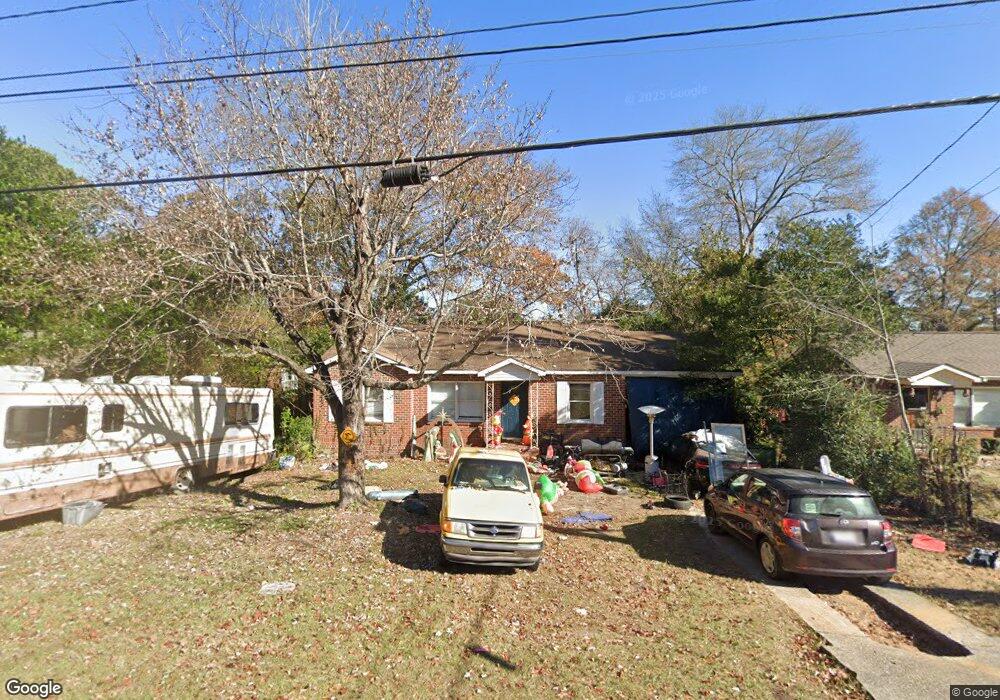
2901 W Britt David Rd Columbus, GA 31909
North Columbus NeighborhoodEstimated Value: $156,235 - $189,000
3
Beds
3
Baths
1,400
Sq Ft
$121/Sq Ft
Est. Value
About This Home
This home is located at 2901 W Britt David Rd, Columbus, GA 31909 and is currently estimated at $170,059, approximately $121 per square foot. 2901 W Britt David Rd is a home located in Muscogee County with nearby schools including Allen Elementary School, Arnold Middle School, and Jordan Vocational High School.
Ownership History
Date
Name
Owned For
Owner Type
Purchase Details
Closed on
Feb 1, 2012
Sold by
Parker Ronald Wayne
Bought by
Leddon Krystal
Current Estimated Value
Home Financials for this Owner
Home Financials are based on the most recent Mortgage that was taken out on this home.
Original Mortgage
$67,900
Interest Rate
3.92%
Mortgage Type
New Conventional
Create a Home Valuation Report for This Property
The Home Valuation Report is an in-depth analysis detailing your home's value as well as a comparison with similar homes in the area
Home Values in the Area
Average Home Value in this Area
Purchase History
We collect this data history from publicly available records. To have your information removed, we recommend requesting removal directly through your county’s website.
| Date | Buyer | Sale Price | Title Company |
|---|---|---|---|
| Leddon Krystal | $71,900 | -- |
Source: Public Records
Mortgage History
We collect this data history from publicly available records. To have your information removed, we recommend requesting removal directly through your county’s website.
| Date | Status | Borrower | Loan Amount |
|---|---|---|---|
| Closed | Leddon Krystal | $67,900 |
Source: Public Records
Tax History
| Year | Tax Paid | Tax Assessment Tax Assessment Total Assessment is a certain percentage of the fair market value that is determined by local assessors to be the total taxable value of land and additions on the property. | Land | Improvement |
|---|---|---|---|---|
| 2025 | $4,848 | $45,544 | $8,352 | $37,192 |
| 2024 | $3,610 | $45,544 | $8,352 | $37,192 |
| 2023 | $198 | $45,544 | $8,352 | $37,192 |
| 2022 | $925 | $39,364 | $8,352 | $31,012 |
| 2021 | $1,037 | $35,872 | $8,352 | $27,520 |
| 2020 | $918 | $35,872 | $8,352 | $27,520 |
| 2019 | $923 | $35,872 | $8,352 | $27,520 |
| 2018 | $923 | $35,872 | $8,352 | $27,520 |
| 2017 | $3,319 | $35,872 | $8,352 | $27,520 |
| 2016 | $1,367 | $33,139 | $4,229 | $28,910 |
| 2015 | $269 | $16,272 | $4,229 | $12,043 |
| 2014 | $476 | $28,760 | $4,229 | $24,531 |
| 2013 | -- | $28,760 | $4,229 | $24,531 |
Source: Public Records
Map
Nearby Homes
- 2900 Piper St
- 3035 Mustang Dr
- 2910 Beech St
- 5724 Sanford Ave
- 3121 Bellanca St
- 3229 Jottings Dr
- 5740 Springhill Ave
- 5 Neassie Ct
- 5818 Winvelly Dr
- 6018 Boeing Dr
- 2528 Lorraine St
- 2516 Lorraine St
- 5805 Fairchild Dr
- 2996 Blanchard Place
- 5435 Wayne Dr
- 5630 Lorenzo Rd
- 2628 52nd St
- 2201 Westminster Way
- 2325 Coventry Dr
- 3626 Grier Ave
- 2907 W Britt David Rd
- 2899 W Britt David Rd
- 2913 W Britt David Rd
- 2895 W Britt David Rd
- 5529 Perry Ave
- 5525 Perry Ave
- 5533 Perry Ave
- 2891 W Britt David Rd
- 2919 W Britt David Rd
- 5519 Perry Ave
- 5539 Perry Ave
- 2927 W Britt David Rd
- 5513 Perry Ave
- 2887 W Britt David Rd
- 2909 Piper St
- 5543 Perry Ave
- 5524 Perry Ave
- 2881 W Britt David Rd
- 2935 W Britt David Rd
- 5503 Perry Ave
Your Personal Tour Guide
Ask me questions while you tour the home.