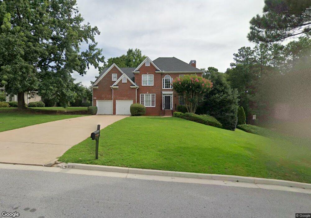
2901 Weatherstone Cir SE Unit 5 Conyers, GA 30094
Estimated Value: $357,613 - $443,000
4
Beds
4
Baths
2,656
Sq Ft
$153/Sq Ft
Est. Value
About This Home
This home is located at 2901 Weatherstone Cir SE Unit 5, Conyers, GA 30094 and is currently estimated at $405,903, approximately $152 per square foot. 2901 Weatherstone Cir SE Unit 5 is a home located in Rockdale County with nearby schools including Flat Shoals Elementary School, Edwards Middle School, and Rockdale County High School.
Ownership History
Date
Name
Owned For
Owner Type
Purchase Details
Closed on
Jun 29, 1998
Sold by
D R Horton Inc
Bought by
Williams Ii Percy and Williams Sandra
Current Estimated Value
Home Financials for this Owner
Home Financials are based on the most recent Mortgage that was taken out on this home.
Original Mortgage
$155,800
Outstanding Balance
$31,994
Interest Rate
7.04%
Mortgage Type
New Conventional
Estimated Equity
$373,909
Create a Home Valuation Report for This Property
The Home Valuation Report is an in-depth analysis detailing your home's value as well as a comparison with similar homes in the area
Home Values in the Area
Average Home Value in this Area
Purchase History
| Date | Buyer | Sale Price | Title Company |
|---|---|---|---|
| Williams Ii Percy | $194,800 | -- |
Source: Public Records
Mortgage History
| Date | Status | Borrower | Loan Amount |
|---|---|---|---|
| Open | Williams Ii Percy | $155,800 |
Source: Public Records
Tax History Compared to Growth
Tax History
| Year | Tax Paid | Tax Assessment Tax Assessment Total Assessment is a certain percentage of the fair market value that is determined by local assessors to be the total taxable value of land and additions on the property. | Land | Improvement |
|---|---|---|---|---|
| 2024 | $4,254 | $170,040 | $30,920 | $139,120 |
| 2023 | $3,645 | $151,760 | $30,800 | $120,960 |
| 2022 | $2,907 | $123,040 | $24,960 | $98,080 |
| 2021 | $2,570 | $103,320 | $20,800 | $82,520 |
| 2020 | $2,298 | $90,920 | $17,760 | $73,160 |
| 2019 | $2,141 | $83,960 | $10,800 | $73,160 |
| 2018 | $1,899 | $75,720 | $10,800 | $64,920 |
| 2017 | $1,765 | $70,640 | $10,800 | $59,840 |
| 2016 | $1,631 | $70,640 | $10,800 | $59,840 |
| 2015 | $1,388 | $62,160 | $9,320 | $52,840 |
| 2014 | $1,060 | $55,080 | $8,000 | $47,080 |
| 2013 | -- | $89,320 | $13,600 | $75,720 |
Source: Public Records
Map
Nearby Homes
- Boston Plan at Millers Pointe
- Atlanta Plan at Millers Pointe
- Columbus Plan at Millers Pointe
- 2464 Lennox Rd SE
- 2608 Downing Park Dr SE
- 784 Stieff Ct SE
- 2537 Lennox Rd SE
- 2197 Boxwood Cir
- 1420 Hillside Place SE
- Astrid Plan at Alder Park
- Harrison Plan at Alder Park
- Baker Plan at Alder Park
- Oliver Plan at Alder Park
- 340 Windsor Walk SE
- 1508 Hillside Dr SE
- 2631 Rolling Hills Way SE
- 1511 Hillside Dr SE
- 1601 Creek Crossing SE
- 309 Windsor Walk SE Unit 1
- 660 Kirkus Dr SE
- 3001 Weldon Place SE
- 2891 Weatherstone Cir SE
- 3011 Weldon Place SE
- 2881 Weatherstone Cir SE
- 3021 Weldon Place SE Unit 5
- 2890 Weatherstone Cir SE Unit 5
- 2890 Weatherstone Cir SE
- 2900 Weatherstone Cir SE
- 3000 Weldon Place SE Unit 5
- 2910 Weatherstone Cir SE Unit 5
- 2871 Weatherstone Cir SE
- 2880 Weatherstone Cir SE Unit 7
- 3010 Weldon Place SE
- 2920 Weatherstone Cir SE
- 3031 Weldon Place SE
- 2870 Weatherstone Cir SE Unit 7
- 2951 Weatherstone Cir SE
- 3020 Weldon Place SE Unit 5
- 2861 Weatherstone Cir SE Unit 7
- 2930 Weatherstone Cir SE