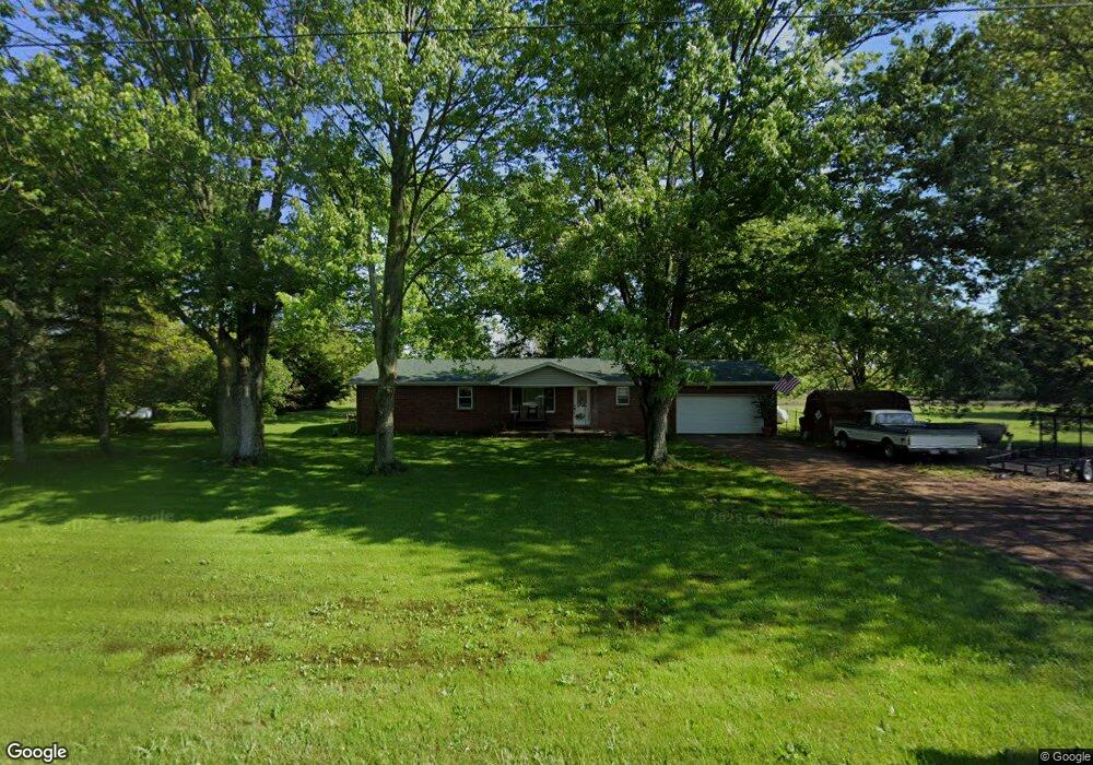
29013 State Route 281 Defiance, OH 43512
Estimated Value: $172,000 - $184,000
3
Beds
2
Baths
1,692
Sq Ft
$106/Sq Ft
Est. Value
About This Home
This home is located at 29013 State Route 281, Defiance, OH 43512 and is currently estimated at $179,557, approximately $106 per square foot. 29013 State Route 281 is a home located in Defiance County with nearby schools including Ayersville Elementary School and Ayersville High School.
Ownership History
Date
Name
Owned For
Owner Type
Purchase Details
Closed on
May 18, 2022
Sold by
Inbody David E and Inbody Kimberly A
Bought by
Davis James L and Wauer Andrea D
Current Estimated Value
Home Financials for this Owner
Home Financials are based on the most recent Mortgage that was taken out on this home.
Original Mortgage
$114,000
Outstanding Balance
$94,827
Interest Rate
4.48%
Mortgage Type
New Conventional
Estimated Equity
$84,730
Purchase Details
Closed on
Feb 1, 1993
Bought by
Inbody David E and Inbody Kimberly A
Create a Home Valuation Report for This Property
The Home Valuation Report is an in-depth analysis detailing your home's value as well as a comparison with similar homes in the area
Home Values in the Area
Average Home Value in this Area
Purchase History
| Date | Buyer | Sale Price | Title Company |
|---|---|---|---|
| Davis James L | -- | None Listed On Document | |
| Inbody David E | $60,000 | -- |
Source: Public Records
Mortgage History
| Date | Status | Borrower | Loan Amount |
|---|---|---|---|
| Open | Davis James L | $114,000 |
Source: Public Records
Tax History Compared to Growth
Tax History
| Year | Tax Paid | Tax Assessment Tax Assessment Total Assessment is a certain percentage of the fair market value that is determined by local assessors to be the total taxable value of land and additions on the property. | Land | Improvement |
|---|---|---|---|---|
| 2024 | $1,548 | $41,890 | $2,710 | $39,180 |
| 2023 | $1,548 | $41,890 | $2,710 | $39,180 |
| 2022 | $1,592 | $35,890 | $2,540 | $33,350 |
| 2021 | $1,592 | $35,890 | $2,540 | $33,350 |
| 2020 | $1,622 | $35,890 | $2,540 | $33,350 |
| 2019 | $1,577 | $33,790 | $3,550 | $30,240 |
| 2018 | $1,487 | $33,790 | $3,550 | $30,240 |
| 2017 | $1,478 | $33,796 | $3,552 | $30,244 |
| 2016 | $1,367 | $31,615 | $3,552 | $28,063 |
| 2015 | $1,339 | $31,615 | $3,552 | $28,063 |
| 2014 | $1,339 | $31,615 | $3,552 | $28,063 |
| 2013 | $1,339 | $31,615 | $3,552 | $28,063 |
| 2012 | $1,339 | $31,616 | $3,553 | $28,063 |
Source: Public Records
Map
Nearby Homes
- 29432 State Route 18
- 28618 Steinmaier Rd
- 1459 Deerwood Dr
- 846 Deerwood Dr
- 850 Deerwood Dr
- 1365 Heatherdowns Dr
- 1408 Heatherdowns Dr
- 1819 Maumee Dr
- 649 Burning Tree Dr
- 673 Burning Tree Dr
- 679 Burning Tree Dr
- 655 Burning Tree Dr
- 1275 Byrnwyck Ct
- 1275 Pinehurst Dr
- 1935 Edgewood Dr
- 1768 Elmwood Dr
- 1702 E Hopkins St
- 26110 Elizabeth St
- H011 County Road 17
- 525 Tiedeman Ave
- 28985 State Route 281
- 28965 State Route 281
- 29059 State Route 281
- 28970 State Route 281
- 28949 State Route 281
- 29095 State Route 281
- 10900 Stevens Rd
- 28913 State Route 281
- 28875 State Route 281
- 28835 State Route 281
- 28799 State Route 281
- 29257 State Route 281
- 29268 State Route 281
- 28755 State Route 281
- 29327 State Route 281
- 28657 State Route 281
- 29393 State Route 281
- 28614 State Route 281
- 10415 Stevens Rd
- 29438 State Route 281