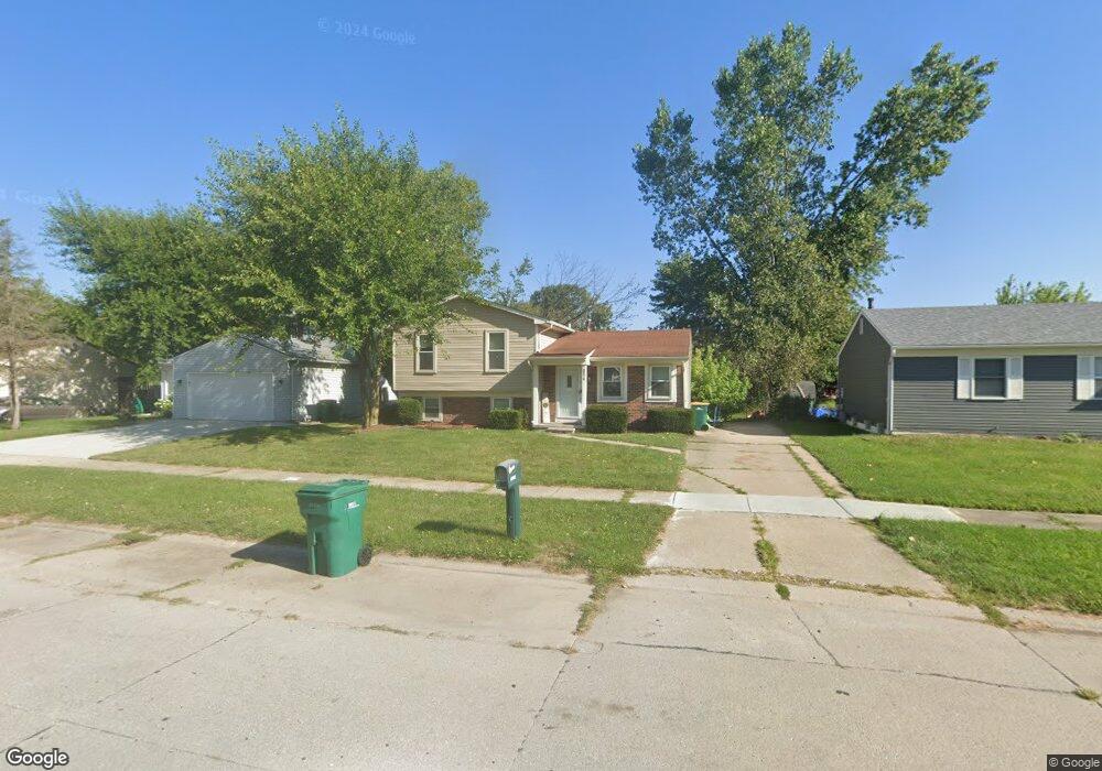
29018 Burning Tree Ln Unit Bldg-Unit Romulus, MI 48174
Estimated Value: $179,000 - $234,000
3
Beds
2
Baths
1,310
Sq Ft
$157/Sq Ft
Est. Value
About This Home
This home is located at 29018 Burning Tree Ln Unit Bldg-Unit, Romulus, MI 48174 and is currently estimated at $205,330, approximately $156 per square foot. 29018 Burning Tree Ln Unit Bldg-Unit is a home located in Wayne County with nearby schools including Halecreek Elementary School, Romulus Middle School, and Romulus Senior High School.
Ownership History
Date
Name
Owned For
Owner Type
Purchase Details
Closed on
Apr 16, 2018
Sold by
Gilje Vahidin
Bought by
Brunson Bryn
Current Estimated Value
Purchase Details
Closed on
Jan 11, 2013
Sold by
Dixon Michael and Dixon Lanie L
Bought by
Giljic Vahidin
Purchase Details
Closed on
Jan 13, 2003
Sold by
Mckinney James A and Mckinney Carla
Bought by
Dixon Michael
Create a Home Valuation Report for This Property
The Home Valuation Report is an in-depth analysis detailing your home's value as well as a comparison with similar homes in the area
Home Values in the Area
Average Home Value in this Area
Purchase History
| Date | Buyer | Sale Price | Title Company |
|---|---|---|---|
| Brunson Bryn | $97,500 | Conetitle Llc | |
| Giljic Vahidin | $32,000 | Progressive Title | |
| Dixon Michael | $106,000 | Multiple |
Source: Public Records
Tax History
| Year | Tax Paid | Tax Assessment Tax Assessment Total Assessment is a certain percentage of the fair market value that is determined by local assessors to be the total taxable value of land and additions on the property. | Land | Improvement |
|---|---|---|---|---|
| 2025 | $2,434 | $100,100 | $0 | $0 |
| 2024 | $2,445 | $93,500 | $0 | $0 |
| 2023 | $2,357 | $78,800 | $0 | $0 |
| 2022 | $2,761 | $76,600 | $0 | $0 |
| 2021 | $2,677 | $58,600 | $0 | $0 |
| 2020 | $2,631 | $58,000 | $0 | $0 |
| 2019 | $2,631 | $45,900 | $0 | $0 |
| 2018 | $1,504 | $46,000 | $0 | $0 |
| 2017 | $964 | $45,400 | $0 | $0 |
| 2016 | $2,446 | $39,100 | $0 | $0 |
| 2015 | $3,470 | $34,700 | $0 | $0 |
| 2013 | $4,260 | $42,600 | $0 | $0 |
| 2012 | $1,268 | $41,200 | $4,700 | $36,500 |
Source: Public Records
Map
Nearby Homes
- 28567 Forest Dale St
- 28510 Halecreek St
- 15654 Isabelle St
- 16265 Harrison
- 16110 Farnum St
- 16277 Harrison
- 28339 Leroy St
- 16068 Middlebelt Rd
- 29067 Cullen Dr Unit BLDG8
- 16913 Aberdeen Dr Unit 220
- 15630 Harrison
- 15756 Woodmont St
- 15900 Sandburg St
- 15486 Orchard St
- 15350 Woodmont St
- 30058 Halecreek St
- 00 Eureka Rd
- 15527 Meadow St
- 15447 Anthony St
- 30294 Cherry Ave
- 29018 Burning Tree Ln
- 29006 Burning Tree Ln
- 29030 Burning Tree Ln
- 29007 Leroy St
- 29042 Burning Tree Ln
- 28856 Burning Tree Ln
- 29021 Leroy St
- 28867 Leroy St
- 29054 Burning Tree Ln
- 29035 Leroy St
- 28853 Leroy St
- 29025 Burning Tree Ln
- 28861 Burning Tree Ln
- 28842 Burning Tree Ln
- 29039 Burning Tree Ln
- 29049 Leroy St
- 28839 Leroy St
- 28828 Burning Tree Ln
- 29066 Burning Tree Ln
- 29051 Burning Tree Ln
Your Personal Tour Guide
Ask me questions while you tour the home.