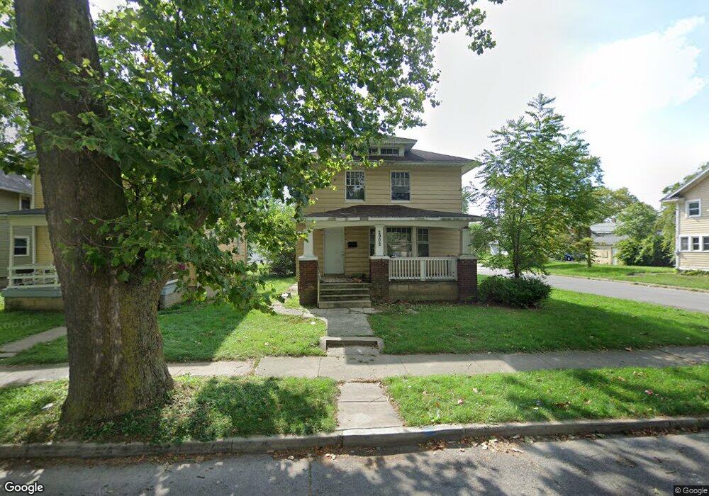
2902 Euclid Ave Fort Wayne, IN 46806
Pontiac Place NeighborhoodEstimated Value: $94,000 - $109,000
4
Beds
2
Baths
1,836
Sq Ft
$57/Sq Ft
Est. Value
About This Home
This home is located at 2902 Euclid Ave, Fort Wayne, IN 46806 and is currently estimated at $104,202, approximately $56 per square foot. 2902 Euclid Ave is a home located in Allen County with nearby schools including Lincoln Elementary School, Shawnee Middle School, and Northrop High School.
Ownership History
Date
Name
Owned For
Owner Type
Purchase Details
Closed on
Nov 8, 2011
Sold by
2902 Euclid Ave Land Trust
Bought by
Chicago Equity Trust Llc
Current Estimated Value
Purchase Details
Closed on
Dec 22, 2006
Sold by
Kinniry Brian Patrick
Bought by
2902 Euclid Ave Land Trust and Renew Realty
Purchase Details
Closed on
Nov 3, 2005
Sold by
Foundation Support Trust
Bought by
Kinniry Brian P
Home Financials for this Owner
Home Financials are based on the most recent Mortgage that was taken out on this home.
Original Mortgage
$50,400
Interest Rate
7.5%
Mortgage Type
Fannie Mae Freddie Mac
Purchase Details
Closed on
Mar 28, 2003
Sold by
Kinniry Brian
Bought by
Renew Realty Llc
Purchase Details
Closed on
Nov 14, 2002
Sold by
Brames Richard L and Rodenbeck Susan
Bought by
Kinniry Brian
Create a Home Valuation Report for This Property
The Home Valuation Report is an in-depth analysis detailing your home's value as well as a comparison with similar homes in the area
Home Values in the Area
Average Home Value in this Area
Purchase History
| Date | Buyer | Sale Price | Title Company |
|---|---|---|---|
| Chicago Equity Trust Llc | $1,481 | None Available | |
| 2902 Euclid Ave Land Trust | -- | None Available | |
| Kinniry Brian P | -- | Progressive Land Title | |
| Renew Realty Llc | -- | Metropolitan Title In Llc | |
| Kinniry Brian | -- | Metropolitan Title Indiana L |
Source: Public Records
Mortgage History
| Date | Status | Borrower | Loan Amount |
|---|---|---|---|
| Previous Owner | Kinniry Brian P | $50,400 |
Source: Public Records
Tax History Compared to Growth
Tax History
| Year | Tax Paid | Tax Assessment Tax Assessment Total Assessment is a certain percentage of the fair market value that is determined by local assessors to be the total taxable value of land and additions on the property. | Land | Improvement |
|---|---|---|---|---|
| 2024 | $1,404 | $71,500 | $11,400 | $60,100 |
| 2022 | $1,146 | $51,000 | $4,300 | $46,700 |
| 2021 | $764 | $34,100 | $600 | $33,500 |
| 2020 | $670 | $30,600 | $700 | $29,900 |
| 2019 | $636 | $29,200 | $1,100 | $28,100 |
| 2018 | $592 | $27,000 | $1,100 | $25,900 |
| 2017 | $560 | $25,300 | $1,100 | $24,200 |
| 2016 | $488 | $22,400 | $1,100 | $21,300 |
| 2014 | $281 | $13,500 | $1,100 | $12,400 |
| 2013 | $241 | $11,600 | $1,100 | $10,500 |
Source: Public Records
Map
Nearby Homes
- 1629 Colerick St
- 442 E Pontiac St
- 1115 E Pontiac St
- 1131 E Pontiac St
- 1117 E Pontiac St
- 3110 Central Dr
- 3201 S Anthony Blvd
- 3105 Plaza Dr
- 2832 Abbott St
- 3025 Holton Ave
- 3002 Holton Ave
- 3123 Holton Ave
- 2747 Abbott St
- 3213 Robinwood Dr
- 3314 Reed St
- 2222 Drexel Ave
- 1220 Colerick St
- 3115 Bowser Ave
- 1411 Fisher St
- 1514 E Creighton Ave
- 2908 Euclid Ave
- 2912 Euclid Ave
- 2916 Euclid Ave
- 2818 Euclid Ave
- 2905 S Anthony Blvd
- 2918 Euclid Ave
- 2821 S Anthony Blvd
- 2814 Euclid Ave
- 1902 Mckee St
- 2915 S Anthony Blvd
- 2817 S Anthony Blvd
- 2821 Euclid Ave
- 2810 Euclid Ave
- 2917 S Anthony Blvd
- 2913 Euclid Ave
- 2815 S Anthony Blvd
- 2817 Euclid Ave
- 2926 Euclid Ave
- 2921 S Anthony Blvd
- 2815 Euclid Ave