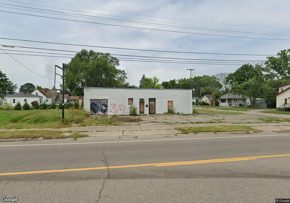
2902 Fenton Rd Flint, MI 48507
South Side NeighborhoodEstimated Value: $22,037
--
Bed
--
Bath
1,200
Sq Ft
$18/Sq Ft
Est. Value
About This Home
This home is located at 2902 Fenton Rd, Flint, MI 48507 and is currently priced at $22,037, approximately $18 per square foot. 2902 Fenton Rd is a home located in Genesee County with nearby schools including Eisenhower School, Flint Southwestern Classical Academy, and International Academy of Flint (K-12).
Ownership History
Date
Name
Owned For
Owner Type
Purchase Details
Closed on
Jun 20, 2017
Sold by
Bourdon Rolland Lee
Bought by
Benson Robert Patrick
Current Estimated Value
Purchase Details
Closed on
Dec 9, 2009
Sold by
Franzel Leonard G and Franzel Carole M
Bought by
Bourdon Rolland Lee
Purchase Details
Closed on
Feb 15, 2000
Sold by
Linn Gerald S
Bought by
Franzel Leonard G and Franzel Carole M
Home Financials for this Owner
Home Financials are based on the most recent Mortgage that was taken out on this home.
Original Mortgage
$20,000
Interest Rate
8.29%
Mortgage Type
Seller Take Back
Create a Home Valuation Report for This Property
The Home Valuation Report is an in-depth analysis detailing your home's value as well as a comparison with similar homes in the area
Home Values in the Area
Average Home Value in this Area
Purchase History
| Date | Buyer | Sale Price | Title Company |
|---|---|---|---|
| Benson Robert Patrick | -- | None Available | |
| Bourdon Rolland Lee | $10,000 | Sky Title Agency | |
| Franzel Leonard G | $20,000 | -- |
Source: Public Records
Mortgage History
| Date | Status | Borrower | Loan Amount |
|---|---|---|---|
| Previous Owner | Franzel Leonard G | $20,000 | |
| Closed | Benson Robert Patrick | $0 |
Source: Public Records
Tax History Compared to Growth
Tax History
| Year | Tax Paid | Tax Assessment Tax Assessment Total Assessment is a certain percentage of the fair market value that is determined by local assessors to be the total taxable value of land and additions on the property. | Land | Improvement |
|---|---|---|---|---|
| 2025 | $1,886 | $31,900 | $0 | $0 |
| 2024 | $1,711 | $37,000 | $0 | $0 |
| 2023 | $1,650 | $25,500 | $0 | $0 |
| 2022 | $0 | $24,600 | $0 | $0 |
| 2021 | $1,721 | $22,400 | $0 | $0 |
| 2020 | $1,555 | $22,200 | $0 | $0 |
| 2019 | $1,920 | $23,600 | $0 | $0 |
| 2018 | $1,711 | $23,500 | $0 | $0 |
| 2017 | $1,104 | $0 | $0 | $0 |
| 2016 | $1,980 | $0 | $0 | $0 |
| 2015 | -- | $0 | $0 | $0 |
| 2014 | -- | $0 | $0 | $0 |
| 2012 | -- | $29,900 | $0 | $0 |
Source: Public Records
Map
Nearby Homes
- 909 Barrie Ave
- 930 Bloor Ave
- 839 SiMcOe Ave
- 839 Barrie Ave
- 843 Ossington Ave
- 842 Ossington Ave
- 943 Paddington Ave
- 936 Lincoln Ave
- 820 Vermilya Ave
- 825 Vermilya Ave
- 741 Barrie Ave
- 812 Remington Ave
- 805 Vermilya Ave
- 734 Barrie Ave
- 1101 Lincoln Ave
- 745 Freeman Ave
- 730 Freeman Ave
- 1225 Vermilya Ave
- 1209 Lincoln Ave
- 657 Barrie Ave
- 1011 Barrie Ave
- 1014 SiMcOe Ave
- 1015 Barrie Ave
- 1018 SiMcOe Ave
- 2917 Fenton Rd
- 1019 Barrie Ave
- 1010 Barrie Ave
- 3005 Fenton Rd
- 1016 Barrie Ave
- 2810 Fenton Rd
- 942 SiMcOe Ave
- 1022 SiMcOe Ave
- 941 Barrie Ave
- 1023 Barrie Ave
- 2802 Fenton Rd
- 1022 Barrie Ave
- 1030 SiMcOe Ave
- 938 SiMcOe Ave
- 955 SiMcOe Ave
- 1031 Barrie Ave