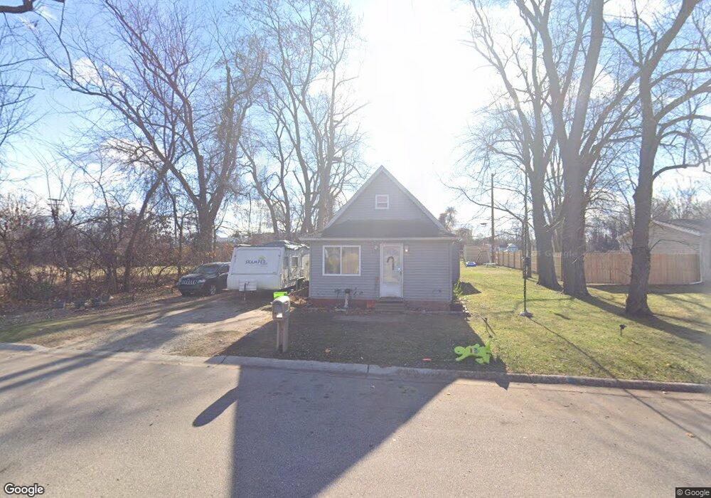
2902 John L Portis Dr Port Huron, MI 48060
Estimated Value: $60,157 - $88,000
2
Beds
1
Bath
748
Sq Ft
$91/Sq Ft
Est. Value
About This Home
This home is located at 2902 John L Portis Dr, Port Huron, MI 48060 and is currently estimated at $68,289, approximately $91 per square foot. 2902 John L Portis Dr is a home located in St. Clair County with nearby schools including Cleveland Elementary School, Central Middle School, and Port Huron High School.
Ownership History
Date
Name
Owned For
Owner Type
Purchase Details
Closed on
Sep 5, 2025
Sold by
Young Troy
Bought by
Renas Properties Llc
Current Estimated Value
Purchase Details
Closed on
May 20, 2011
Sold by
Citizens First Mortgage Llc
Bought by
Mcdowell Joseph D and Mcdowell Marcella
Purchase Details
Closed on
Mar 11, 2010
Sold by
Gunter Jessie
Bought by
Citizens First Mortgage Llc and Cf Bancorp Mortgage Company
Create a Home Valuation Report for This Property
The Home Valuation Report is an in-depth analysis detailing your home's value as well as a comparison with similar homes in the area
Home Values in the Area
Average Home Value in this Area
Purchase History
| Date | Buyer | Sale Price | Title Company |
|---|---|---|---|
| Renas Properties Llc | $58,000 | None Listed On Document | |
| Young Troy | $53,000 | Bell Title | |
| Mcdowell Joseph D | $7,500 | Parks Title | |
| Citizens First Mortgage Llc | $18,000 | None Available |
Source: Public Records
Tax History Compared to Growth
Tax History
| Year | Tax Paid | Tax Assessment Tax Assessment Total Assessment is a certain percentage of the fair market value that is determined by local assessors to be the total taxable value of land and additions on the property. | Land | Improvement |
|---|---|---|---|---|
| 2025 | $2,138 | $29,100 | $0 | $0 |
| 2024 | $887 | $25,900 | $0 | $0 |
| 2023 | $847 | $22,500 | $0 | $0 |
| 2022 | $770 | $19,000 | $0 | $0 |
| 2021 | $884 | $15,200 | $0 | $0 |
| 2020 | $693 | $13,400 | $13,400 | $0 |
| 2019 | $621 | $10,800 | $0 | $0 |
| 2018 | $608 | $10,800 | $0 | $0 |
| 2017 | $559 | $9,000 | $0 | $0 |
| 2016 | $483 | $9,000 | $0 | $0 |
| 2015 | $474 | $9,000 | $9,000 | $0 |
| 2014 | $474 | $8,800 | $8,800 | $0 |
| 2013 | -- | $8,800 | $0 | $0 |
Source: Public Records
Map
Nearby Homes
- 2702 Vanness St
- 2600 Vanness St
- 2513 Vanness St
- 2511 Vanness St
- 2506 Vanness St
- 0 Dove Rd Unit G31368528
- 3230 Ashland Ct
- 3548 Cleveland St
- 9999 Cleveland Ave
- 2627 24th St
- 3104 Sturges St
- 3830 Military St
- 9999 24th St
- 3136 Military St
- Lot 3 24th St
- 000 Gratiot Blvd
- 00 Gratiot Blvd
- 3333 Ravenswood Rd Unit 4A
- 3333 Ravenswood Rd
- 00 Moak St
- 2902 John L Portis Dr
- 2828 John L Portis Dr
- 2932 John L Portis Dr
- 2831 John L Portis Dr
- 2829 John L Portis Dr
- 2831 Nern St
- 3006 30th St
- 3000 30th St
- 3000 30th St
- 3000 30th St
- 3000 30th St
- 3000 30th St
- 3000 30th St
- 3000 30th St
- 2802 Nern St Unit 2802 John L Portis
- 2802 Nern St
- 3022 30th St
- 2802 John L Portis Dr
- 0 Nern St Unit 5433659
- 0 Nern St Unit 5519461