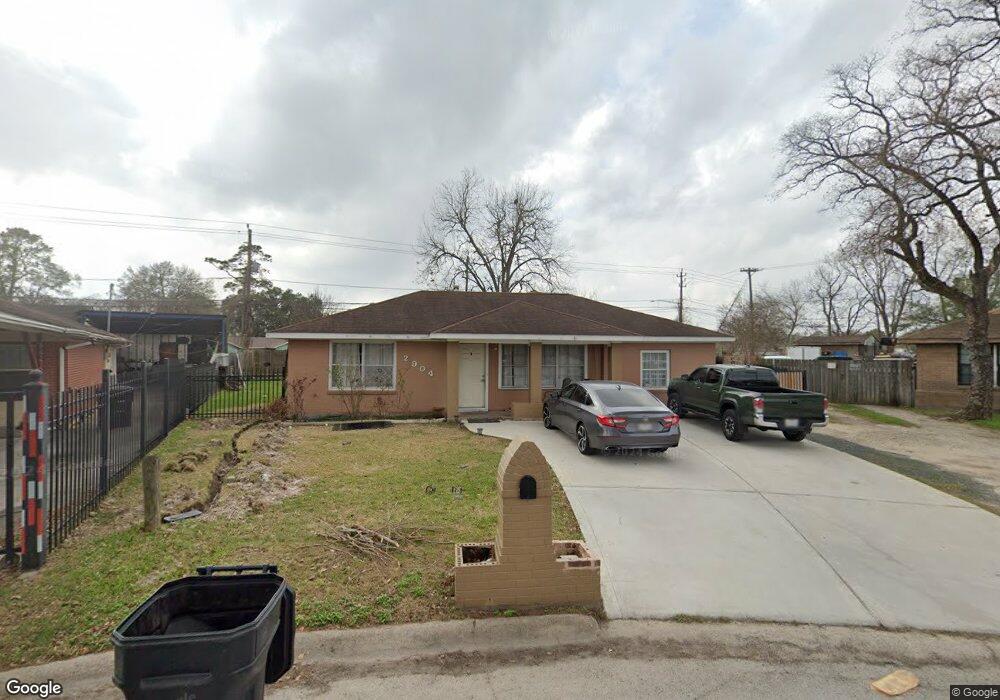
2904 Barksdale Dr Houston, TX 77093
Eastex-Jensen NeighborhoodEstimated Value: $185,000 - $213,000
1
Bed
1
Bath
1,632
Sq Ft
$120/Sq Ft
Est. Value
About This Home
This home is located at 2904 Barksdale Dr, Houston, TX 77093 and is currently estimated at $195,782, approximately $119 per square foot. 2904 Barksdale Dr is a home located in Harris County with nearby schools including Scarborough Elementary School, Patrick Henry Middle School, and Sam Houston Math, Science & Technology Center.
Ownership History
Date
Name
Owned For
Owner Type
Purchase Details
Closed on
Apr 24, 2014
Sold by
Barron Jose S
Bought by
Barron Maria Delaluz
Current Estimated Value
Purchase Details
Closed on
Apr 6, 1999
Sold by
Sommers Nolie B
Bought by
Barron Jose Concepcion
Home Financials for this Owner
Home Financials are based on the most recent Mortgage that was taken out on this home.
Original Mortgage
$55,250
Interest Rate
6.89%
Purchase Details
Closed on
Jul 30, 1996
Sold by
Sommers Knolie Beatrice and Sommers Cullen Thomas
Bought by
Sommers Knollie Beatrice
Create a Home Valuation Report for This Property
The Home Valuation Report is an in-depth analysis detailing your home's value as well as a comparison with similar homes in the area
Home Values in the Area
Average Home Value in this Area
Purchase History
| Date | Buyer | Sale Price | Title Company |
|---|---|---|---|
| Barron Maria Delaluz | -- | None Available | |
| Barron Jose Concepcion | -- | -- | |
| Sommers Knollie Beatrice | -- | -- |
Source: Public Records
Mortgage History
| Date | Status | Borrower | Loan Amount |
|---|---|---|---|
| Previous Owner | Barron Jose Concepcion | $55,250 |
Source: Public Records
Tax History Compared to Growth
Tax History
| Year | Tax Paid | Tax Assessment Tax Assessment Total Assessment is a certain percentage of the fair market value that is determined by local assessors to be the total taxable value of land and additions on the property. | Land | Improvement |
|---|---|---|---|---|
| 2025 | $1,610 | $204,995 | $73,235 | $131,760 |
| 2024 | $1,610 | $193,900 | $60,359 | $133,541 |
| 2023 | $1,610 | $194,855 | $60,359 | $134,496 |
| 2022 | $2,689 | $167,242 | $40,239 | $127,003 |
| 2021 | $2,588 | $125,298 | $26,155 | $99,143 |
| 2020 | $2,444 | $118,784 | $26,155 | $92,629 |
| 2019 | $2,322 | $109,587 | $22,131 | $87,456 |
| 2018 | $1,395 | $83,422 | $22,131 | $61,291 |
| 2017 | $2,109 | $83,422 | $22,131 | $61,291 |
| 2016 | $1,934 | $76,468 | $22,131 | $54,337 |
| 2015 | $1,674 | $76,468 | $22,131 | $54,337 |
| 2014 | $1,674 | $91,264 | $22,131 | $69,133 |
Source: Public Records
Map
Nearby Homes
- 1728 Little York Rd
- 1904 Little York Rd
- 2636 Lone Oak Rd
- 2629 Kowis St
- 4918 Langley Rd
- 2817 Cromwell St
- 3418 Hopper Rd
- 2315 Langley Rd
- 3804 Cedar Hill Ln
- 2332 Margaret St
- 2415 Goodloe St
- 3214 Brea Crest St
- 2915 Brea Crest St
- 2311 Warwick Rd
- 2237 Cromwell St
- 2152 William Tell St
- 3202 Parker Rd
- 2122 Kowis St
- 2326 Sunny Dr
- 11716 Innsbury Dr
- 10803 Royal Pine Dr
- 2908 Barksdale Dr
- 2912 Barksdale Dr
- 10807 Royal Pine Dr
- 2907 Barksdale Dr
- 10811 Royal Pine Dr
- 2916 Barksdale Dr
- 2907 Yorkwood St
- 2911 Barksdale Dr
- 2903 Yorkwood St
- 2911 Yorkwood St
- 10759 Royal Pine Dr
- 10815 Royal Pine Dr
- 2920 Barksdale Dr
- 2915 Yorkwood St
- 2915 Barksdale Dr
- 2908 Trenton Rd
- 2919 Yorkwood St
- 2912 Trenton Rd
- 10755 Royal Pine Dr