
2904 Broadview Dr NW Huntsville, AL 35810
Mastin Lake Park NeighborhoodAbout This Home
MOVE-IN READY
This home is move-in ready. Schedule your tour now or start your application today.
Monthly Recurring Fees:
$10.95 - Utility Management
Maymont Homes is committed to clear and upfront pricing. In addition to the advertised rent, residents may have monthly fees, including a $10.95 utility management fee, a $25.00 wastewater fee for homes on septic systems, and an amenity fee for homes with smart home technology, valet trash, or other community amenities. This does not include utilities or optional fees, including but not limited to pet fees and renter’s insurance.
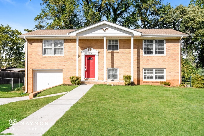
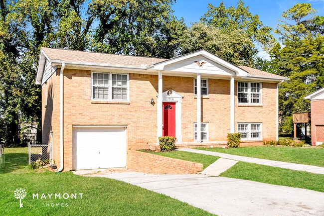
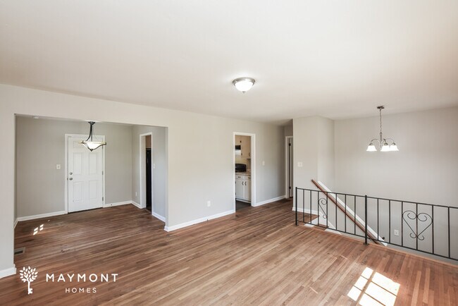
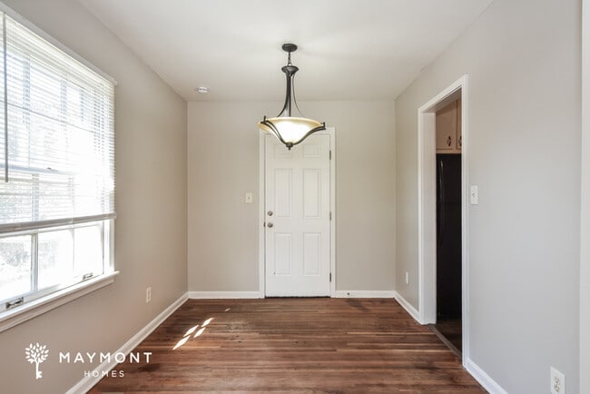
Welcome to this cozy 4-bedroom, 2-bathroom home offering 1,525 sq ft of comfort and functionality. With its generous layout, this home provides plenty of space to relax, entertain, and make your own.
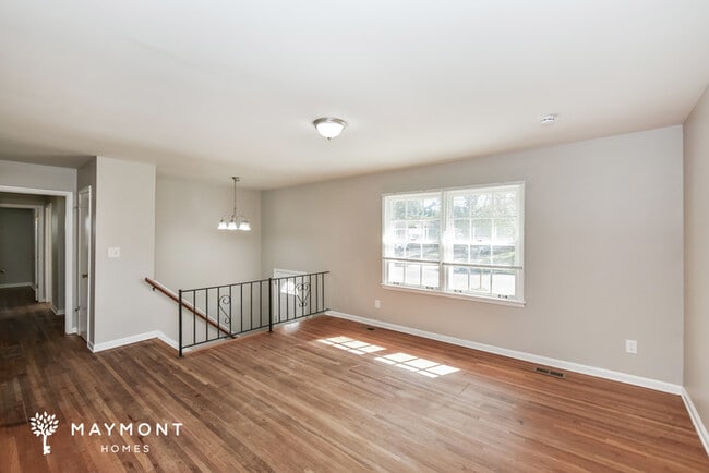
A classic column grand entrance sets the tone as you arrive, adding timeless curb appeal. Inside, the spacious eat-in kitchen is a true highlight, featuring matching appliances, abundant counter and cabinet space, and hardwood floors that bring warmth and character to the heart of the home. The living areas are designed for both comfort and style, making everyday living a breeze.
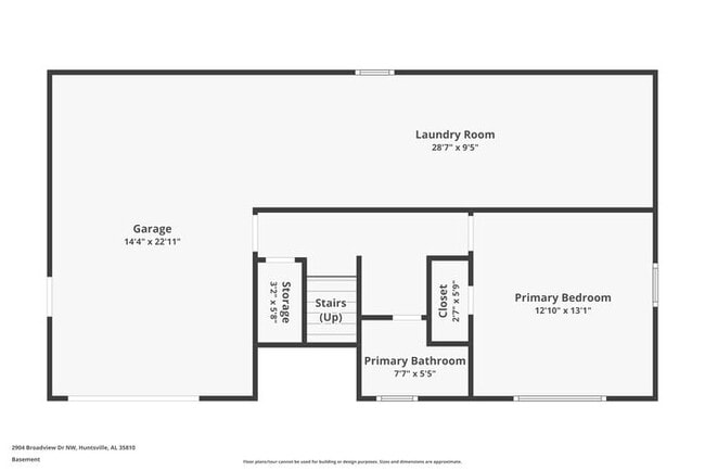
Additional features include a convenient one-car garage and a vaulted deck overlooking the large grassy backyard, perfect for outdoor dining, gatherings, or simply enjoying the fresh air.
Located in Huntsville, this home places you close to shopping, dining, and all the amenities the city has to offer.
Don’t miss out on this inviting property, apply today!
*Maymont Homes provides residents with convenient solutions, including simplified utility billing, a flexible rent payment option, and an affordable security deposit alternative. Visit our website or contact us for more details.
This information is deemed reliable, but not guaranteed. All measurements are approximate. Actual product and home specifications may vary in dimension or detail. Images are for representational purposes only. Some programs and services may not be available in all market areas.
Prices and availability are subject to change without notice. Advertised rent prices do not include the required application fee, the partially refundable reservation fee (due upon application approval), or the mandatory monthly utility management fee (in select market areas.) Residents must maintain renters insurance as specified in their lease. If third-party renters insurance is not provided, residents will be automatically enrolled in our Master Insurance Policy for a fee. Select homes may be located in communities that require a monthly fee for community-specific amenities or services.
For complete details, please contact a company leasing representative. Equal Housing Opportunity.
Estimated availability date is subject to change based on construction timelines and move-out confirmation.
This property allows self guided viewing without an appointment. Contact for details.

Map
Property History
| Date | Event | Price | List to Sale | Price per Sq Ft |
|---|---|---|---|---|
| 12/03/2025 12/03/25 | Price Changed | $1,425 | -1.4% | $1 / Sq Ft |
| 11/26/2025 11/26/25 | Price Changed | $1,445 | -3.3% | $1 / Sq Ft |
| 11/20/2025 11/20/25 | Price Changed | $1,495 | -3.2% | $1 / Sq Ft |
| 10/16/2025 10/16/25 | Price Changed | $1,545 | -3.1% | $1 / Sq Ft |
| 09/09/2025 09/09/25 | For Rent | $1,595 | -- | -- |
- 2818 Brett Rd NW
- 2904 Pulaski Pike NW
- 2906 Sparkman Dr NW
- 3129 Millbrook Dr NW
- 2814 Claiborne Rd NW
- 3121 Greenhill Dr NW
- 2901 Greenhill Dr NW
- 3605 Sparkman Dr NW
- 3116 Greenhill Dr NW
- 2917 Ford Place NW
- 3306 Reynolds Dr NW
- 3023 Greenhill Dr NW
- 3628 Grizzard Rd NW
- 3400 Brenda St NW
- 2603 Bonnie View Dr
- 2602 Carlsbad Dr NW
- 3.92 Acres Sparkman Dr NW
- 2420 Redmont Rd NW
- 3509 Fay St NW
- 3604 Knollwood Dr NW
- 3208 Harvey St NW
- 2814 Claiborne Rd NW
- 3304 Pulaski Pike NW
- 3319 Barton Ave NW
- 3207 Tucker Dr NW
- 3610 Dawnwood Dr NW
- 2711 Clayton Dr NW
- 2710 Cave Ave NW
- 2620 Thornhill Rd NW
- 3610 Williamsburg Dr NW
- 3721 Broadmor Rd NW
- 2640 Blue Spring Rd NW
- 2803 Mallory Ave NW
- 2201 Shady Lane Dr NW
- 4504 Raton Blvd NW
- 3930 Pulaski Pike NW
- 4712 Cavett Dr NW
- 4211 Tee Jay Dr NW
- 1729 Laverne Dr NW
- 1611 Clubview Dr NW