Estimated Value: $260,850 - $282,000
3
Beds
2
Baths
1,682
Sq Ft
$161/Sq Ft
Est. Value
About This Home
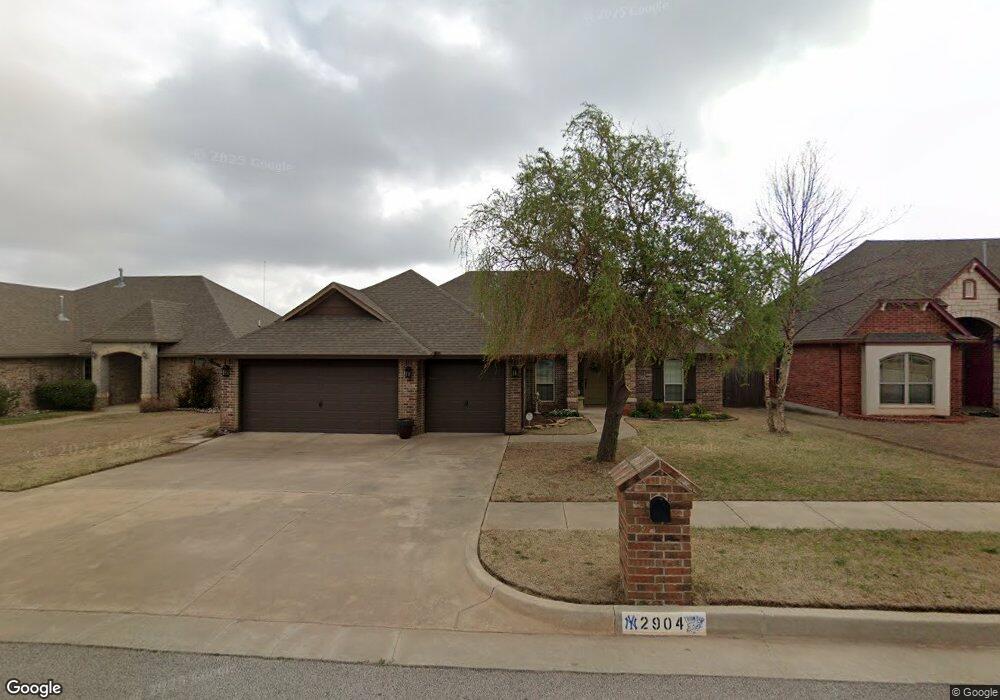
This home is located at 2904 Brookstone Ct, Moore, OK 73160 and is currently estimated at $270,463, approximately $160 per square foot. 2904 Brookstone Ct is a home with nearby schools including Bryant Elementary School, Central Junior High School, and Moore High School.
Ownership History
Date
Name
Owned For
Owner Type
Purchase Details
Closed on
Nov 2, 2012
Sold by
Harvest Homes Properties Llc
Bought by
Cross Matthew D and Cross Addie L
Current Estimated Value
Home Financials for this Owner
Home Financials are based on the most recent Mortgage that was taken out on this home.
Original Mortgage
$166,670
Outstanding Balance
$113,152
Interest Rate
3.4%
Mortgage Type
FHA
Estimated Equity
$157,311
Purchase Details
Closed on
Jan 6, 2011
Sold by
Ventura Homes Inc
Bought by
Harvest Homes Properties Llc
Home Financials for this Owner
Home Financials are based on the most recent Mortgage that was taken out on this home.
Original Mortgage
$140,800
Interest Rate
4.36%
Mortgage Type
Construction
Create a Home Valuation Report for This Property
The Home Valuation Report is an in-depth analysis detailing your home's value as well as a comparison with similar homes in the area
Home Values in the Area
Average Home Value in this Area
Purchase History
| Date | Buyer | Sale Price | Title Company |
|---|---|---|---|
| Cross Matthew D | $170,000 | None Available | |
| Harvest Homes Properties Llc | $33,000 | Fa |
Source: Public Records
Mortgage History
| Date | Status | Borrower | Loan Amount |
|---|---|---|---|
| Open | Cross Matthew D | $166,670 | |
| Previous Owner | Harvest Homes Properties Llc | $140,800 |
Source: Public Records
Tax History
| Year | Tax Paid | Tax Assessment Tax Assessment Total Assessment is a certain percentage of the fair market value that is determined by local assessors to be the total taxable value of land and additions on the property. | Land | Improvement |
|---|---|---|---|---|
| 2025 | $2,971 | $25,261 | $4,305 | $20,956 |
| 2023 | $2,779 | $23,811 | $4,083 | $19,728 |
| 2022 | $2,684 | $22,697 | $4,080 | $18,617 |
| 2021 | $2,613 | $22,036 | $4,123 | $17,913 |
| 2020 | $2,535 | $21,394 | $4,027 | $17,367 |
| 2016 | $2,535 | $20,771 | $3,900 | $16,871 |
Source: Public Records
Map
Nearby Homes
- 1201 NE 26th St
- 940 NE 28th St
- 1025 NE 32nd St
- 1025 NE 33rd Terrace
- 3440 Lakeside Dr
- 900 NE 34th Terrace
- 1001 NE 34th Terrace
- 1500 NE 33rd Terrace
- 904 NE 21st St
- 1113 NE 21st Ct
- 3509 Tahoe Dr
- 2617 Ethan Ln
- 2512 SE 93rd St
- 3304 Paul Dr
- 9109 Blackfork Ln
- 9108 Blackfork Ln
- 9105 Blackfork Ln
- 9104 Blackfork Ln
- Belmore Plus Plan at Sweetwater
- Wayne Plan at Sweetwater
- 2908 Brookstone Ct
- 2900 Brookstone Ct
- 2912 Brookstone Ct
- 2905 Brookstone Ct
- 2901 Brookstone Ct
- 1021 NE 27th St
- 2909 Brookstone Ct
- 2809 Brookstone Ct
- 3000 Brookstone Ct
- 1029 NE 27th St
- 1100 NE 29th St
- 2913 Brookstone Ct
- 2805 Brookstone Ct
- 3001 Brookstone Ct
- 3001 Bradford Dr
- 2801 Brookstone Ct
- 3005 Brookstone Ct
- 3004 Brookstone Ct
- 1010 NE 27th St
- 3009 Brookstone Ct