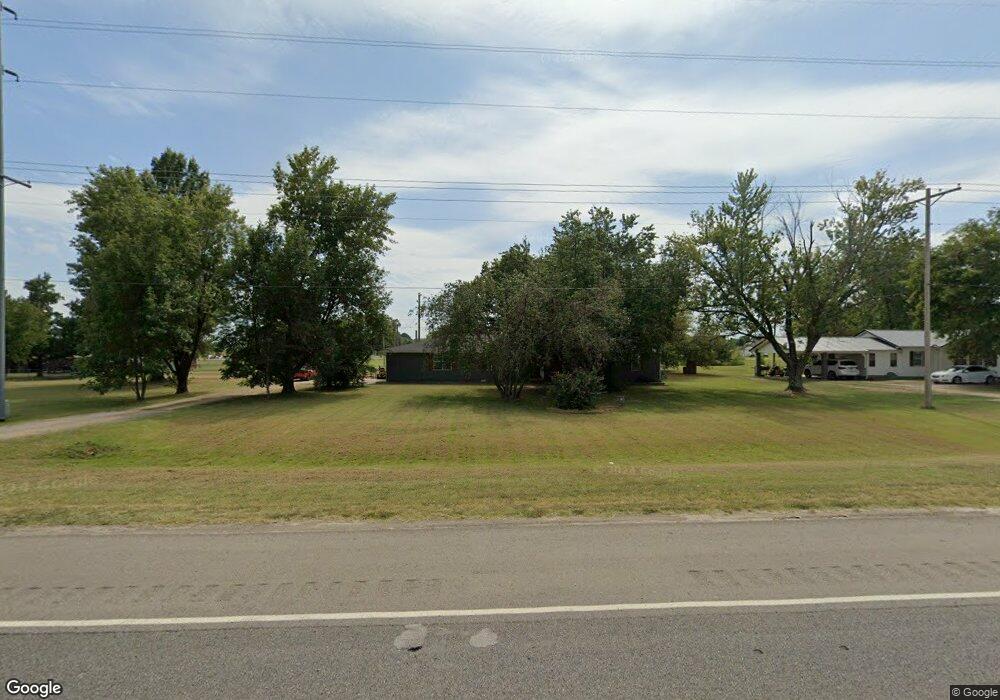
2904 E Shawntel Smith Blvd Muldrow, OK 74948
Estimated Value: $239,000 - $278,000
3
Beds
2
Baths
1,999
Sq Ft
$129/Sq Ft
Est. Value
About This Home
This home is located at 2904 E Shawntel Smith Blvd, Muldrow, OK 74948 and is currently estimated at $256,876, approximately $128 per square foot. 2904 E Shawntel Smith Blvd is a home located in Sequoyah County with nearby schools including Muldrow Elementary School, Muldrow Middle School, and Muldrow High School.
Ownership History
Date
Name
Owned For
Owner Type
Purchase Details
Closed on
Jul 25, 2023
Sold by
Page Karen Dianne and Page Stephen Lee
Bought by
Fargo Lucas and Lattimore-Fargo Madison
Current Estimated Value
Purchase Details
Closed on
Sep 22, 2022
Sold by
Dianne Page Karen and Lee Stephen
Bought by
Big Ten Properties Llc
Purchase Details
Closed on
Oct 5, 2009
Sold by
Click Tommy and Click Wanell
Bought by
Page Karen Dianne and Page Stephen Lee
Create a Home Valuation Report for This Property
The Home Valuation Report is an in-depth analysis detailing your home's value as well as a comparison with similar homes in the area
Home Values in the Area
Average Home Value in this Area
Purchase History
| Date | Buyer | Sale Price | Title Company |
|---|---|---|---|
| Fargo Lucas | -- | None Listed On Document | |
| Big Ten Properties Llc | $15,000 | -- | |
| Page Karen Dianne | -- | None Available |
Source: Public Records
Tax History Compared to Growth
Tax History
| Year | Tax Paid | Tax Assessment Tax Assessment Total Assessment is a certain percentage of the fair market value that is determined by local assessors to be the total taxable value of land and additions on the property. | Land | Improvement |
|---|---|---|---|---|
| 2025 | $973 | $13,695 | $3,722 | $9,973 |
| 2024 | $973 | $13,043 | $2,239 | $10,804 |
| 2023 | $927 | $12,422 | $2,239 | $10,183 |
| 2022 | $125 | $1,755 | $644 | $1,111 |
| 2021 | $513 | $8,223 | $1,243 | $6,980 |
| 2020 | $513 | $8,223 | $1,243 | $6,980 |
| 2019 | $514 | $8,228 | $1,243 | $6,985 |
| 2018 | $514 | $8,228 | $1,243 | $6,985 |
| 2017 | $526 | $8,404 | $1,243 | $7,161 |
| 2016 | $538 | $8,575 | $1,243 | $7,332 |
| 2015 | $536 | $8,542 | $1,243 | $7,299 |
| 2014 | $548 | $8,707 | $1,243 | $7,464 |
Source: Public Records
Map
Nearby Homes
- 110907 S 4760 Rd
- 407 W Ray Fine Blvd
- 400 W Ray Fine Blvd
- 110662 S 4750 Rd
- TBD W Ray Fine Blvd
- 404 W Ray Fine Blvd
- 0000 Cottonwood Rd
- 113 Cherokee Blvd
- 511 Mayfield Dr
- 505 Mayfield Dr
- 112368 S 4770 Rd
- TBD U S Highway 64
- 475495 E 1130 Rd
- 476120 E 1091 Rd
- 1009 SE 10th St
- 304 Oakdale Rd
- 450 Stockton Ln
- 200 S Jeff Ln
- 910 James St
- 109365 S 4749 Rd
- 2900 E Shawntel Smith Blvd
- 111058 S 4760 Rd
- 0 S Cottonwood Rd
- 475962 E 1111 Rd
- 475963 E 1111 Rd
- 2809 E Shawntel Smith Blvd
- 111183 S 4760 Rd
- 2000 N Cottonwood Rd
- 0 N Cottonwood Rd
- 1000 N Cottonwood Rd
- 111047 S 4760 Rd
- 111158 S 4760 Rd
- Tract 3 E 1112 Rd
- 2706 E Shawntel Smith Blvd
- 111235 S 4759 Rd
- 2801 E Shawntel Smith Blvd
- 2702 E Shawntel Smith Blvd
- 110859 S 4760 Rd
- 475855 E 1112 Rd
- 111234 S 4760 Rd