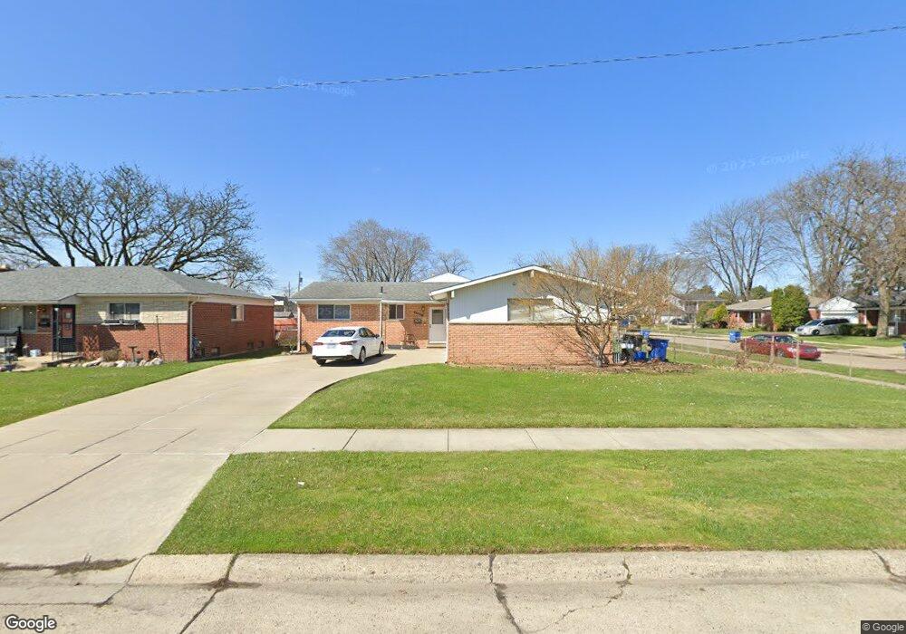
29047 Merrick Ave Warren, MI 48092
Northwest Warren NeighborhoodEstimated Value: $263,882 - $298,000
3
Beds
3
Baths
1,363
Sq Ft
$207/Sq Ft
Est. Value
About This Home
This home is located at 29047 Merrick Ave, Warren, MI 48092 and is currently estimated at $281,971, approximately $206 per square foot. 29047 Merrick Ave is a home located in Macomb County with nearby schools including Lean Elementary School, Beer Middle School, and Warren Mott High School.
Ownership History
Date
Name
Owned For
Owner Type
Purchase Details
Closed on
Feb 4, 2011
Sold by
Kim Chae Sun
Bought by
Woodard James
Current Estimated Value
Home Financials for this Owner
Home Financials are based on the most recent Mortgage that was taken out on this home.
Original Mortgage
$82,845
Outstanding Balance
$56,689
Interest Rate
4.78%
Mortgage Type
FHA
Estimated Equity
$225,282
Purchase Details
Closed on
Sep 10, 2010
Sold by
Bac Home Loans Servicing Lp
Bought by
Federal National Mortgage Association
Purchase Details
Closed on
Aug 20, 2010
Sold by
Kim Chae Sun
Bought by
Bac Home Loans Servicing Lp
Create a Home Valuation Report for This Property
The Home Valuation Report is an in-depth analysis detailing your home's value as well as a comparison with similar homes in the area
Home Values in the Area
Average Home Value in this Area
Purchase History
| Date | Buyer | Sale Price | Title Company |
|---|---|---|---|
| Woodard James | $85,000 | Attorneys Title Agency Llc | |
| Federal National Mortgage Association | -- | None Available | |
| Bac Home Loans Servicing Lp | $178,866 | None Available |
Source: Public Records
Mortgage History
| Date | Status | Borrower | Loan Amount |
|---|---|---|---|
| Open | Woodard James | $82,845 |
Source: Public Records
Tax History
| Year | Tax Paid | Tax Assessment Tax Assessment Total Assessment is a certain percentage of the fair market value that is determined by local assessors to be the total taxable value of land and additions on the property. | Land | Improvement |
|---|---|---|---|---|
| 2025 | $3,421 | $124,010 | $0 | $0 |
| 2024 | $35 | $118,530 | $0 | $0 |
| 2023 | $3,173 | $105,020 | $0 | $0 |
| 2022 | $3,066 | $91,110 | $0 | $0 |
| 2021 | $3,120 | $86,340 | $0 | $0 |
| 2020 | $3,008 | $81,720 | $0 | $0 |
| 2019 | $2,900 | $74,350 | $0 | $0 |
| 2018 | $2,946 | $75,490 | $0 | $0 |
| 2017 | $2,909 | $69,310 | $12,950 | $56,360 |
| 2016 | $2,906 | $69,310 | $0 | $0 |
| 2015 | -- | $61,900 | $0 | $0 |
| 2012 | -- | $50,600 | $0 | $0 |
Source: Public Records
Map
Nearby Homes
- 2052 Roman Ct
- 1957 Nicholas Ct
- 28423 James Dr
- 29273 Tessmer Ct Unit 87
- 29713 Mackenzie Cir W
- 1687 Fontaine Ave
- 28452 Universal Dr
- 28212 Universal Dr Unit I114
- 28130 Universal Dr Unit H96
- 1714 Moulin Ave
- 28306 Universal Dr
- 1705 Moulin Ave
- 28028 Universal Dr
- 28419 Park Ct
- 1405 Dulong Ave
- 30121 Woodhouse Dr
- 28427 Wexford Dr
- 28641 Denise St
- 29147 Milton Ave
- 1224 Darlene Ave
- 29035 Merrick Ave
- 2250 Geoffry Dr
- 29023 Merrick Ave
- 2238 Geoffry Dr
- 2265 Geoffry Dr
- 2253 Geoffry Dr
- 2277 Geoffry Dr
- 29046 Merrick Ave
- 29034 Merrick Ave
- 29011 Merrick Ave
- 2303 Geoffry Dr
- 2241 Geoffry Dr
- 2226 Geoffry Dr
- 2315 Geoffry Dr
- 29022 Merrick Ave
- 2330 Geoffry Dr
- 29282 Merrick Ave
- 29245 Merrick Ave
- 2327 Geoffry Dr
- 29303 Westbrook Ave
Your Personal Tour Guide
Ask me questions while you tour the home.