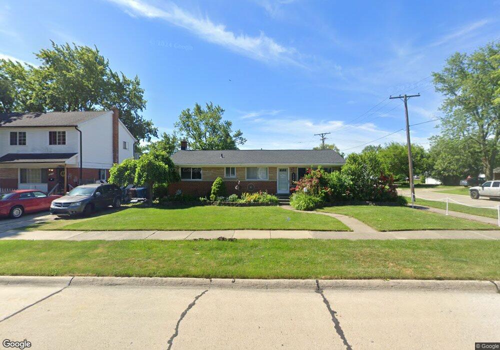
29049 Bridge St Garden City, MI 48135
Estimated Value: $177,000 - $209,000
--
Bed
1
Bath
1,078
Sq Ft
$181/Sq Ft
Est. Value
About This Home
This home is located at 29049 Bridge St, Garden City, MI 48135 and is currently estimated at $195,588, approximately $181 per square foot. 29049 Bridge St is a home located in Wayne County with nearby schools including Douglas Elementary 3-4 Campus, Memorial Elementary 1-2 Campus, and Garden City Middle School.
Ownership History
Date
Name
Owned For
Owner Type
Purchase Details
Closed on
Sep 7, 2021
Sold by
Dunklee Cathy M and The Cathy Dunklee Revocable Tr
Bought by
Ray Angela and Ray Michael
Current Estimated Value
Home Financials for this Owner
Home Financials are based on the most recent Mortgage that was taken out on this home.
Original Mortgage
$127,645
Outstanding Balance
$115,974
Interest Rate
2.7%
Mortgage Type
FHA
Estimated Equity
$79,614
Purchase Details
Closed on
Sep 23, 2013
Sold by
Dunklee Cathy M
Bought by
Dunklee Cathy M and Cathy Dunklee Revocable Trust
Purchase Details
Closed on
Mar 26, 2004
Sold by
Flack William J and Flack Brian J
Bought by
Dunklee Cathy M
Purchase Details
Closed on
Sep 25, 2000
Sold by
Wimberly Wendy A Joyce
Bought by
Flack Brian J
Create a Home Valuation Report for This Property
The Home Valuation Report is an in-depth analysis detailing your home's value as well as a comparison with similar homes in the area
Home Values in the Area
Average Home Value in this Area
Purchase History
| Date | Buyer | Sale Price | Title Company |
|---|---|---|---|
| Ray Angela | $130,000 | Amrock Llc | |
| Dunklee Cathy M | -- | None Available | |
| Dunklee Cathy M | $157,500 | Metropolitan Title Company | |
| Flack Brian J | $143,000 | -- |
Source: Public Records
Mortgage History
| Date | Status | Borrower | Loan Amount |
|---|---|---|---|
| Open | Ray Angela | $127,645 |
Source: Public Records
Tax History Compared to Growth
Tax History
| Year | Tax Paid | Tax Assessment Tax Assessment Total Assessment is a certain percentage of the fair market value that is determined by local assessors to be the total taxable value of land and additions on the property. | Land | Improvement |
|---|---|---|---|---|
| 2025 | $4,024 | $88,100 | $0 | $0 |
| 2024 | $4,024 | $86,300 | $0 | $0 |
| 2023 | $3,859 | $75,600 | $0 | $0 |
| 2022 | $4,318 | $72,100 | $0 | $0 |
| 2021 | $2,608 | $65,700 | $0 | $0 |
| 2020 | $2,940 | $64,200 | $0 | $0 |
| 2019 | $2,201 | $54,500 | $0 | $0 |
| 2018 | $1,989 | $45,500 | $0 | $0 |
| 2017 | $1,156 | $42,700 | $0 | $0 |
| 2016 | $2,513 | $39,300 | $0 | $0 |
| 2015 | $3,334 | $35,700 | $0 | $0 |
| 2013 | $3,230 | $33,000 | $0 | $0 |
| 2012 | $3,537 | $35,200 | $7,800 | $27,400 |
Source: Public Records
Map
Nearby Homes
- 28912 Cambridge St
- 29498 Bridge St
- 28730 Bridge St
- 28627 Bridge St
- 29801 Bridge St
- 6747 Burnly St
- 28843 Balmoral St
- 6649 Burnly St
- 29878 Malvern St
- 6705 Whitby St
- 28832 Block St
- 28343 Maplewood St
- 28614 Block St
- 28538 Block St
- 28424 Elmwood St
- 6253 Lathers St
- 6326 Lathers St
- 7304 Gilman St
- 29256 Brody Ave
- 7401 Floral St
- 29039 Bridge St
- 6891 Central St
- 29028 Cambridge St
- 29025 Bridge St
- 29020 Cambridge St
- 29108 Cambridge St
- 29015 Bridge St
- 6940 Central St
- 29014 Cambridge St
- 29123 Bridge St
- 29040 Bridge St
- 6941 Central St
- 29026 Bridge St
- 29150 Cambridge St
- 29122 Cambridge St
- 29010 Cambridge St
- 29005 Bridge St
- 29124 Bridge St
- 29133 Bridge St
- 29004 Cambridge St