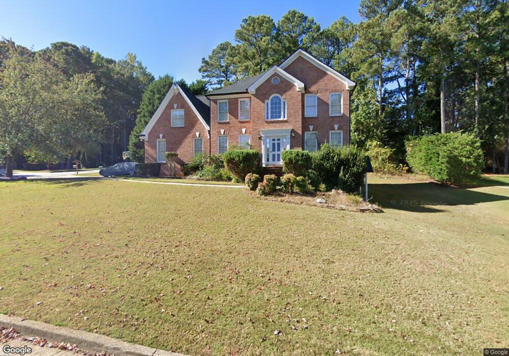
2905 Adams Pointe Dr Unit 1 Snellville, GA 30078
Estimated Value: $475,000 - $573,000
4
Beds
3
Baths
2,690
Sq Ft
$192/Sq Ft
Est. Value
About This Home
This home is located at 2905 Adams Pointe Dr Unit 1, Snellville, GA 30078 and is currently estimated at $517,196, approximately $192 per square foot. 2905 Adams Pointe Dr Unit 1 is a home located in Gwinnett County with nearby schools including Brookwood Elementary School, Alton C. Crews Middle School, and Brookwood High School.
Ownership History
Date
Name
Owned For
Owner Type
Purchase Details
Closed on
Jan 11, 2018
Sold by
Allen Sharon G
Bought by
Allen Daryl K
Current Estimated Value
Home Financials for this Owner
Home Financials are based on the most recent Mortgage that was taken out on this home.
Original Mortgage
$83,889
Outstanding Balance
$47,150
Interest Rate
3.93%
Mortgage Type
New Conventional
Estimated Equity
$470,046
Purchase Details
Closed on
Jul 25, 2001
Sold by
Allen Daryl K
Bought by
Allen Daryl K and Allen Sharon G
Home Financials for this Owner
Home Financials are based on the most recent Mortgage that was taken out on this home.
Original Mortgage
$182,500
Interest Rate
7.1%
Mortgage Type
New Conventional
Purchase Details
Closed on
Oct 1, 1996
Sold by
Col Good Co Inc
Bought by
Allen Daryl K Sharon G
Create a Home Valuation Report for This Property
The Home Valuation Report is an in-depth analysis detailing your home's value as well as a comparison with similar homes in the area
Home Values in the Area
Average Home Value in this Area
Purchase History
| Date | Buyer | Sale Price | Title Company |
|---|---|---|---|
| Allen Daryl K | -- | -- | |
| Allen Daryl K | -- | -- | |
| Allen Daryl K Sharon G | $174,000 | -- |
Source: Public Records
Mortgage History
| Date | Status | Borrower | Loan Amount |
|---|---|---|---|
| Open | Allen Daryl K | $83,889 | |
| Previous Owner | Allen Daryl K | $182,500 | |
| Closed | Allen Daryl K Sharon G | $0 |
Source: Public Records
Tax History Compared to Growth
Tax History
| Year | Tax Paid | Tax Assessment Tax Assessment Total Assessment is a certain percentage of the fair market value that is determined by local assessors to be the total taxable value of land and additions on the property. | Land | Improvement |
|---|---|---|---|---|
| 2024 | $2,164 | $206,040 | $30,000 | $176,040 |
| 2023 | $2,164 | $203,120 | $32,400 | $170,720 |
| 2022 | $6,776 | $180,440 | $30,000 | $150,440 |
| 2021 | $5,113 | $131,560 | $21,200 | $110,360 |
| 2020 | $5,143 | $131,560 | $21,200 | $110,360 |
| 2019 | $4,318 | $113,440 | $18,400 | $95,040 |
| 2018 | $4,324 | $113,440 | $18,400 | $95,040 |
| 2016 | $3,719 | $96,080 | $19,200 | $76,880 |
| 2015 | $3,758 | $96,080 | $19,200 | $76,880 |
| 2014 | $3,779 | $96,080 | $19,200 | $76,880 |
Source: Public Records
Map
Nearby Homes
- Easton Plan at Watson Park
- Kenwood Plan at Watson Park
- Aiken Plan at Watson Park
- Lawrence Plan at Watson Park
- Stockbridge Plan at Watson Park
- 1953 Watson Park Dr
- 1936 Oakwood Grove Dr Unit 1
- 1916 Oakwood Grove Dr Unit 1
- 3075 Oak Meadow Dr
- 1845 Lisa Springs Dr
- 3103 Redwood Grove Park Unit 4
- 2067 Crescent Dr SW
- 3063 Bruckner Blvd
- 1809 Mornington Ln
- 1686 Norton Estates Dr
- 2845 Long Shadow Ct
- 2141 Slick Stone Dr
- 2237 Foley Park St
- 1631 Oak Rd
- 1897 Adams Pointe Ct Unit 2
- 2885 Adams Pointe Dr Unit 1
- 2900 Adams Pointe Dr Unit 1
- 1887 Adams Pointe Ct Unit 2
- 2890 Adams Pointe Dr
- 1894 Adams Pointe Ct
- 2886 Adams Brook Way
- 2875 Adams Pointe Dr Unit 1
- 0 Adams Brook Way
- 2880 Adams Pointe Dr Unit 1
- 2855 Adams Brook Way
- 1877 Adams Pointe Ct
- 1934 McGee Rd
- 1950 McGee Rd
- 2876 Adams Brook Way
- 2935 Manor Ct Unit 1
- 2925 Manor Ct
- 2865 Adams Pointe Dr
- 2870 Adams Pointe Dr
- 1874 Adams Pointe Ct Unit 2