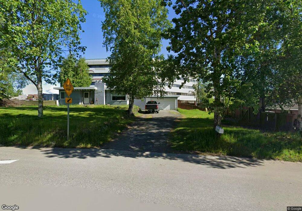
2905 Aspen Dr Anchorage, AK 99517
Spenard NeighborhoodEstimated Value: $399,478 - $404,000
4
Beds
2
Baths
2,120
Sq Ft
$189/Sq Ft
Est. Value
About This Home
This home is located at 2905 Aspen Dr, Anchorage, AK 99517 and is currently estimated at $401,739, approximately $189 per square foot. 2905 Aspen Dr is a home located in Anchorage Municipality with nearby schools including Northwood Elementary School, Romig Middle School, and West High School.
Ownership History
Date
Name
Owned For
Owner Type
Purchase Details
Closed on
Apr 7, 2025
Sold by
Akhappytime Llc
Bought by
Kim Alexander
Current Estimated Value
Purchase Details
Closed on
Dec 9, 2024
Sold by
Spenard Assets Llc
Bought by
Akhappytime Llc
Purchase Details
Closed on
Nov 22, 2021
Sold by
Akhappytime Llc
Bought by
Spenard Assets Llc
Purchase Details
Closed on
Jun 29, 2012
Sold by
Red River Lodging Inc
Bought by
Kim Alexander Doo Wook
Create a Home Valuation Report for This Property
The Home Valuation Report is an in-depth analysis detailing your home's value as well as a comparison with similar homes in the area
Home Values in the Area
Average Home Value in this Area
Purchase History
| Date | Buyer | Sale Price | Title Company |
|---|---|---|---|
| Kim Alexander | -- | None Listed On Document | |
| Akhappytime Llc | -- | None Listed On Document | |
| Spenard Assets Llc | -- | None Listed On Document | |
| Kim Alexander Doo Wook | -- | None Available |
Source: Public Records
Tax History Compared to Growth
Tax History
| Year | Tax Paid | Tax Assessment Tax Assessment Total Assessment is a certain percentage of the fair market value that is determined by local assessors to be the total taxable value of land and additions on the property. | Land | Improvement |
|---|---|---|---|---|
| 2025 | $5,680 | $347,100 | $101,400 | $245,700 |
| 2024 | $5,680 | $351,800 | $101,400 | $250,400 |
| 2023 | $5,581 | $327,700 | $101,400 | $226,300 |
| 2022 | $5,517 | $327,600 | $101,400 | $226,200 |
| 2021 | $5,696 | $316,100 | $101,400 | $214,700 |
| 2020 | $5,307 | $312,200 | $101,400 | $210,800 |
| 2019 | $5,027 | $307,300 | $101,400 | $205,900 |
| 2018 | $4,869 | $296,900 | $93,600 | $203,300 |
| 2017 | $4,870 | $311,000 | $93,600 | $217,400 |
| 2016 | $4,176 | $302,800 | $88,000 | $214,800 |
| 2015 | $4,176 | $285,800 | $88,000 | $197,800 |
| 2014 | $4,176 | $283,500 | $88,000 | $195,500 |
Source: Public Records
Map
Nearby Homes
- 2808 Iris Dr
- 4302 Forrest Rd
- 2891 W Intl Airport Rd Unit C108
- 2815 W International Airport Rd Unit B104
- 3333 Lakeshore Dr Unit 5
- 3333 Lakeshore Dr Unit 2
- 3913 Barbara Dr
- NHN Northwood Dr
- 5000 Northwood Dr
- 4000 Iowa Dr
- 3900 Crosson Dr
- 2101 W 47th Ave
- 2040 Wenmatt Cir
- 2820 Wiley Post Ave
- 2202 Lincoln Ave
- 2925 W 36th Ave
- 1808 W 47th Ave
- 2702 Mcrae Rd
- 2105 Mckinley Ave
- 3517 Vintage Cir
- 2907 Aspen Dr
- 2903 Aspen Dr
- 2901 Aspen Dr
- 4619 Spendard Rd
- 4619 Spenard Rd Unit 1
- 4619 Spenard Rd Unit C
- 4619 Spenard Rd
- 2902 Aspen Dr
- 2904 Aspen Dr
- 2906 Aspen Dr
- 2900 Aspen Dr
- 2813 Aspen Dr
- 2812 Aspen Dr
- 2812 Aspen Dr Unit A
- 2810 Aspen Dr
- 2904 Iris Dr
- 2906 Iris Dr
- 2825 Tundra Ct
- 2902 Iris Dr
- 2901 Valleywood Dr