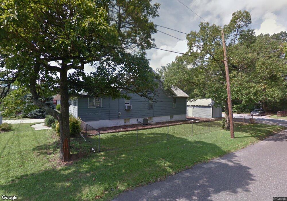
2905 Haddonfield Rd Pennsauken, NJ 08110
Estimated Value: $453,477
--
Bed
--
Bath
1,450
Sq Ft
$313/Sq Ft
Est. Value
About This Home
This home is located at 2905 Haddonfield Rd, Pennsauken, NJ 08110 and is currently estimated at $453,477, approximately $312 per square foot. 2905 Haddonfield Rd is a home located in Camden County with nearby schools including Pennsauken High School and St. Peter Elementary School.
Ownership History
Date
Name
Owned For
Owner Type
Purchase Details
Closed on
Nov 6, 2013
Sold by
Flynn Robert J and Flynn Carol L
Bought by
Postulos Distribution Inc
Current Estimated Value
Home Financials for this Owner
Home Financials are based on the most recent Mortgage that was taken out on this home.
Original Mortgage
$661,000
Interest Rate
4.15%
Mortgage Type
Future Advance Clause Open End Mortgage
Create a Home Valuation Report for This Property
The Home Valuation Report is an in-depth analysis detailing your home's value as well as a comparison with similar homes in the area
Home Values in the Area
Average Home Value in this Area
Purchase History
| Date | Buyer | Sale Price | Title Company |
|---|---|---|---|
| Postulos Distribution Inc | $200,000 | Golden Title Agency |
Source: Public Records
Mortgage History
| Date | Status | Borrower | Loan Amount |
|---|---|---|---|
| Previous Owner | Postulos Distribution Inc | $661,000 |
Source: Public Records
Tax History Compared to Growth
Tax History
| Year | Tax Paid | Tax Assessment Tax Assessment Total Assessment is a certain percentage of the fair market value that is determined by local assessors to be the total taxable value of land and additions on the property. | Land | Improvement |
|---|---|---|---|---|
| 2025 | $8,156 | $240,000 | $126,100 | $113,900 |
| 2024 | $7,998 | $187,400 | $90,000 | $97,400 |
| 2023 | $7,998 | $187,400 | $90,000 | $97,400 |
| 2022 | $7,232 | $187,400 | $90,000 | $97,400 |
| 2021 | $7,408 | $187,400 | $90,000 | $97,400 |
| 2020 | $6,653 | $187,400 | $90,000 | $97,400 |
| 2019 | $6,730 | $187,400 | $90,000 | $97,400 |
| 2018 | $6,765 | $187,400 | $90,000 | $97,400 |
| 2017 | $6,778 | $187,400 | $90,000 | $97,400 |
| 2016 | $6,656 | $187,400 | $90,000 | $97,400 |
| 2015 | $6,855 | $187,400 | $90,000 | $97,400 |
| 2014 | $6,585 | $118,400 | $60,000 | $58,400 |
Source: Public Records
Map
Nearby Homes
- 2905 Powell Ave
- 3007 Haddonfield Rd
- 2644 Powell Ave
- 3422 Palace Ct
- 641 N Coles Ave
- 2617 Hadley Dr
- 8760 Stockton Ave
- 8517 Osler Ave
- 7750 Hesson Ln
- 2543 Burning Tree Rd
- 8331 Stockton Ave
- 3002 Gladwyn Ave
- 7911 Park Ave
- 2410 Shelley Ln
- 7624 Githens Ave
- 7916 Marion Ave
- 41 Orchard Ave
- 5 Kohlmyer Dr
- 3221 Union Ave
- 204 W Germantown Ave
- 2917 Haddonfield Rd
- 2845 Haddonfield Rd
- 2904 Powell Ave
- 2908 Powell Ave
- 2912 Powell Ave
- 2830 Powell Ave
- 2860 Haddonfield Rd
- 2920 Powell Ave
- 2828 Powell Ave
- 2852 Haddonfield Rd
- 2932 Powell Ave
- 2821 Haddonfield Rd Unit 1 residential
- 2821 Haddonfield Rd Unit 3
- 2821 Haddonfield Rd
- 2846 Haddonfield Rd
- 2824 Powell Ave
- 2932 Haddonfield Rd
- 2944 Powell Ave
- 8973 Irving Ave
- 2905 Morton Ave