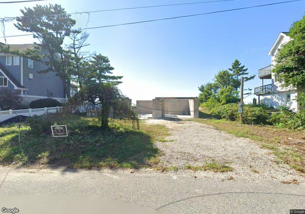
2905 Shore Dr Villas, NJ 08251
Estimated Value: $1,034,000 - $1,574,000
--
Bed
--
Bath
3,156
Sq Ft
$435/Sq Ft
Est. Value
About This Home
This home is located at 2905 Shore Dr, Villas, NJ 08251 and is currently estimated at $1,372,783, approximately $434 per square foot. 2905 Shore Dr is a home located in Cape May County.
Ownership History
Date
Name
Owned For
Owner Type
Purchase Details
Closed on
Oct 21, 2022
Sold by
Shue Chouzan John
Bought by
Pearl Oasis Llc
Current Estimated Value
Home Financials for this Owner
Home Financials are based on the most recent Mortgage that was taken out on this home.
Original Mortgage
$647,250
Outstanding Balance
$625,564
Interest Rate
6.7%
Mortgage Type
New Conventional
Estimated Equity
$747,219
Purchase Details
Closed on
Sep 5, 2012
Sold by
Wall Richard J and Wall Paula G
Bought by
Shue Chouzan John
Purchase Details
Closed on
Aug 19, 1996
Sold by
Tremo Ralph P
Bought by
Wall Richard J and Wall Paula G
Home Financials for this Owner
Home Financials are based on the most recent Mortgage that was taken out on this home.
Original Mortgage
$185,000
Interest Rate
8.4%
Create a Home Valuation Report for This Property
The Home Valuation Report is an in-depth analysis detailing your home's value as well as a comparison with similar homes in the area
Home Values in the Area
Average Home Value in this Area
Purchase History
| Date | Buyer | Sale Price | Title Company |
|---|---|---|---|
| Pearl Oasis Llc | $863,000 | -- | |
| Shue Chouzan John | $550,000 | None Available | |
| Wall Richard J | $285,000 | -- |
Source: Public Records
Mortgage History
| Date | Status | Borrower | Loan Amount |
|---|---|---|---|
| Open | Pearl Oasis Llc | $647,250 | |
| Previous Owner | Wall Richard J | $185,000 |
Source: Public Records
Tax History Compared to Growth
Tax History
| Year | Tax Paid | Tax Assessment Tax Assessment Total Assessment is a certain percentage of the fair market value that is determined by local assessors to be the total taxable value of land and additions on the property. | Land | Improvement |
|---|---|---|---|---|
| 2025 | $16,916 | $528,000 | $528,000 | -- |
| 2024 | $16,916 | $834,100 | $528,000 | $306,100 |
| 2023 | $16,674 | $834,100 | $528,000 | $306,100 |
| 2022 | $16,165 | $834,100 | $528,000 | $306,100 |
| 2021 | $15,681 | $834,100 | $528,000 | $306,100 |
| 2020 | $15,431 | $834,100 | $528,000 | $306,100 |
| 2019 | $15,047 | $834,100 | $528,000 | $306,100 |
| 2018 | $14,689 | $834,100 | $528,000 | $306,100 |
| 2017 | $14,705 | $834,100 | $528,000 | $306,100 |
| 2016 | $14,480 | $834,100 | $528,000 | $306,100 |
| 2015 | $14,013 | $834,100 | $528,000 | $306,100 |
| 2014 | $13,554 | $834,100 | $528,000 | $306,100 |
Source: Public Records
Map
Nearby Homes
- 3005 Shore Dr
- 2988 Bybrook Dr
- 203 Shadeland Ave
- 2710 Bybrook Dr
- 118 Shadeland Ave
- 221 Cedardale Ave
- 402 2nd Ave
- 320 Oakdale Ave
- 307 Oakdale Ave
- 412 Hollywood Rd
- 308 Beechwood Ave
- 9 Cedardale Ct
- 12 Cedardale Ct
- 14 Cedardale Ct
- 3 Cedardale Ct
- 6 Cedardale Ct
- BRISTOL Plan at Shawmount Village
- 514 Baywyn Rd
- 110 Oakdale Ave
- 100 Oakdale Ave
- 2909 Shore Dr
- 2901 Shore Dr
- 517 Sandlewood Rd
- 2809 Shore Dr
- 516 Mistletoe Rd
- 3001 Shore Dr
- 2805 Shore Dr
- 516 Sandlewood Rd
- 2802 Shore Dr
- 512 Sandlewood Rd
- 507 Sandlewood Rd
- 2801 Shore Dr
- 508 Mistletoe Rd
- 513 Mistletoe Rd
- 3009 Shore Dr
- 517 Beachplum Rd
- 508 Sandlewood Rd
- 514 Delview Rd
- 513 Beachplum Rd
- 505 Sandlewood Rd
