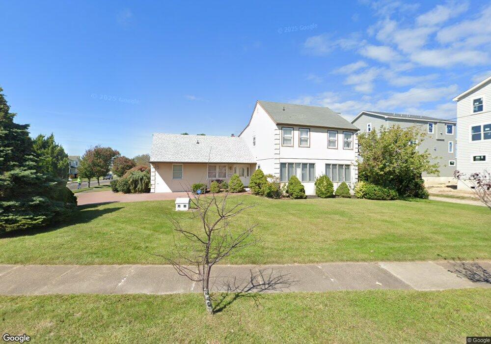
2905 W Brigantine Ave Brigantine, NJ 08203
Estimated Value: $797,000 - $1,315,000
Studio
--
Bath
2,760
Sq Ft
$396/Sq Ft
Est. Value
About This Home
This home is located at 2905 W Brigantine Ave, Brigantine, NJ 08203 and is currently estimated at $1,093,818, approximately $396 per square foot. 2905 W Brigantine Ave is a home located in Atlantic County with nearby schools including Brigantine Elementary School and New Hope Christian Academy/Robinson Small Learning Center.
Ownership History
Date
Name
Owned For
Owner Type
Purchase Details
Closed on
Sep 2, 2009
Sold by
Cane Vincent and Cane Barbara
Bought by
Cane Vincent and Cane Barbara
Current Estimated Value
Purchase Details
Closed on
Mar 14, 2003
Sold by
Dinapoli Salvatore C and Dinapoli Josephine
Bought by
Crane Vincent and Crane Barbara
Purchase Details
Closed on
Mar 30, 1998
Sold by
Gavin Margaret E
Bought by
Dinapoli Salvatore C and Dinapoli Josephine
Home Financials for this Owner
Home Financials are based on the most recent Mortgage that was taken out on this home.
Original Mortgage
$145,000
Interest Rate
6.98%
Create a Home Valuation Report for This Property
The Home Valuation Report is an in-depth analysis detailing your home's value as well as a comparison with similar homes in the area
Home Values in the Area
Average Home Value in this Area
Purchase History
| Date | Buyer | Sale Price | Title Company |
|---|---|---|---|
| Cane Vincent | -- | None Available | |
| Crane Vincent | $300,000 | Commonwealth | |
| Dinapoli Salvatore C | $18,000 | The Title Company |
Source: Public Records
Mortgage History
| Date | Status | Borrower | Loan Amount |
|---|---|---|---|
| Previous Owner | Dinapoli Salvatore C | $145,000 |
Source: Public Records
Tax History
| Year | Tax Paid | Tax Assessment Tax Assessment Total Assessment is a certain percentage of the fair market value that is determined by local assessors to be the total taxable value of land and additions on the property. | Land | Improvement |
|---|---|---|---|---|
| 2025 | $8,721 | $463,900 | $300,000 | $163,900 |
| 2024 | $8,721 | $463,900 | $300,000 | $163,900 |
Source: Public Records
Map
Nearby Homes
- 312 31st St S
- 2905 Revere Blvd
- 3318 W Brigantine Ave Unit 3
- 3007 Bayshore Ave Unit 4
- 3007 Bayshore Ave Unit 12
- 345 35th St S Unit A
- 327 36th St S Unit B
- 2502 Ocean Ave
- 3512 Bayshore Ave
- 326 S 37 St Unit A
- 2500 Bayshore Ave
- 106 24th St S
- 251 38th St S
- 245 38th St S Unit A
- 201 23rd St S
- 103 24th St S
- 223 40th St S
- 314 41st St S
- 301 20th St S
- 1904 W Brigantine Ave
- 213 30th St S
- 2901 W Brigantine Ave
- 210 29th St S
- 210 S 34th Unit 2 St Unit 2
- 209 30th St S
- 3001 Atlantic Brigantine Blvd
- 2904 W Brigantine Ave
- 206 29th St S
- 205 30th St S
- 208 30th St S
- 204 30th St S
- 204 29th St S
- 3000 W Brigantine Ave
- 213 29th St S
- 301 30th St S
- 2900 W Brigantine Ave
- 3002 W Brigantine Ave
- 209 29th St S
- 201 30th St S
- 3015 Brigantine Blvd
Your Personal Tour Guide
Ask me questions while you tour the home.