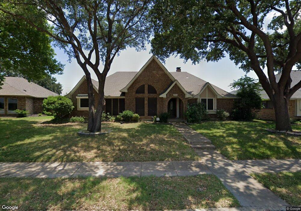
2906 Maple Ct Carrollton, TX 75007
Northwest Carrollton NeighborhoodEstimated Value: $452,955 - $536,000
--
Bed
2
Baths
2,492
Sq Ft
$203/Sq Ft
Est. Value
About This Home
This home is located at 2906 Maple Ct, Carrollton, TX 75007 and is currently estimated at $505,239, approximately $202 per square foot. 2906 Maple Ct is a home located in Denton County with nearby schools including Kent Elementary School, Blalack Middle School, and Creekview High School.
Ownership History
Date
Name
Owned For
Owner Type
Purchase Details
Closed on
Jul 15, 2015
Sold by
Cannon Gary Lee
Bought by
Cannon Linda Marie
Current Estimated Value
Home Financials for this Owner
Home Financials are based on the most recent Mortgage that was taken out on this home.
Original Mortgage
$145,000
Outstanding Balance
$113,886
Interest Rate
4.07%
Mortgage Type
Assumption
Estimated Equity
$391,353
Purchase Details
Closed on
Apr 22, 1994
Sold by
Troxel Zack Melvin and Troxel Kathy Shannon
Bought by
Cannon Gary Lee and Cannon Linda Marie
Home Financials for this Owner
Home Financials are based on the most recent Mortgage that was taken out on this home.
Original Mortgage
$105,000
Interest Rate
7.61%
Create a Home Valuation Report for This Property
The Home Valuation Report is an in-depth analysis detailing your home's value as well as a comparison with similar homes in the area
Home Values in the Area
Average Home Value in this Area
Purchase History
| Date | Buyer | Sale Price | Title Company |
|---|---|---|---|
| Cannon Linda Marie | -- | None Available | |
| Cannon Gary Lee | -- | -- |
Source: Public Records
Mortgage History
| Date | Status | Borrower | Loan Amount |
|---|---|---|---|
| Open | Cannon Linda Marie | $145,000 | |
| Closed | Cannon Gary Lee | $105,000 |
Source: Public Records
Tax History Compared to Growth
Tax History
| Year | Tax Paid | Tax Assessment Tax Assessment Total Assessment is a certain percentage of the fair market value that is determined by local assessors to be the total taxable value of land and additions on the property. | Land | Improvement |
|---|---|---|---|---|
| 2025 | $3,073 | $464,277 | $96,600 | $367,677 |
| 2024 | $7,329 | $428,519 | $0 | $0 |
| 2023 | $2,946 | $389,563 | $96,600 | $383,339 |
| 2022 | $6,810 | $354,148 | $96,600 | $265,512 |
| 2021 | $6,655 | $321,953 | $67,200 | $254,753 |
| 2020 | $6,439 | $309,020 | $67,200 | $241,820 |
| 2019 | $6,621 | $302,264 | $67,200 | $235,064 |
| 2018 | $6,343 | $285,907 | $67,200 | $218,707 |
| 2017 | $6,302 | $280,850 | $67,200 | $213,650 |
| 2016 | $4,621 | $272,225 | $46,368 | $225,857 |
| 2015 | $4,263 | $234,081 | $46,368 | $187,713 |
| 2014 | $4,263 | $215,614 | $46,368 | $169,246 |
| 2013 | -- | $205,109 | $46,368 | $158,741 |
Source: Public Records
Map
Nearby Homes
- 2926 Hunters Point Ln
- 2924 Sunset Point Ln
- 1106 Alameda Dr
- 1002 Nottingham Dr
- 2903 Fort Point Ln
- 1008 Nottingham Dr
- 1036 Clinton St
- 3102 Aspen
- 1020 Nottingham Dr
- 2903 Golden Gate Ct
- 1027 Ridgeview Cir
- 2813 Staffordshire Dr
- 2909 Redwood Dr
- 2812 Orchid St
- 1409 Golden Gate Dr
- 1132 Cemetery Hill Rd
- 1113 Derbyshire Ln
- 1513 Silverleaf Dr
- 3127 Honeydew Dr
- 1003 Bellflower Ct
- 2904 Maple Ct
- 2908 Maple Ct
- 2902 Maple Ct
- 2910 Maple Ct
- 2920 Maple Ct
- 2900 Maple Ct
- 1006 Clinton St
- 2900 Hunters Point Ln
- 2925 Hunters Point Ln
- 2923 Hunters Point Ln
- 2927 Hunters Point Ln
- 2918 Maple Ct
- 2914 Maple Ct
- 2921 Hunters Point Ln
- 2929 Hunters Point Ln
- 2916 Maple Ct
- 2919 Hunters Point Ln
- 2931 Hunters Point Ln
- 1008 Clinton St
- 2917 Hunters Point Ln