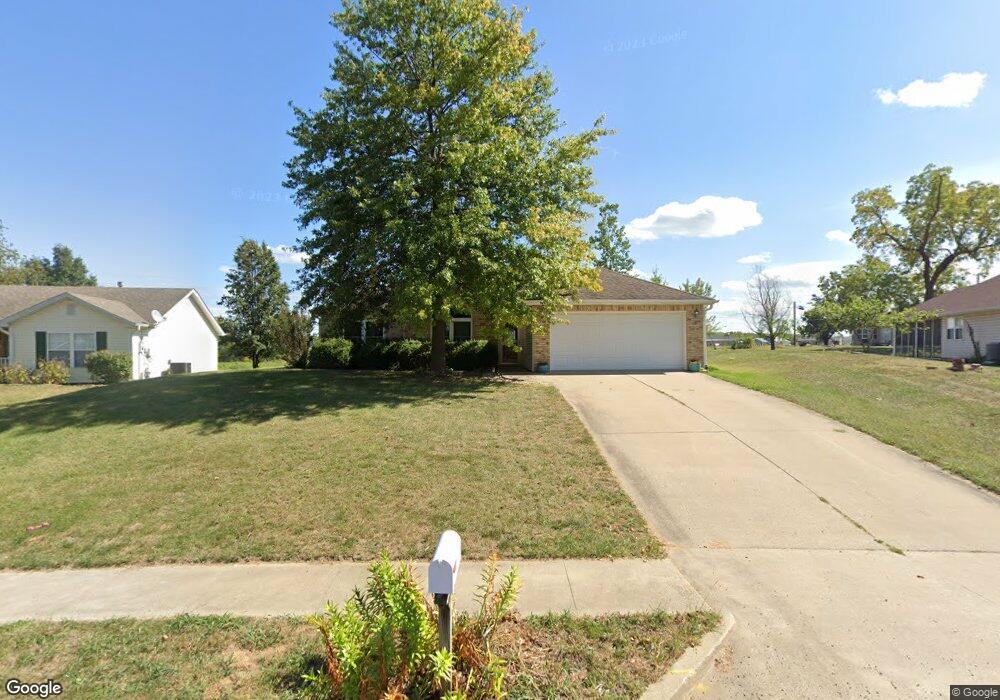
2906 Shingo Ct Columbia, MO 65202
Estimated Value: $267,000 - $290,000
3
Beds
2
Baths
1,555
Sq Ft
$177/Sq Ft
Est. Value
About This Home
This home is located at 2906 Shingo Ct, Columbia, MO 65202 and is currently estimated at $274,729, approximately $176 per square foot. 2906 Shingo Ct is a home located in Boone County with nearby schools including Blue Ridge Elementary School, John B. Lange Middle School, and Muriel W. Battle High School.
Ownership History
Date
Name
Owned For
Owner Type
Purchase Details
Closed on
Jul 15, 2011
Sold by
Hesemann Nathan and Hesemann Laura
Bought by
Mathis Eric W and Mathis Lisa A
Current Estimated Value
Home Financials for this Owner
Home Financials are based on the most recent Mortgage that was taken out on this home.
Original Mortgage
$116,958
Outstanding Balance
$79,930
Interest Rate
4.37%
Mortgage Type
FHA
Estimated Equity
$194,799
Create a Home Valuation Report for This Property
The Home Valuation Report is an in-depth analysis detailing your home's value as well as a comparison with similar homes in the area
Home Values in the Area
Average Home Value in this Area
Purchase History
| Date | Buyer | Sale Price | Title Company |
|---|---|---|---|
| Mathis Eric W | -- | Boone Central Title Company |
Source: Public Records
Mortgage History
| Date | Status | Borrower | Loan Amount |
|---|---|---|---|
| Open | Mathis Eric W | $116,958 |
Source: Public Records
Tax History Compared to Growth
Tax History
| Year | Tax Paid | Tax Assessment Tax Assessment Total Assessment is a certain percentage of the fair market value that is determined by local assessors to be the total taxable value of land and additions on the property. | Land | Improvement |
|---|---|---|---|---|
| 2025 | $1,827 | $31,008 | $3,344 | $27,664 |
| 2024 | $1,827 | $27,075 | $3,344 | $23,731 |
| 2023 | $1,811 | $27,075 | $3,344 | $23,731 |
| 2022 | $1,675 | $25,061 | $3,344 | $21,717 |
| 2021 | $1,678 | $25,061 | $3,344 | $21,717 |
| 2020 | $1,717 | $24,088 | $3,344 | $20,744 |
| 2019 | $1,717 | $24,088 | $3,344 | $20,744 |
| 2018 | $1,662 | $0 | $0 | $0 |
| 2017 | $1,642 | $23,161 | $3,344 | $19,817 |
| 2016 | $1,685 | $23,161 | $3,344 | $19,817 |
| 2015 | $1,555 | $23,161 | $3,344 | $19,817 |
| 2014 | $1,563 | $23,161 | $3,344 | $19,817 |
Source: Public Records
Map
Nearby Homes
- 2905 Gene Dr
- 2809 Shingo Ct
- 2808 Pine Dr
- 2810 Waynesboro Dr
- 4308 Brunswick Dr
- 3913 Bragg Ct
- 4204 Fourwinds Dr
- 3921 Bragg Ct
- 2601 Mistywood Ct
- 2501 Nest Ct
- 3905 Bragg Ct
- 3901 Bragg Ct
- 3409 Brown Station Rd
- 0 Paris Rd
- 3001 Brown Station Rd
- 2805 Brown Station Rd
- 1100 Kennesaw Unit 102
- 1100 Kennesaw Unit 104
- 3204 Ravello Dr
- 2907 E Henley Dr