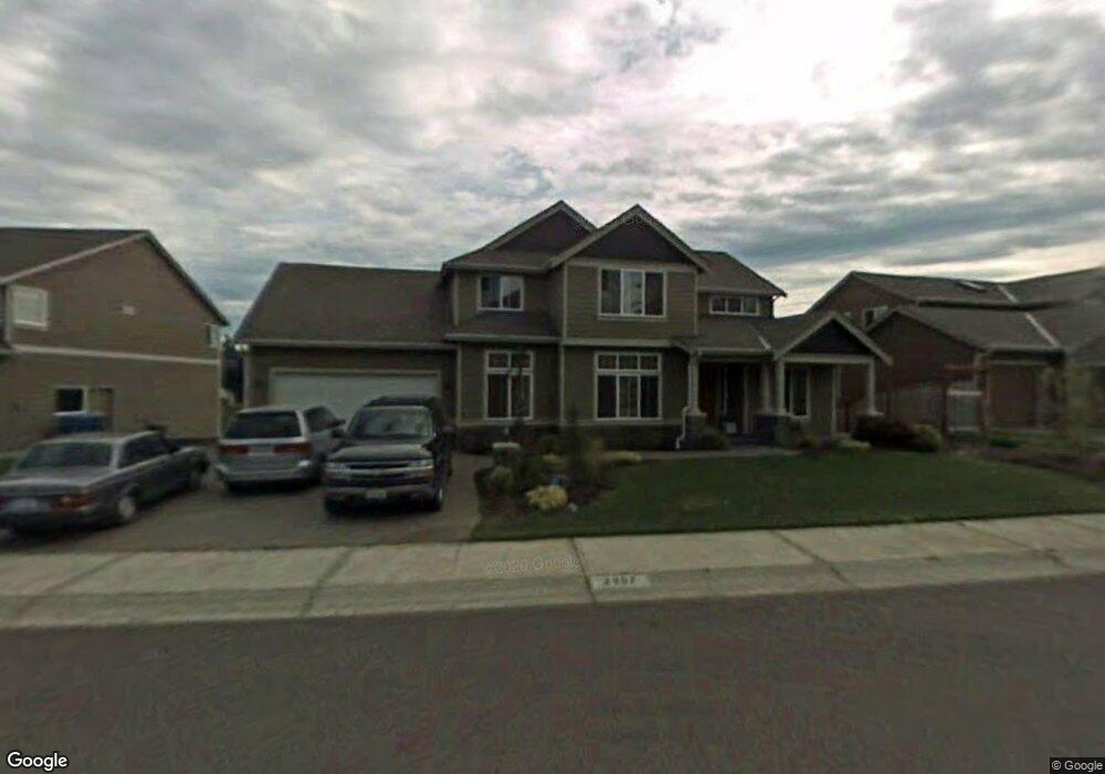
2907 219th Ave E Lake Tapps, WA 98391
Estimated Value: $1,087,000 - $1,273,000
4
Beds
4
Baths
3,576
Sq Ft
$332/Sq Ft
Est. Value
About This Home
This home is located at 2907 219th Ave E, Lake Tapps, WA 98391 and is currently estimated at $1,188,500, approximately $332 per square foot. 2907 219th Ave E is a home located in Pierce County with nearby schools including Dieringer Heights Elementary School, Lake Tapps Elementary School, and North Tapps Middle School.
Ownership History
Date
Name
Owned For
Owner Type
Purchase Details
Closed on
Jun 7, 2005
Sold by
Hendrickson Construction Inc
Bought by
Nuttall Kent D and Nuttall Pamela J
Current Estimated Value
Home Financials for this Owner
Home Financials are based on the most recent Mortgage that was taken out on this home.
Original Mortgage
$497,560
Outstanding Balance
$257,411
Interest Rate
5.62%
Mortgage Type
Fannie Mae Freddie Mac
Estimated Equity
$931,089
Create a Home Valuation Report for This Property
The Home Valuation Report is an in-depth analysis detailing your home's value as well as a comparison with similar homes in the area
Home Values in the Area
Average Home Value in this Area
Purchase History
| Date | Buyer | Sale Price | Title Company |
|---|---|---|---|
| Nuttall Kent D | $621,950 | First American Title Ins Co |
Source: Public Records
Mortgage History
| Date | Status | Borrower | Loan Amount |
|---|---|---|---|
| Open | Nuttall Kent D | $497,560 | |
| Closed | Nuttall Kent D | $62,195 |
Source: Public Records
Tax History Compared to Growth
Tax History
| Year | Tax Paid | Tax Assessment Tax Assessment Total Assessment is a certain percentage of the fair market value that is determined by local assessors to be the total taxable value of land and additions on the property. | Land | Improvement |
|---|---|---|---|---|
| 2025 | $10,736 | $1,177,300 | $340,500 | $836,800 |
| 2024 | $10,736 | $1,168,700 | $301,200 | $867,500 |
| 2023 | $10,736 | $1,087,900 | $310,100 | $777,800 |
| 2022 | $10,112 | $1,054,800 | $297,600 | $757,200 |
| 2021 | $10,112 | $779,400 | $215,100 | $564,300 |
| 2019 | $9,082 | $748,000 | $181,100 | $566,900 |
| 2018 | $10,542 | $717,500 | $148,000 | $569,500 |
| 2017 | $8,560 | $684,400 | $130,200 | $554,200 |
| 2016 | $8,391 | $536,200 | $104,200 | $432,000 |
| 2014 | $7,750 | $525,300 | $104,200 | $421,100 |
| 2013 | $7,750 | $473,100 | $94,900 | $378,200 |
Source: Public Records
Map
Nearby Homes
- 21706 Quiet Water Loop
- 2606 214th Ave E
- 21217 23rd Street Ct E
- 2722 210th Ave E
- 3418 204th Avenue Ct E
- 20204 Island Pkwy E
- 1328 213th Ave E
- 992 210th Ave E
- 991 210th Ave E
- 982 210th Ave E
- 987 210th Ave E
- 21028 Snag Island Dr E
- 2911 196th Avenue Ct E
- 21011 6th Street Ct E
- 1510 199th Ave E
- 438 XX Auburn EnuMcLaw Rd SE
- 5412 232nd Ave E
- 18225 SE 416th St
- 5842 229th Ave E Unit 274
- 5846 229th Ave E Unit 275
- 2915 219th Ave E
- 2903 219th Ave E
- 3001 219th Ave E
- 2906 219th Ave E
- 2910 219th Ave E
- 21802 29th St E
- 2916 219th Ave E
- 21905 29th St E
- 3009 219th Ave E
- 21813 Quiet Water Loop
- 3004 219th Ave E
- 3010 219th Ave E
- 2911 217th Avenue Ct E
- 2905 217th Avenue Ct E
- 21807 Quiet Water Loop
- 21807 Quiet Water Loop E
- 3017 219th Ave E
- 21816 Quiet Water Loop
- 21803 Quiet Water Loop