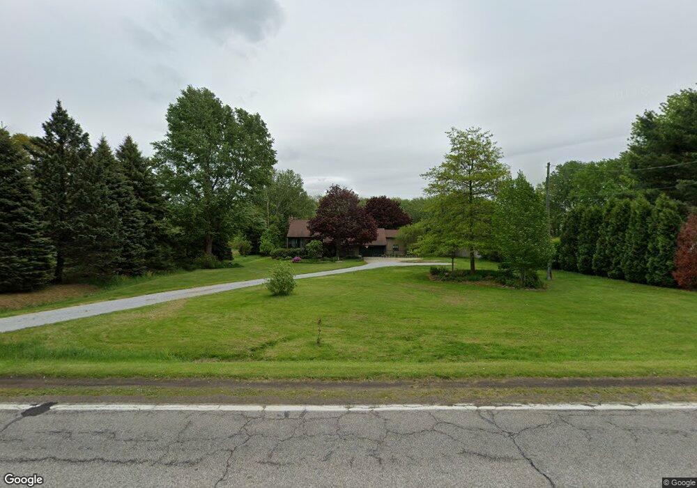
2907 Burns Rd Madison, OH 44057
Estimated Value: $278,000 - $375,000
3
Beds
3
Baths
1,452
Sq Ft
$216/Sq Ft
Est. Value
About This Home
This home is located at 2907 Burns Rd, Madison, OH 44057 and is currently estimated at $313,974, approximately $216 per square foot. 2907 Burns Rd is a home located in Lake County with nearby schools including South Elementary School, Madison Middle School, and Madison High School.
Ownership History
Date
Name
Owned For
Owner Type
Purchase Details
Closed on
Apr 20, 2001
Sold by
Smith Jacqueline M
Bought by
Middleton James E and Middleton Deborah L
Current Estimated Value
Home Financials for this Owner
Home Financials are based on the most recent Mortgage that was taken out on this home.
Original Mortgage
$60,000
Interest Rate
7.02%
Purchase Details
Closed on
Mar 22, 2001
Sold by
Smith Jacqueline M
Bought by
Socosky Don D and Socosky Carol J
Home Financials for this Owner
Home Financials are based on the most recent Mortgage that was taken out on this home.
Original Mortgage
$60,000
Interest Rate
7.02%
Purchase Details
Closed on
Dec 16, 1999
Sold by
Hubaker Jacqueline M and Hubaker Jacqueline M
Bought by
Smith Jacqueline M
Purchase Details
Closed on
Jun 29, 1992
Bought by
Hubaker Jacqueline M
Create a Home Valuation Report for This Property
The Home Valuation Report is an in-depth analysis detailing your home's value as well as a comparison with similar homes in the area
Home Values in the Area
Average Home Value in this Area
Purchase History
| Date | Buyer | Sale Price | Title Company |
|---|---|---|---|
| Middleton James E | $4,000 | -- | |
| Socosky Don D | $138,000 | Cleveland Title | |
| Smith Jacqueline M | -- | Cresi | |
| Hubaker Jacqueline M | -- | -- |
Source: Public Records
Mortgage History
| Date | Status | Borrower | Loan Amount |
|---|---|---|---|
| Previous Owner | Socosky Don D | $60,000 |
Source: Public Records
Tax History Compared to Growth
Tax History
| Year | Tax Paid | Tax Assessment Tax Assessment Total Assessment is a certain percentage of the fair market value that is determined by local assessors to be the total taxable value of land and additions on the property. | Land | Improvement |
|---|---|---|---|---|
| 2024 | -- | $95,430 | $20,720 | $74,710 |
| 2023 | $7,326 | $65,910 | $15,040 | $50,870 |
| 2022 | $4,041 | $65,910 | $15,040 | $50,870 |
| 2021 | $4,048 | $65,910 | $15,040 | $50,870 |
| 2020 | $3,953 | $56,810 | $12,960 | $43,850 |
| 2019 | $3,956 | $56,810 | $12,960 | $43,850 |
| 2018 | $3,824 | $57,120 | $13,290 | $43,830 |
| 2017 | $3,955 | $57,120 | $13,290 | $43,830 |
| 2016 | $3,757 | $57,120 | $13,290 | $43,830 |
| 2015 | $3,422 | $57,120 | $13,290 | $43,830 |
| 2014 | $3,500 | $57,120 | $13,290 | $43,830 |
| 2013 | $3,507 | $57,120 | $13,290 | $43,830 |
Source: Public Records
Map
Nearby Homes
- 1087 W Mallard Dr Unit C29
- 0 N Ridge (Us Rt 20) Rd Unit 4151016
- 2656 Lake Breeze Dr
- 12 Square Circle Dr
- 0 Norwood Dr Unit 5101897
- 5742 Abiding Way
- 5734 Middle Ridge Rd
- 5470 N Ridge Rd
- 0 Mcmackin Rd Unit 5102732
- 11 Hawaiian Dr
- 6073 Chapel Rd
- 24 Hawaiian Dr
- 6835 Shelly Dr
- 249 W Main St
- 5930 Keith Dr
- 6046 Dundee St
- 53 S Lake St
- 1861 Stirling Rd
- 1877 Clyde Rd
- V/L Townline Rd