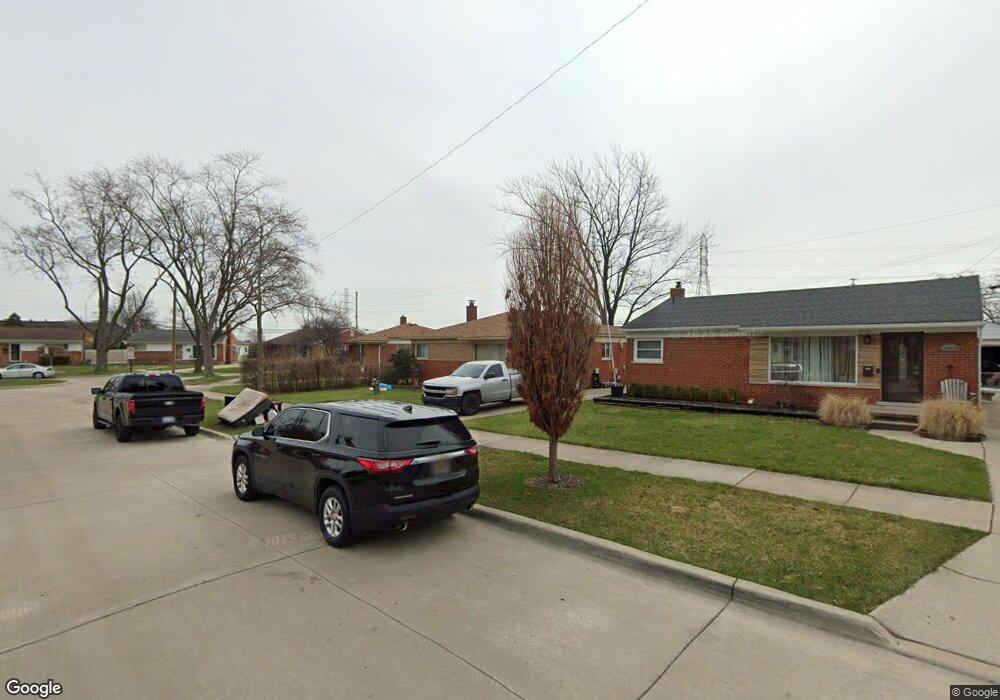
29084 Fourner Ave Madison Heights, MI 48071
Estimated Value: $259,000 - $285,000
3
Beds
1
Bath
1,266
Sq Ft
$212/Sq Ft
Est. Value
About This Home
This home is located at 29084 Fourner Ave, Madison Heights, MI 48071 and is currently estimated at $267,866, approximately $211 per square foot. 29084 Fourner Ave is a home located in Oakland County with nearby schools including Lamphere High School, Keys Grace Academy, and Temple Christian Academy.
Ownership History
Date
Name
Owned For
Owner Type
Purchase Details
Closed on
Aug 6, 2024
Sold by
Lyons Howard and Lyons Nancy
Bought by
Lyons Howard and Mcalonan Mary
Current Estimated Value
Home Financials for this Owner
Home Financials are based on the most recent Mortgage that was taken out on this home.
Original Mortgage
$203,500
Outstanding Balance
$201,232
Interest Rate
6.95%
Mortgage Type
FHA
Estimated Equity
$66,634
Purchase Details
Closed on
Oct 30, 1998
Sold by
Taylor Richard S
Bought by
Lyons Howard
Home Financials for this Owner
Home Financials are based on the most recent Mortgage that was taken out on this home.
Original Mortgage
$133,231
Interest Rate
6.8%
Create a Home Valuation Report for This Property
The Home Valuation Report is an in-depth analysis detailing your home's value as well as a comparison with similar homes in the area
Home Values in the Area
Average Home Value in this Area
Purchase History
| Date | Buyer | Sale Price | Title Company |
|---|---|---|---|
| Lyons Howard | -- | None Listed On Document | |
| Lyons Howard | -- | None Listed On Document | |
| Lyons Howard | $135,000 | -- |
Source: Public Records
Mortgage History
| Date | Status | Borrower | Loan Amount |
|---|---|---|---|
| Open | Lyons Howard | $203,500 | |
| Closed | Lyons Howard | $203,500 | |
| Previous Owner | Lyons Howard | $133,231 |
Source: Public Records
Tax History Compared to Growth
Tax History
| Year | Tax Paid | Tax Assessment Tax Assessment Total Assessment is a certain percentage of the fair market value that is determined by local assessors to be the total taxable value of land and additions on the property. | Land | Improvement |
|---|---|---|---|---|
| 2024 | $2,673 | $113,700 | $0 | $0 |
| 2023 | $2,567 | $101,960 | $0 | $0 |
| 2022 | $2,986 | $92,900 | $0 | $0 |
| 2021 | $2,951 | $87,670 | $0 | $0 |
| 2020 | $2,403 | $84,090 | $0 | $0 |
| 2019 | $2,811 | $78,700 | $0 | $0 |
| 2018 | $2,769 | $61,810 | $0 | $0 |
| 2017 | $2,324 | $61,810 | $0 | $0 |
| 2016 | $2,230 | $54,130 | $0 | $0 |
| 2015 | -- | $48,910 | $0 | $0 |
| 2014 | -- | $41,740 | $0 | $0 |
| 2011 | -- | $43,040 | $0 | $0 |
Source: Public Records
Map
Nearby Homes
- 29118 Sherry Ave
- 1922 N Wilson Ave
- 1939 N Connecticut Ave
- 1116 Symes Ct
- 1029 Symes Ct
- 2225 N Connecticut Ave
- 28349 Hampden St
- 1208 E 12 Mile (Corner Lot) Rd
- 1208 E 12 Mile (Eastern Lot) Rd
- 1208 E 12 Mile (Center Lot) Rd
- 1019 N Edgeworth Ave
- 905 W Parker Ave
- 2414 N Connecticut Ave
- 2500 N Wilson Ave
- 1018 E 12 Mile Rd
- 2517 N Wilson Ave
- 2451 N Connecticut Ave
- 28695 Diesing Dr
- 1117 N Vermont Ave
- 27907 Lenox Ave
- 29076 Fourner Ave
- 29068 Fourner Ave
- 29092 Fourner Ave
- 29060 Sherry Ave
- 29079 Fourner Ave
- 29089 Fourner Ave
- 29067 Fourner Ave
- 29050 Sherry Ave
- 29106 Mark Ave
- 29121 Mark Ave
- 29112 Mark Ave
- 29120 Mark Ave
- 29131 Mark Ave
- 29079 Sherry Ave
- 29065 Sherry Ave
- 29091 Sherry Ave
- 29128 Mark Ave
- 29132 Sherry Ave
- 29055 Sherry Ave
- 29101 Sherry Ave