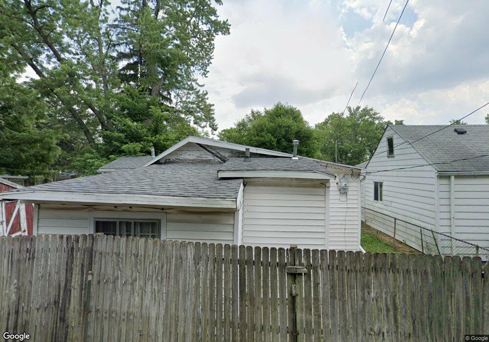
2909 Howey Rd Columbus, OH 43224
North Linden NeighborhoodEstimated Value: $131,821 - $151,000
2
Beds
1
Bath
828
Sq Ft
$169/Sq Ft
Est. Value
About This Home
This home is located at 2909 Howey Rd, Columbus, OH 43224 and is currently estimated at $140,205, approximately $169 per square foot. 2909 Howey Rd is a home located in Franklin County with nearby schools including Como Elementary School, Dominion Middle School, and Whetstone High School.
Ownership History
Date
Name
Owned For
Owner Type
Purchase Details
Closed on
Apr 18, 2025
Sold by
Dyer Earn E
Bought by
Dyer Family Irrevocable Living Trust and Dyer
Current Estimated Value
Purchase Details
Closed on
Oct 29, 2018
Sold by
Hughes Christy and Estate Of Shirlene Lowe
Bought by
Dyer Erarn E
Purchase Details
Closed on
Jul 18, 1994
Sold by
Dyer Randal V
Bought by
Shirlene Lowe
Purchase Details
Closed on
Dec 16, 1988
Purchase Details
Closed on
Dec 2, 1988
Create a Home Valuation Report for This Property
The Home Valuation Report is an in-depth analysis detailing your home's value as well as a comparison with similar homes in the area
Home Values in the Area
Average Home Value in this Area
Purchase History
| Date | Buyer | Sale Price | Title Company |
|---|---|---|---|
| Dyer Family Irrevocable Living Trust | -- | None Listed On Document | |
| Dyer Erarn E | $20,000 | None Available | |
| Shirlene Lowe | $20,000 | -- | |
| -- | $14,900 | -- | |
| -- | $9,000 | -- |
Source: Public Records
Tax History
| Year | Tax Paid | Tax Assessment Tax Assessment Total Assessment is a certain percentage of the fair market value that is determined by local assessors to be the total taxable value of land and additions on the property. | Land | Improvement |
|---|---|---|---|---|
| 2025 | $1,927 | $42,040 | $11,760 | $30,280 |
| 2024 | $1,927 | $42,040 | $11,760 | $30,280 |
| 2023 | $1,903 | $42,035 | $11,760 | $30,275 |
| 2022 | $962 | $18,100 | $5,290 | $12,810 |
| 2021 | $964 | $18,100 | $5,290 | $12,810 |
| 2020 | $965 | $18,100 | $5,290 | $12,810 |
| 2019 | $936 | $15,050 | $4,410 | $10,640 |
| 2018 | $810 | $15,050 | $4,410 | $10,640 |
| 2017 | $936 | $15,050 | $4,410 | $10,640 |
| 2016 | $754 | $11,100 | $3,920 | $7,180 |
| 2015 | $687 | $11,100 | $3,920 | $7,180 |
| 2014 | $688 | $11,100 | $3,920 | $7,180 |
| 2013 | $377 | $12,320 | $4,340 | $7,980 |
Source: Public Records
Map
Nearby Homes
- 2888 Howey Rd
- 2897 Grasmere Ave
- 2872 Howey Rd
- 2874 Grasmere Ave
- 2950 Grasmere Ave
- 2992 Howey Rd
- 964 E Weber Rd
- 3081 Grasmere Ave
- 1222 Manchester Ave
- 3035 Audubon Rd
- 2916 Hamilton Ave
- 816 Melrose Ave
- 1166 Minnesota Ave
- 3147 Grasmere Ave
- 1311 E Weber Rd
- 1199 Minnesota Ave
- 773 Melrose Ave
- 2610 Atwood Terrace
- 978 E North Broadway St
- 2595 Grasmere Ave
- 2917 Howey Rd
- 2905 Howey Rd
- 2899 Howey Rd
- 2923 Howey Rd
- 2895 Howey Rd
- 2916 Atwood Terrace
- 2922 Atwood Terrace
- 2912 Atwood Terrace
- 0 Howey Rd
- 0 Howey Rd
- 2928 Atwood Terrace
- 2908 Atwood Terrace
- 2908 Howey Rd Unit 910
- 2914 Howey Rd
- 2934 Atwood Terrace
- 2902 Atwood Terrace
- 2935 Howey Rd
- 2902 Howey Rd
- 2920 Howey Rd
- 2885 Howey Rd
Your Personal Tour Guide
Ask me questions while you tour the home.