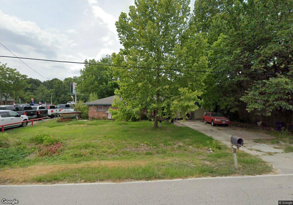
2909 Lincoln Dr Houston, TX 77038
North Houston Neighborhood
3
Beds
2
Baths
1,956
Sq Ft
0.27
Acres
About This Home
This home is located at 2909 Lincoln Dr, Houston, TX 77038. 2909 Lincoln Dr is a home located in Harris County with nearby schools including Kujawa EC/Pre-K/K School, Carter Academy, and Shotwell Middle School.
Ownership History
Date
Name
Owned For
Owner Type
Purchase Details
Closed on
Feb 14, 2012
Sold by
Downs Diane Lynn
Bought by
Downs Timothy Wayne
Purchase Details
Closed on
Sep 10, 1997
Sold by
Holmes Jamie
Bought by
Downs Allan W and 149 Auto Sales
Home Financials for this Owner
Home Financials are based on the most recent Mortgage that was taken out on this home.
Original Mortgage
$28,000
Interest Rate
7.48%
Mortgage Type
Purchase Money Mortgage
Purchase Details
Closed on
May 15, 1995
Sold by
Holmes Thomas Dee and Holmes Thomas
Bought by
Holmes Jamie Ruth and Holmes Jamie
Create a Home Valuation Report for This Property
The Home Valuation Report is an in-depth analysis detailing your home's value as well as a comparison with similar homes in the area
Home Values in the Area
Average Home Value in this Area
Purchase History
| Date | Buyer | Sale Price | Title Company |
|---|---|---|---|
| Downs Timothy Wayne | -- | None Available | |
| Downs Allan W | -- | First American Title | |
| Holmes Jamie Ruth | -- | First American Title |
Source: Public Records
Mortgage History
| Date | Status | Borrower | Loan Amount |
|---|---|---|---|
| Previous Owner | Downs Allan W | $28,000 |
Source: Public Records
Tax History Compared to Growth
Tax History
| Year | Tax Paid | Tax Assessment Tax Assessment Total Assessment is a certain percentage of the fair market value that is determined by local assessors to be the total taxable value of land and additions on the property. | Land | Improvement |
|---|---|---|---|---|
| 2025 | $2,584 | $133,228 | $119,440 | $13,788 |
| 2024 | $2,584 | $133,554 | $119,440 | $14,114 |
| 2023 | $2,584 | $134,204 | $119,440 | $14,764 |
| 2022 | $1,512 | $73,534 | $59,720 | $13,814 |
| 2021 | $1,541 | $71,519 | $59,720 | $11,799 |
| 2020 | $1,640 | $72,201 | $59,720 | $12,481 |
| 2019 | $2,885 | $121,261 | $108,780 | $12,481 |
| 2018 | $1,606 | $111,823 | $108,780 | $3,043 |
| 2017 | $2,534 | $111,823 | $108,780 | $3,043 |
| 2016 | $2,543 | $112,197 | $108,780 | $3,417 |
| 2015 | $2,426 | $108,780 | $108,780 | $0 |
| 2014 | $2,426 | $108,780 | $108,780 | $0 |
Source: Public Records
Map
Nearby Homes
- 2846 W Mount Houston Rd
- 2845 Washington Dr
- 9218 Washington Dr
- 9217 Washington Dr
- 9206 Washington Dr
- 2930 Washington Dr
- 2934 Washington Dr
- 11207 Royal Rock Ct
- 11618 Wren Crossing Dr
- 11623 Quinn Ridge Way
- 11638 Township Dale Ct
- 11422 Royal Thistle Ct
- 2647 Royal Thistle Dr
- 10911 Camarillo Ct
- 11726 Wren Crossing Dr
- 10923 Whistlers Cottage Ct
- 11707 Madison Oak St
- 11727 State Highway 249
- 2631 Palmetto Valley Dr
- 2734 Donellan Dr
- 2854 W Mount Houston
- 2922 Lincoln Dr
- 2906 Lincoln Dr
- 2842 Lincoln Dr Unit 1
- 2842 Lincoln Dr
- 2842 Lincoln Dr
- 0 Lincoln Dr
- 2905 Washington Dr
- 2849 Washington Dr
- 2921 Washington Dr
- 2833 Lincoln Dr
- 2830 Lincoln Dr
- 9215 Washington Dr
- 9213 Washington Dr
- 2837 Washington Dr
- 2947 Washington Dr
- 2926 Washington Dr
- 2833 Washington Dr
- 2826 Lincoln Dr
- 2918 Star Peak Dr