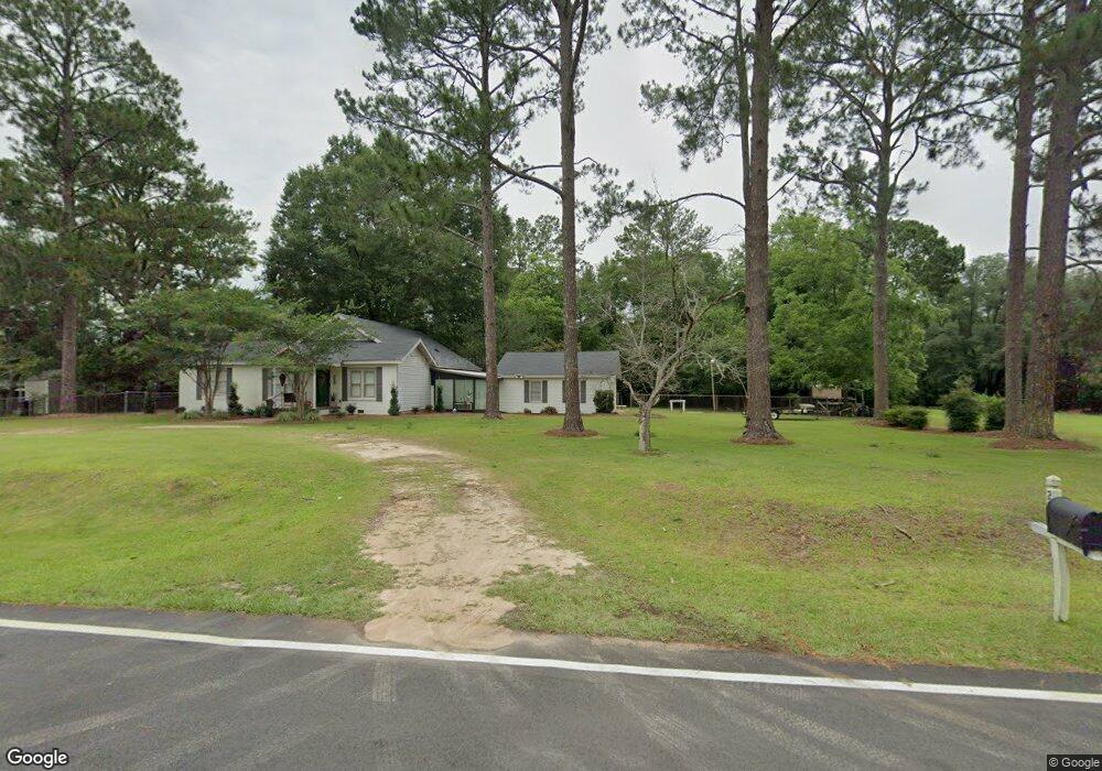
2909 Lonesome Rd Albany, GA 31721
Estimated Value: $130,000 - $273,000
3
Beds
2
Baths
2,380
Sq Ft
$72/Sq Ft
Est. Value
About This Home
This home is located at 2909 Lonesome Rd, Albany, GA 31721 and is currently estimated at $171,037, approximately $71 per square foot. 2909 Lonesome Rd is a home located in Dougherty County with nearby schools including Alice Coachman Elementary School, Southside Middle School, and Monroe High School.
Ownership History
Date
Name
Owned For
Owner Type
Purchase Details
Closed on
Oct 6, 2022
Sold by
Mathis Marilyn Gayla
Bought by
Laing Ivy E
Current Estimated Value
Purchase Details
Closed on
Oct 4, 2022
Sold by
Hines Leanne W
Bought by
Hines Leanne W and Laing Ivy E
Purchase Details
Closed on
Jun 30, 2015
Sold by
Willis Bernice T
Bought by
Willis Bernice T and Laing Jacinda W
Purchase Details
Closed on
Jan 29, 2015
Sold by
Willis Bernice T
Bought by
Mathis Marilyn Gayla
Purchase Details
Closed on
Mar 26, 2014
Sold by
Willis Ivey J
Bought by
Willis Bernice T
Purchase Details
Closed on
Jun 4, 1960
Bought by
Willis Ivey J
Create a Home Valuation Report for This Property
The Home Valuation Report is an in-depth analysis detailing your home's value as well as a comparison with similar homes in the area
Home Values in the Area
Average Home Value in this Area
Purchase History
| Date | Buyer | Sale Price | Title Company |
|---|---|---|---|
| Laing Ivy E | -- | -- | |
| Laing Ivy E | $41,667 | -- | |
| Laing Ivy E | $41,667 | -- | |
| Hines Leanne W | $41,667 | -- | |
| Willis Bernice T | -- | -- | |
| Mathis Marilyn Gayla | -- | -- | |
| Willis Bernice T | -- | -- | |
| Willis Ivey J | -- | -- |
Source: Public Records
Tax History Compared to Growth
Tax History
| Year | Tax Paid | Tax Assessment Tax Assessment Total Assessment is a certain percentage of the fair market value that is determined by local assessors to be the total taxable value of land and additions on the property. | Land | Improvement |
|---|---|---|---|---|
| 2024 | $1,331 | $30,800 | $3,800 | $27,000 |
| 2023 | $499 | $30,800 | $3,800 | $27,000 |
| 2022 | $1,335 | $30,800 | $3,800 | $27,000 |
| 2021 | $1,235 | $30,800 | $3,800 | $27,000 |
| 2020 | $1,237 | $30,800 | $3,800 | $27,000 |
| 2019 | $1,240 | $30,800 | $3,800 | $27,000 |
| 2018 | $1,243 | $30,800 | $3,800 | $27,000 |
| 2017 | $1,157 | $30,800 | $3,800 | $27,000 |
| 2016 | $1,158 | $30,800 | $3,800 | $27,000 |
| 2015 | $1,160 | $30,800 | $3,800 | $27,000 |
| 2014 | -- | $30,600 | $3,600 | $27,000 |
Source: Public Records
Map
Nearby Homes
- 0000 Hamilton Dr
- 2613 Lonesome Rd
- 6413 Newton Rd
- 3610 Slade Ave
- 3710 Coakley Ave
- 6224 Newton Rd
- 3211 Higgins Dr
- 2610 North Ave
- 4200 Vanderbilt Dr
- 3108 Higgins Dr
- 5407 Paulk Dr
- 5404 Paulk Dr
- 5616 Newton Rd
- 1610 Lily Pond Rd
- 3432 Aristedes Ct
- 000 Lily Pond Rd
- 1503 Lily Pond Rd
- 906 Lockett Station Rd
- 902 Lockett Station Rd
- 2307 Evergreen Dr
- 2911 Lonesome Rd
- 2908 Lark Ave
- 2913 Lonesome Rd
- 2905 Lonesome Rd
- 2910 Lark Ave
- 2915 Lonesome Rd
- 2910 Lonesome Rd
- 2912 Lonesome Rd
- 2917 Lonesome Rd
- 2907 Lark Ave
- 2909 Lark Ave
- 2911 Lark Ave
- 3709 Oliver Dr
- 2919 Lonesome Rd
- 2915 Lark Ave
- 2924 Lonesome Rd
- 3708 Hamilton Dr
- 3705 Oliver Dr
- 3706 Hamilton Dr
- 2908 Dove Ave