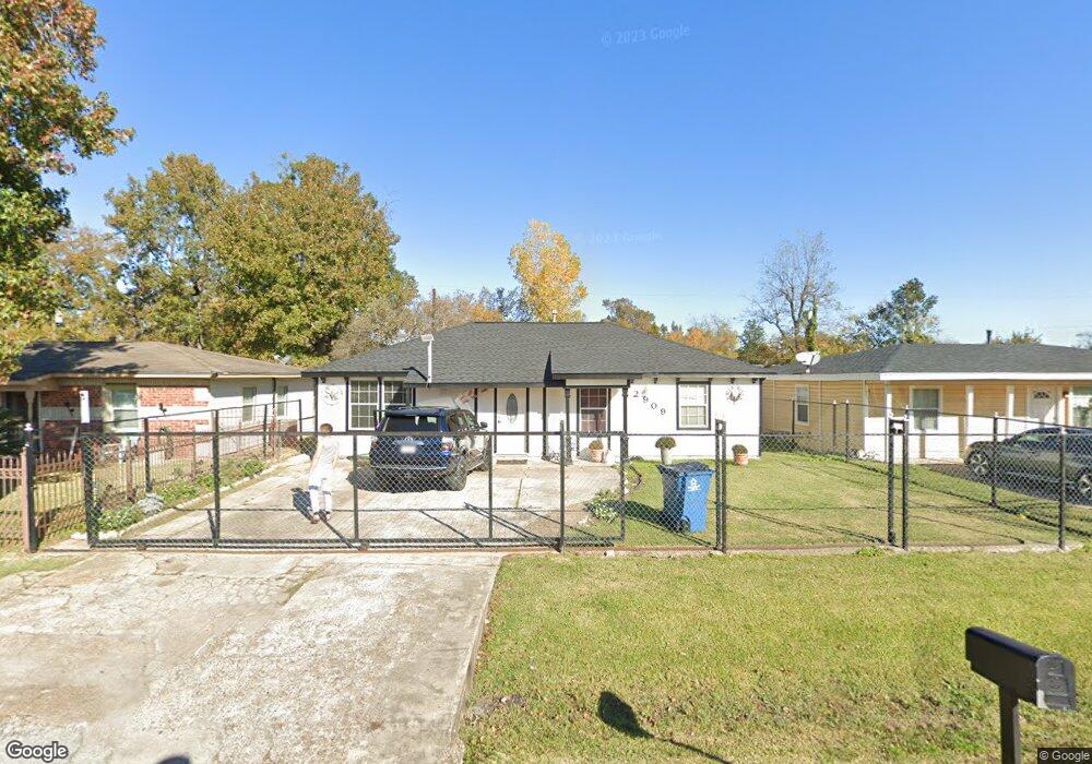
2909 Mohawk St Houston, TX 77093
East Aldine NeighborhoodEstimated Value: $189,000 - $226,000
2
Beds
1
Bath
1,188
Sq Ft
$172/Sq Ft
Est. Value
About This Home
This home is located at 2909 Mohawk St, Houston, TX 77093 and is currently estimated at $204,767, approximately $172 per square foot. 2909 Mohawk St is a home located in Harris County with nearby schools including Scarborough Elementary School, Patrick Henry Middle School, and Sam Houston Math, Science & Technology Center.
Ownership History
Date
Name
Owned For
Owner Type
Purchase Details
Closed on
Aug 23, 2017
Sold by
Alfaro Jorge and Alfaro Socorro
Bought by
Chacon Guerra Luz Irene
Current Estimated Value
Purchase Details
Closed on
Jul 27, 2012
Sold by
Federal National Mortgage Association
Bought by
Alfaro Jorge
Purchase Details
Closed on
Jul 22, 2008
Sold by
Cervantes Juan and Cervantes Mary A
Bought by
Federal National Mortgage Association
Create a Home Valuation Report for This Property
The Home Valuation Report is an in-depth analysis detailing your home's value as well as a comparison with similar homes in the area
Home Values in the Area
Average Home Value in this Area
Purchase History
| Date | Buyer | Sale Price | Title Company |
|---|---|---|---|
| Chacon Guerra Luz Irene | -- | None Available | |
| Alfaro Jorge | -- | None Available | |
| Federal National Mortgage Association | $68,000 | None Available |
Source: Public Records
Tax History Compared to Growth
Tax History
| Year | Tax Paid | Tax Assessment Tax Assessment Total Assessment is a certain percentage of the fair market value that is determined by local assessors to be the total taxable value of land and additions on the property. | Land | Improvement |
|---|---|---|---|---|
| 2025 | $1,042 | $219,101 | $40,308 | $178,793 |
| 2024 | $1,042 | $219,101 | $40,308 | $178,793 |
| 2023 | $1,042 | $240,202 | $40,308 | $199,894 |
| 2022 | $2,030 | $191,969 | $30,844 | $161,125 |
| 2021 | $1,959 | $154,423 | $30,844 | $123,579 |
| 2020 | $1,853 | $129,893 | $30,844 | $99,049 |
| 2019 | $2,782 | $129,893 | $30,844 | $99,049 |
| 2018 | $1,597 | $74,567 | $30,844 | $43,723 |
| 2017 | $1,597 | $74,567 | $30,844 | $43,723 |
| 2016 | $1,597 | $74,567 | $30,844 | $43,723 |
| 2015 | $1,547 | $72,326 | $19,278 | $53,048 |
| 2014 | $1,547 | $72,326 | $19,278 | $53,048 |
Source: Public Records
Map
Nearby Homes
- 2817 Cromwell St
- 2629 Kowis St
- 2915 Brea Crest St
- 3214 Brea Crest St
- 2636 Lone Oak Rd
- 11716 Innsbury Dr
- 2311 Warwick Rd
- 3111 Hartwick Rd
- 2237 Cromwell St
- 2723 Castledale Dr
- 2326 Sunny Dr
- 3418 Hopper Rd
- 11746 Somerset Ln
- 2922 Bertrand St
- 1728 Little York Rd
- 2306 Wardmont St
- 2930 Bertrand St
- 1904 Little York Rd
- 2152 William Tell St
- 2131 Cromwell St Unit D