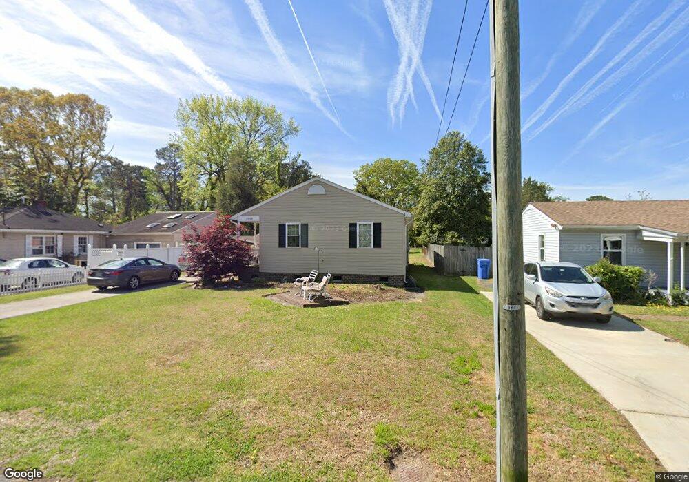
2909 Springfield Ave Chesapeake, VA 23325
Indian River NeighborhoodEstimated Value: $281,000 - $304,000
3
Beds
2
Baths
1,160
Sq Ft
$253/Sq Ft
Est. Value
About This Home
This home is located at 2909 Springfield Ave, Chesapeake, VA 23325 and is currently estimated at $294,037, approximately $253 per square foot. 2909 Springfield Ave is a home located in Chesapeake City with nearby schools including Norfolk Highlands Primary School, Sparrow Road Intermediate School, and Indian River Middle.
Ownership History
Date
Name
Owned For
Owner Type
Purchase Details
Closed on
Dec 14, 2001
Sold by
L D Enterprises
Bought by
Parker Diane E
Current Estimated Value
Home Financials for this Owner
Home Financials are based on the most recent Mortgage that was taken out on this home.
Original Mortgage
$83,800
Outstanding Balance
$33,110
Interest Rate
6.72%
Estimated Equity
$260,927
Create a Home Valuation Report for This Property
The Home Valuation Report is an in-depth analysis detailing your home's value as well as a comparison with similar homes in the area
Home Values in the Area
Average Home Value in this Area
Purchase History
| Date | Buyer | Sale Price | Title Company |
|---|---|---|---|
| Parker Diane E | $105,000 | -- |
Source: Public Records
Mortgage History
| Date | Status | Borrower | Loan Amount |
|---|---|---|---|
| Open | Parker Diane E | $83,800 |
Source: Public Records
Tax History
| Year | Tax Paid | Tax Assessment Tax Assessment Total Assessment is a certain percentage of the fair market value that is determined by local assessors to be the total taxable value of land and additions on the property. | Land | Improvement |
|---|---|---|---|---|
| 2025 | $2,495 | $251,500 | $120,000 | $131,500 |
| 2024 | $2,495 | $247,000 | $110,000 | $137,000 |
| 2023 | $2,055 | $218,500 | $100,000 | $118,500 |
| 2022 | $2,093 | $207,200 | $90,000 | $117,200 |
| 2021 | $1,828 | $174,100 | $75,000 | $99,100 |
| 2020 | $1,791 | $170,600 | $75,000 | $95,600 |
| 2019 | $1,791 | $170,600 | $75,000 | $95,600 |
| 2018 | $1,792 | $173,800 | $75,000 | $98,800 |
| 2017 | $1,884 | $179,400 | $75,000 | $104,400 |
| 2016 | $1,884 | $179,400 | $75,000 | $104,400 |
| 2015 | $1,854 | $176,600 | $75,000 | $101,600 |
| 2014 | $1,825 | $173,800 | $75,000 | $98,800 |
Source: Public Records
Map
Nearby Homes
- 2802 Canton Ave
- 330 Kemp Ln
- 116 Rollingswood Rd
- 3005 Menands Dr
- 4112 Mingo Trail
- 113 Commonwealth Ave
- 503 Stalham Rd
- 1131 Lilac Ave
- 2609 Harling Dr
- 1123 Myrtle Ave
- 2912 Scotia Dr
- 604 Amick Rd
- 1943 Sycamore Ln
- .112ac Montclair Ave
- 1216 Myrtle Ave
- 2607 Berkley Ave
- 862 E Sparrow Rd
- 3502 Cornick Ave
- 1116 Elder Ave
- 2923 Berkley Ave
- 2907 Springfield Ave
- 2911 Springfield Ave
- 2905 Springfield Ave
- 2992 Springfield Ave
- 2904 Princeton Ave
- 3001 Springfield Ave
- 2902A Princeton Ave
- 2903 Springfield Ave
- 2916 Springfield Ave
- 2912 Princeton Ave
- 3000 Springfield Ave
- 2902 Princeton Ave
- 2902 Princeton Ave
- 2902 Princeton Ave Unit A
- 2910 Springfield Ave
- 2916 Princeton Ave
- 2916 Princeton Ave Unit 2
- 2916 Princeton Ave Unit 1
- 2916 Princeton Ave Unit B
- 702 Wingfield Ave
Your Personal Tour Guide
Ask me questions while you tour the home.