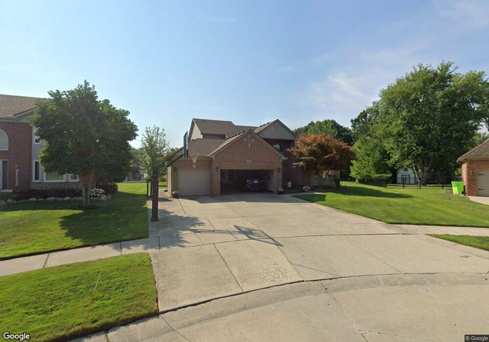
29094 Bay Pointe Dr Unit Bldg-Unit Chesterfield, MI 48047
Estimated Value: $500,000 - $539,000
4
Beds
3
Baths
2,553
Sq Ft
$201/Sq Ft
Est. Value
About This Home
This home is located at 29094 Bay Pointe Dr Unit Bldg-Unit, Chesterfield, MI 48047 and is currently estimated at $513,404, approximately $201 per square foot. 29094 Bay Pointe Dr Unit Bldg-Unit is a home located in Macomb County with nearby schools including Dean A. Naldrett School, Anchor Bay Middle School South, and Anchor Bay High School.
Ownership History
Date
Name
Owned For
Owner Type
Purchase Details
Closed on
Feb 28, 2023
Sold by
Peck Corey and Peck Jennifer
Bought by
Peck Corey and Peck Corey
Current Estimated Value
Purchase Details
Closed on
Mar 5, 2018
Sold by
Gustavus Timothy and Gustavus Tammy L
Bought by
Peck Corey and Peck Jennifer
Purchase Details
Closed on
Nov 12, 2003
Sold by
Homes By Mancini & Assoc Inc
Bought by
Gustavus Timothy and Gustavus Tammy L
Purchase Details
Closed on
Nov 25, 2002
Sold by
Baycourt Development Llc
Bought by
Homes By Mancini & Assoc Inc
Create a Home Valuation Report for This Property
The Home Valuation Report is an in-depth analysis detailing your home's value as well as a comparison with similar homes in the area
Home Values in the Area
Average Home Value in this Area
Purchase History
| Date | Buyer | Sale Price | Title Company |
|---|---|---|---|
| Peck Corey | -- | -- | |
| Peck Corey | $310,000 | Title One Inc | |
| Gustavus Timothy | $310,585 | -- | |
| Homes By Mancini & Assoc Inc | $58,000 | Greco |
Source: Public Records
Tax History Compared to Growth
Tax History
| Year | Tax Paid | Tax Assessment Tax Assessment Total Assessment is a certain percentage of the fair market value that is determined by local assessors to be the total taxable value of land and additions on the property. | Land | Improvement |
|---|---|---|---|---|
| 2025 | $6,526 | $243,300 | $0 | $0 |
| 2024 | $3,704 | $223,400 | $0 | $0 |
| 2023 | $3,511 | $209,700 | $0 | $0 |
| 2022 | $5,914 | $175,500 | $0 | $0 |
| 2021 | $5,759 | $162,000 | $0 | $0 |
| 2020 | $3,226 | $156,000 | $0 | $0 |
| 2019 | $5,334 | $146,700 | $0 | $0 |
| 2018 | $4,430 | $140,900 | $20,800 | $120,100 |
| 2017 | $4,336 | $134,150 | $20,800 | $113,350 |
| 2016 | $4,329 | $134,150 | $0 | $0 |
| 2015 | $2,069 | $125,650 | $0 | $0 |
| 2014 | $2,069 | $115,250 | $14,950 | $100,300 |
| 2012 | -- | $0 | $0 | $0 |
Source: Public Records
Map
Nearby Homes
- 29371 Bayside Cir N
- 29213 Rachid Ln
- 29705 Alexandra Ln Unit 13
- 47460 Sugarbush Rd
- 47685 Jefferson Ave
- 29126 Brooke Meadows Ct
- 47812 Forbes Dr
- 29401 Wand Dr
- 47031 Jefferson Ave
- 47900 Jefferson Ave
- 47978 Jefferson Ave
- 000 Farwell St
- 29050 Farwell St
- 47935 Remington Ct
- 00000 21 Mile Rd
- 28490 Cotton Rd Unit 3
- 46835 Putnam Ct
- 46133 Edgewater St
- 28715 Portsmouth Ct Unit 32
- 28734 Yarmouth Ct Unit 18
- 29094 Bay Pointe Dr
- 29098 Bay Pointe Dr
- 29090 Bay Pointe Dr
- 29237 Rachid Ct
- 29236 Rachid Ct
- 29102 Bay Pointe Dr
- 29086 Bay Pointe Dr
- 29106 Bay Pointe Dr
- 29097 Bay Pointe Dr
- 29240 Rachid Ct
- 29082 Bay Pointe Dr
- 29241 Rachid Ct
- 29101 Bay Pointe Dr
- 29110 Bay Pointe Dr
- 29078 Bay Pointe Dr
- 29105 Bay Pointe Dr
- 29244 Rachid Ct
- 47620 Clairmont Ln
- 29245 Rachid Ct
- 47375 Bayside Cir E