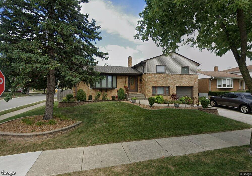
291 Braddock Dr Melrose Park, IL 60160
North Maywood NeighborhoodEstimated Value: $391,547 - $411,000
3
Beds
3
Baths
1,827
Sq Ft
$220/Sq Ft
Est. Value
About This Home
This home is located at 291 Braddock Dr, Melrose Park, IL 60160 and is currently estimated at $401,387, approximately $219 per square foot. 291 Braddock Dr is a home located in Cook County with nearby schools including Jane Addams Elementary School, Stevenson Middle School, and Proviso East High School.
Ownership History
Date
Name
Owned For
Owner Type
Purchase Details
Closed on
Jun 16, 2005
Sold by
Hughes Michael and Hughes Kimberly
Bought by
Alanis Josefina and Corral Daniel
Current Estimated Value
Home Financials for this Owner
Home Financials are based on the most recent Mortgage that was taken out on this home.
Original Mortgage
$285,000
Outstanding Balance
$149,839
Interest Rate
5.87%
Mortgage Type
Unknown
Estimated Equity
$251,548
Create a Home Valuation Report for This Property
The Home Valuation Report is an in-depth analysis detailing your home's value as well as a comparison with similar homes in the area
Home Values in the Area
Average Home Value in this Area
Purchase History
| Date | Buyer | Sale Price | Title Company |
|---|---|---|---|
| Alanis Josefina | $285,000 | Git |
Source: Public Records
Mortgage History
| Date | Status | Borrower | Loan Amount |
|---|---|---|---|
| Open | Alanis Josefina | $285,000 |
Source: Public Records
Tax History Compared to Growth
Tax History
| Year | Tax Paid | Tax Assessment Tax Assessment Total Assessment is a certain percentage of the fair market value that is determined by local assessors to be the total taxable value of land and additions on the property. | Land | Improvement |
|---|---|---|---|---|
| 2024 | $6,289 | $27,518 | $4,900 | $22,618 |
| 2023 | $5,656 | $27,518 | $4,900 | $22,618 |
| 2022 | $5,656 | $21,776 | $4,200 | $17,576 |
| 2021 | $5,771 | $21,776 | $4,200 | $17,576 |
| 2020 | $5,680 | $21,776 | $4,200 | $17,576 |
| 2019 | $5,171 | $19,380 | $3,850 | $15,530 |
| 2018 | $5,150 | $19,380 | $3,850 | $15,530 |
| 2017 | $5,658 | $21,296 | $3,850 | $17,446 |
| 2016 | $4,917 | $17,838 | $3,500 | $14,338 |
| 2015 | $4,801 | $17,838 | $3,500 | $14,338 |
| 2014 | $4,668 | $17,838 | $3,500 | $14,338 |
| 2013 | $5,228 | $21,256 | $3,500 | $17,756 |
Source: Public Records
Map
Nearby Homes
- 291 Division St
- 1401 N 5th Ave
- 1118 N 6th Ave
- 1650 Riverwoods Dr Unit 503
- 1650 Riverwoods Dr Unit 205
- 918 Park Dr
- 1700 Riverwoods Dr Unit 517
- 1700 Riverwoods Dr Unit 314
- 1616 N 12th Ave
- 1202 Elsie Dr
- 1200 N 11th Ave
- 1114 N 11th Ave
- 1209 Helen Dr
- 619 N 4th Ave
- 613 Huron St
- 1630 N 15th Ave
- 407 N 2nd Ave
- 1718 N 15th Ave
- 1303 Rice St
- 87 Ohio St
- 281 Braddock Dr
- 1621 Clinton Ct
- 301 Braddock Dr
- 271 Braddock Dr
- 1620 Channing Ct
- 1620 Clinton Ct
- 1631 Clinton Ct
- 280 Braddock Dr
- 290 Braddock Dr
- 1620 Charleston Ct
- 1620 Charleston Ct
- 270 Braddock Dr
- 341 Braddock Dr
- 300 Braddock Dr
- 1630 Channing Ct
- 1630 Clinton Ct
- 260 Braddock Dr
- 1641 Clinton Ct
- 320 Braddock Dr
- 1640 Channing Ct
