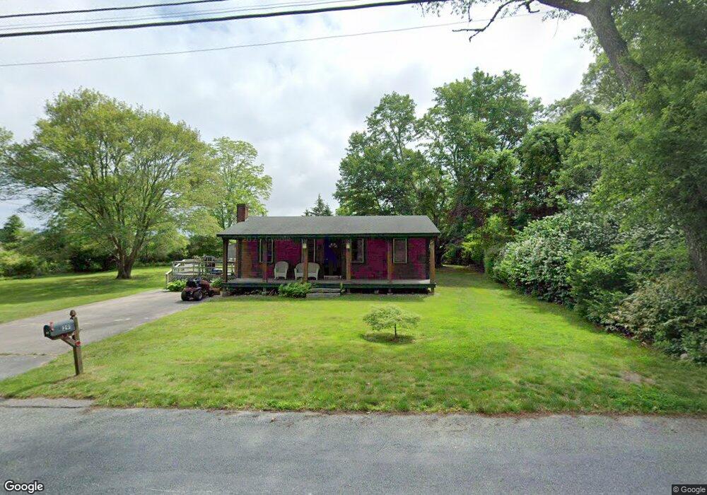
291 Broad Rock Rd Wakefield, RI 02879
Estimated Value: $412,900 - $460,000
2
Beds
1
Bath
756
Sq Ft
$580/Sq Ft
Est. Value
About This Home
This home is located at 291 Broad Rock Rd, Wakefield, RI 02879 and is currently estimated at $438,475, approximately $579 per square foot. 291 Broad Rock Rd is a home located in Washington County with nearby schools including South Kingstown High School and South Shore School.
Ownership History
Date
Name
Owned For
Owner Type
Purchase Details
Closed on
Dec 30, 2003
Sold by
Sisson Charles Richard
Bought by
Smith Douglas A
Current Estimated Value
Home Financials for this Owner
Home Financials are based on the most recent Mortgage that was taken out on this home.
Original Mortgage
$110,000
Interest Rate
6.01%
Mortgage Type
Purchase Money Mortgage
Create a Home Valuation Report for This Property
The Home Valuation Report is an in-depth analysis detailing your home's value as well as a comparison with similar homes in the area
Home Values in the Area
Average Home Value in this Area
Purchase History
| Date | Buyer | Sale Price | Title Company |
|---|---|---|---|
| Smith Douglas A | $190,000 | -- |
Source: Public Records
Mortgage History
| Date | Status | Borrower | Loan Amount |
|---|---|---|---|
| Open | Smith Douglas A | $180,000 | |
| Closed | Smith Douglas A | $120,000 | |
| Closed | Smith Douglas A | $110,000 |
Source: Public Records
Tax History Compared to Growth
Tax History
| Year | Tax Paid | Tax Assessment Tax Assessment Total Assessment is a certain percentage of the fair market value that is determined by local assessors to be the total taxable value of land and additions on the property. | Land | Improvement |
|---|---|---|---|---|
| 2025 | $2,996 | $335,100 | $178,500 | $156,600 |
| 2024 | $2,903 | $262,700 | $137,100 | $125,600 |
| 2023 | $2,903 | $262,700 | $137,100 | $125,600 |
| 2022 | $2,877 | $262,700 | $137,100 | $125,600 |
| 2021 | $3,036 | $210,100 | $119,100 | $91,000 |
| 2020 | $3,036 | $210,100 | $119,100 | $91,000 |
| 2019 | $3,036 | $210,100 | $119,100 | $91,000 |
| 2018 | $2,965 | $189,100 | $110,800 | $78,300 |
| 2017 | $2,895 | $189,100 | $110,800 | $78,300 |
| 2016 | $2,854 | $189,100 | $110,800 | $78,300 |
| 2015 | $2,891 | $186,300 | $108,300 | $78,000 |
| 2014 | $2,884 | $186,300 | $108,300 | $78,000 |
Source: Public Records
Map
Nearby Homes
- 70 Broad Rock Rd
- 40 Amos St
- 128 North Rd
- 3 Larkin St
- 73 Camden Ct
- 128 Camden Ct
- 918 Saugatucket Rd
- 156 River St Unit B
- 957 Saugatucket Rd
- 48 Stone Bridge Dr
- 10 Hendricks St
- 37 Columbia St
- 45 Cherry Ln Unit C
- 39 Hazard Ave
- 53 Rocky Brook Way
- 228 Rodman St
- 229 Saugatucket Rd
- 128 Rodman St
- 115 Dam St
- 17 Celestial Heights Dr
- 281 Broad Rock Rd
- 300 Broad Rock Rd
- 284 Broad Rock Rd
- 271 Broad Rock Rd
- 14 Arbor Way
- 274 Broad Rock Rd
- 322 Broad Rock Rd
- 260 Broad Rock Rd
- 15 Arbor Way
- 32 Arbor Way
- 14 Greybirch Ct
- 250 Broad Rock Rd
- 27 Arbor Way
- 425 Oakwoods Dr
- 35 Greybirch Ct
- 37 Spruce Ct
- 415 Oakwoods Dr
- 240 Broad Rock Rd
- 41 Arbor Way
- 43 Spruce Ct