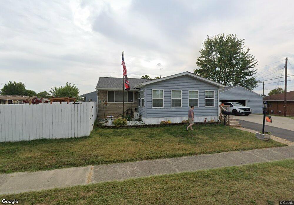
291 Calahan Rd Columbus, OH 43207
Obetz-Lockbourne NeighborhoodEstimated Value: $175,098 - $212,000
3
Beds
2
Baths
924
Sq Ft
$209/Sq Ft
Est. Value
About This Home
This home is located at 291 Calahan Rd, Columbus, OH 43207 and is currently estimated at $193,025, approximately $208 per square foot. 291 Calahan Rd is a home located in Franklin County with nearby schools including Parsons Elementary School, Buckeye Middle School, and Marion-Franklin High School.
Ownership History
Date
Name
Owned For
Owner Type
Purchase Details
Closed on
Jul 30, 1999
Sold by
Moore Elizabeth E
Bought by
Needles Anthony D and Needles Cynthia E
Current Estimated Value
Home Financials for this Owner
Home Financials are based on the most recent Mortgage that was taken out on this home.
Original Mortgage
$77,600
Outstanding Balance
$22,369
Interest Rate
7.69%
Estimated Equity
$170,656
Purchase Details
Closed on
Mar 1, 1999
Sold by
Estate Of Charles H Moore Sr
Bought by
Moore Elizabeth E
Purchase Details
Closed on
Jan 11, 1960
Bought by
Moore Charles H
Create a Home Valuation Report for This Property
The Home Valuation Report is an in-depth analysis detailing your home's value as well as a comparison with similar homes in the area
Home Values in the Area
Average Home Value in this Area
Purchase History
| Date | Buyer | Sale Price | Title Company |
|---|---|---|---|
| Needles Anthony D | $80,000 | Amerititle Mill Run | |
| Moore Elizabeth E | -- | -- | |
| Moore Charles H | -- | -- |
Source: Public Records
Mortgage History
| Date | Status | Borrower | Loan Amount |
|---|---|---|---|
| Open | Needles Anthony D | $77,600 |
Source: Public Records
Tax History Compared to Growth
Tax History
| Year | Tax Paid | Tax Assessment Tax Assessment Total Assessment is a certain percentage of the fair market value that is determined by local assessors to be the total taxable value of land and additions on the property. | Land | Improvement |
|---|---|---|---|---|
| 2024 | $2,449 | $54,570 | $16,170 | $38,400 |
| 2023 | $2,418 | $54,565 | $16,170 | $38,395 |
| 2022 | $1,910 | $36,830 | $10,470 | $26,360 |
| 2021 | $1,914 | $36,830 | $10,470 | $26,360 |
| 2020 | $1,916 | $36,830 | $10,470 | $26,360 |
| 2019 | $1,953 | $32,200 | $9,100 | $23,100 |
| 2018 | $1,944 | $32,200 | $9,100 | $23,100 |
| 2017 | $2,044 | $32,200 | $9,100 | $23,100 |
| 2016 | $2,136 | $32,240 | $6,760 | $25,480 |
| 2015 | $1,939 | $32,240 | $6,760 | $25,480 |
| 2014 | $1,943 | $32,240 | $6,760 | $25,480 |
| 2013 | $1,009 | $33,915 | $7,105 | $26,810 |
Source: Public Records
Map
Nearby Homes
- 2901 Parsons Ave
- 145 Ziegler Ave
- 164 E Alcott Rd
- 228 Currier Dr
- 229 Southard Dr
- 443 Carolann Ave
- 3161 Lewis Rd
- 19 E Castle Rd
- 2808 Dolby Dr
- 0 F Ave Unit 224036459
- 84 Betz Rd
- 82 Delray Rd
- 115 W Castle Rd
- 256 Rumsey Rd Unit 258
- 162 Phelps Rd
- 3380 Parsons Ave
- 400 Colton Rd
- 202 Williams Rd
- 780 Basswood Rd
- 574 Koebel Ave
- 2861 Hillgate Rd
- 283 Calahan Rd
- 2867 Hillgate Rd
- 275 Calahan Rd
- 282 Calahan Rd
- 278 Schryver Rd
- 2852 Hillgate Rd
- 290 Schryver Rd
- 2860 Hillgate Rd
- 2831 Hillgate Rd
- 2846 Hillgate Rd
- 2866 Hillgate Rd
- 276 Calahan Rd
- 272 Schryver Rd
- 2840 Hillgate Rd
- 2874 Hillgate Rd
- 2823 Hillgate Rd
- 266 Schryver Rd
- 268 Calahan Rd
- 2832 Hillgate Rd