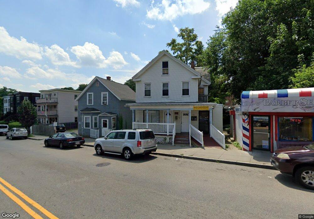
291 Cummins Hwy Unit 293 Roslindale, MA 02131
Roslindale NeighborhoodEstimated Value: $961,206
--
Bed
2
Baths
1,200
Sq Ft
$801/Sq Ft
Est. Value
About This Home
This home is located at 291 Cummins Hwy Unit 293, Roslindale, MA 02131 and is currently estimated at $961,206, approximately $801 per square foot. 291 Cummins Hwy Unit 293 is a home located in Suffolk County with nearby schools including Brooke Charter School Roslindale, Sacred Heart STEM School, and St. Clare High School.
Ownership History
Date
Name
Owned For
Owner Type
Purchase Details
Closed on
May 14, 2015
Sold by
C Washington Llc
Bought by
Woghiren Osazee
Current Estimated Value
Purchase Details
Closed on
Jan 6, 2005
Sold by
Roberts Wayne W
Bought by
Woghiren Osazee
Home Financials for this Owner
Home Financials are based on the most recent Mortgage that was taken out on this home.
Original Mortgage
$308,000
Interest Rate
5.75%
Mortgage Type
Commercial
Purchase Details
Closed on
Feb 26, 1999
Sold by
Wmfc 1997 Prop Inc
Bought by
Richards Sonia
Purchase Details
Closed on
Jun 11, 1998
Sold by
Edme Mona
Bought by
Wmfc 1997-4 Prop Inc
Purchase Details
Closed on
Jun 29, 1990
Sold by
Benway Joseph T
Bought by
Edme Mona
Create a Home Valuation Report for This Property
The Home Valuation Report is an in-depth analysis detailing your home's value as well as a comparison with similar homes in the area
Home Values in the Area
Average Home Value in this Area
Purchase History
| Date | Buyer | Sale Price | Title Company |
|---|---|---|---|
| Woghiren Osazee | -- | -- | |
| Woghiren Osazee | $440,000 | -- | |
| Richards Sonia | $135,000 | -- | |
| Wmfc 1997-4 Prop Inc | $147,900 | -- | |
| Edme Mona | $165,000 | -- |
Source: Public Records
Mortgage History
| Date | Status | Borrower | Loan Amount |
|---|---|---|---|
| Previous Owner | Edme Mona | $308,000 | |
| Previous Owner | Edme Mona | $88,000 | |
| Previous Owner | Edme Mona | $24,000 |
Source: Public Records
Tax History Compared to Growth
Tax History
| Year | Tax Paid | Tax Assessment Tax Assessment Total Assessment is a certain percentage of the fair market value that is determined by local assessors to be the total taxable value of land and additions on the property. | Land | Improvement |
|---|---|---|---|---|
| 2025 | -- | $478,500 | $128,300 | $350,200 |
| 2024 | -- | $493,200 | $128,300 | $364,900 |
| 2023 | $0 | $499,900 | $128,300 | $371,600 |
| 2022 | $0 | $471,600 | $128,300 | $343,300 |
| 2021 | $0 | $472,700 | $119,800 | $352,900 |
| 2020 | $0 | $462,800 | $119,800 | $343,000 |
| 2019 | $0 | $455,000 | $119,800 | $335,200 |
| 2018 | $0 | $439,000 | $115,500 | $323,500 |
| 2017 | $0 | $422,000 | $111,200 | $310,800 |
| 2016 | -- | $374,500 | $102,600 | $271,900 |
| 2015 | -- | $329,500 | $89,800 | $239,700 |
| 2014 | -- | $310,000 | $81,300 | $228,700 |
Source: Public Records
Map
Nearby Homes
- 543 Hyde Park Ave Unit 1
- 25 Pinedale Rd Unit 1
- 8 Mount Calvary Rd Unit 4
- 16 Hilburn Place
- 87 Clare Ave
- 27 Rowe St
- 250 Poplar St Unit 1
- 32 Jewett St
- 417 Poplar St
- 415 Poplar St
- 25 Crandall St
- 273 Metropolitan Ave Unit 2
- 36 Neponset Ave Unit 1
- 175 Clare Ave Unit B3
- 67 Cummins Hwy Unit 101
- 103-105 Neponset Ave
- 103 Neponset Ave Unit 103A
- 71 Wyvern St
- 105 Neponset Ave Unit 105
- 187 Florence St Unit 2L
- 291 Cummins Hwy Unit 1
- 293 Cummins Hwy Unit 2
- 295 Cummins Hwy Unit 297R
- 612 Hyde Park Ave Unit 614
- 297 Cummins Hwy Unit 2
- 301 Cummins Hwy Unit 303
- 301 Cummins Hwy Unit 3
- 612 Hyde Park Ave
- 618 Hyde Park Ave Unit 3
- 618 Hyde Park Ave Unit 2
- 618 Hyde Park Ave Unit 1
- 618 Hyde Park Ave Unit 618
- 600 Hyde Park Ave
- 602 Hyde Park Ave Unit 2
- 305 Cummins Hwy Unit 3L
- 305 Cummins Hwy
- 305 Cummins Hwy Unit 1R
- 305 Cummins Hwy Unit 1L
- 305 Cummins Hwy
- 9 Hadwin Way