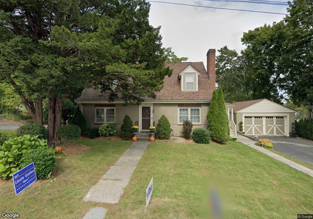
291 Dale St Waltham, MA 02451
Highlands NeighborhoodEstimated Value: $1,070,000 - $1,452,000
4
Beds
2
Baths
4,470
Sq Ft
$267/Sq Ft
Est. Value
About This Home
This home is located at 291 Dale St, Waltham, MA 02451 and is currently estimated at $1,193,490, approximately $267 per square foot. 291 Dale St is a home located in Middlesex County with nearby schools including Thomas R Plympton Elementary School, John F Kennedy Middle School, and Waltham Sr High School.
Ownership History
Date
Name
Owned For
Owner Type
Purchase Details
Closed on
Jun 5, 2018
Sold by
Romard Daniel P
Bought by
Daniel P Romard T
Current Estimated Value
Purchase Details
Closed on
Jul 31, 1998
Sold by
Begrin Muriel H Est
Bought by
Romard Daniel P
Home Financials for this Owner
Home Financials are based on the most recent Mortgage that was taken out on this home.
Original Mortgage
$210,000
Interest Rate
6.92%
Mortgage Type
Purchase Money Mortgage
Create a Home Valuation Report for This Property
The Home Valuation Report is an in-depth analysis detailing your home's value as well as a comparison with similar homes in the area
Home Values in the Area
Average Home Value in this Area
Purchase History
| Date | Buyer | Sale Price | Title Company |
|---|---|---|---|
| Daniel P Romard T | -- | -- | |
| Romard Daniel P | $273,500 | -- |
Source: Public Records
Mortgage History
| Date | Status | Borrower | Loan Amount |
|---|---|---|---|
| Previous Owner | Romard Daniel P | $161,598 | |
| Previous Owner | Romard Daniel P | $64,000 | |
| Previous Owner | Romard Daniel P | $210,000 |
Source: Public Records
Tax History Compared to Growth
Tax History
| Year | Tax Paid | Tax Assessment Tax Assessment Total Assessment is a certain percentage of the fair market value that is determined by local assessors to be the total taxable value of land and additions on the property. | Land | Improvement |
|---|---|---|---|---|
| 2025 | $8,303 | $845,500 | $427,600 | $417,900 |
| 2024 | $8,109 | $841,200 | $427,600 | $413,600 |
| 2023 | $7,773 | $753,200 | $388,000 | $365,200 |
| 2022 | $7,847 | $704,400 | $364,300 | $340,100 |
| 2021 | $6,487 | $657,900 | $332,600 | $325,300 |
| 2020 | $7,334 | $613,700 | $301,100 | $312,600 |
| 2019 | $7,235 | $571,500 | $301,100 | $270,400 |
| 2018 | $6,663 | $528,400 | $278,800 | $249,600 |
| 2017 | $6,318 | $503,000 | $253,400 | $249,600 |
| 2016 | $6,060 | $495,100 | $245,500 | $249,600 |
| 2015 | $5,843 | $445,000 | $229,700 | $215,300 |
Source: Public Records
Map
Nearby Homes
- 14 Willard St
- 37 Summit St
- 14 Claremont St
- 91 Prentice St
- 326 Bacon St
- 43-45 Welligton Unit 3
- 15 Banks St Unit 4
- 16 Winter St Unit 26C
- 15 Howard St
- 948 Main St Unit 209
- 948 Main St Unit 105
- 49 Lincoln St
- 79-81 Vernon St
- 160 School St Unit 3-1
- 32 Harvard St Unit 2
- 511 Lexington St
- 202 Bear Hill Rd
- 15 Cedarcroft Ln
- 39 Floyd St Unit 2
- 158 Church St
- 5 Willard St
- 0 Willard St Unit 71998155
- 279 Dale St
- 10 Willard St
- 290 Dale St
- 6 Willard St
- 15 Willard St
- 7 Totten Cir
- 275 Dale St Unit 277
- 23 Willard St
- 305 Dale St
- 24 Willard St
- 276 Dale St
- 300 Dale St
- 269 Dale St Unit 1
- 269 Dale St Unit 2
- 267-269 Dale St
- 267 Dale St Unit 269
- 27 Willard St
- 309 Dale St