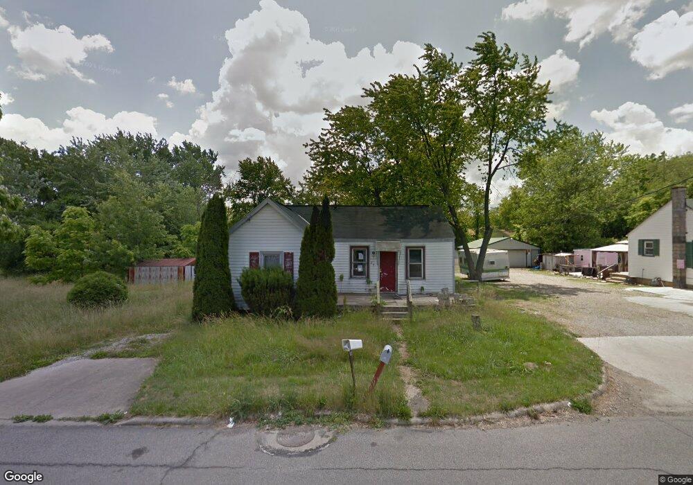
291 Harmon Ave Mansfield, OH 44903
Estimated Value: $66,000 - $86,000
3
Beds
1
Bath
920
Sq Ft
$79/Sq Ft
Est. Value
About This Home
This home is located at 291 Harmon Ave, Mansfield, OH 44903 and is currently estimated at $73,008, approximately $79 per square foot. 291 Harmon Ave is a home located in Richland County with nearby schools including Goal Digital Academy, Foundation Academy, and St. Peter's Elementary/Montessori School.
Ownership History
Date
Name
Owned For
Owner Type
Purchase Details
Closed on
Nov 15, 2024
Sold by
Akhtar Nasreen and Khan Chudary T
Bought by
Ishtias Zainis
Current Estimated Value
Purchase Details
Closed on
Oct 7, 2022
Sold by
Khan Chudray I
Bought by
Akhtar Nasreen
Purchase Details
Closed on
Feb 24, 2015
Sold by
Barney Rhonda
Bought by
Khan Chudary I
Purchase Details
Closed on
Oct 11, 2004
Sold by
Barney Ernest L and Barney Ernest
Bought by
Barney Rhonda
Purchase Details
Closed on
Apr 6, 1993
Sold by
Edmiston Hattie
Bought by
Barney Ernest L
Create a Home Valuation Report for This Property
The Home Valuation Report is an in-depth analysis detailing your home's value as well as a comparison with similar homes in the area
Home Values in the Area
Average Home Value in this Area
Purchase History
| Date | Buyer | Sale Price | Title Company |
|---|---|---|---|
| Ishtias Zainis | -- | None Listed On Document | |
| Akhtar Nasreen | $250 | -- | |
| Khan Chudary I | $3,200 | Chicago Title Agency Of Nort | |
| Barney Rhonda | -- | -- | |
| Barney Ernest L | $5,800 | -- |
Source: Public Records
Tax History
| Year | Tax Paid | Tax Assessment Tax Assessment Total Assessment is a certain percentage of the fair market value that is determined by local assessors to be the total taxable value of land and additions on the property. | Land | Improvement |
|---|---|---|---|---|
| 2024 | $1,673 | $1,670 | $1,170 | $500 |
| 2023 | $1,824 | $1,670 | $1,170 | $500 |
| 2022 | $81 | $1,410 | $1,040 | $370 |
| 2021 | $6,746 | $1,410 | $1,040 | $370 |
| 2020 | $83 | $1,410 | $1,040 | $370 |
| 2019 | $92 | $1,410 | $1,040 | $370 |
| 2018 | $537 | $1,410 | $1,040 | $370 |
| 2017 | $567 | $8,340 | $2,530 | $5,810 |
| 2016 | $611 | $7,870 | $2,400 | $5,470 |
| 2015 | $611 | $7,870 | $2,400 | $5,470 |
| 2014 | $468 | $7,870 | $2,400 | $5,470 |
| 2012 | -- | $8,280 | $2,530 | $5,750 |
Source: Public Records
Map
Nearby Homes
- 0 Highway 30
- 118 Raymond Ave
- 580 N Mulberry St
- 524 Lida St
- 701 Springmill St
- 516 Burns St
- 572 France St
- 0 Voegele Ave Unit Lot 6048, 6049, 6
- 492 Stark St
- 739 Armstrong St
- 0 State Route 314 Unit 9069650
- 688 Mcpherson St
- 640 Hanna Rd
- 368 W 6th St
- 447 Spayer Ln
- 891 Springmill Rd
- 641 Averill Ave
- 0 Lemley Ave Unit 9070540
- 212 Penn Ave
- 344 W 5th St
- 297 Harmon Ave
- 303 Harmon Ave
- 284 Grandview Ave
- 294 Grandview Ave
- 292 Harmon St
- 282 Harmon St
- 304 Grandview Ave
- 275 Harmon Ave
- 309 Harmon Ave
- 292 Harmon Ave
- 288 Harmon Ave
- 298 Harmon Ave
- 282 Harmon Ave
- 278 Harmon Ave
- 267 Harmon Ave
- 270 Grandview Ave
- 272 Harmon Ave
- 314 Harmon Ave
- 323 Harmon Ave
- 283 Grandview Ave
Your Personal Tour Guide
Ask me questions while you tour the home.