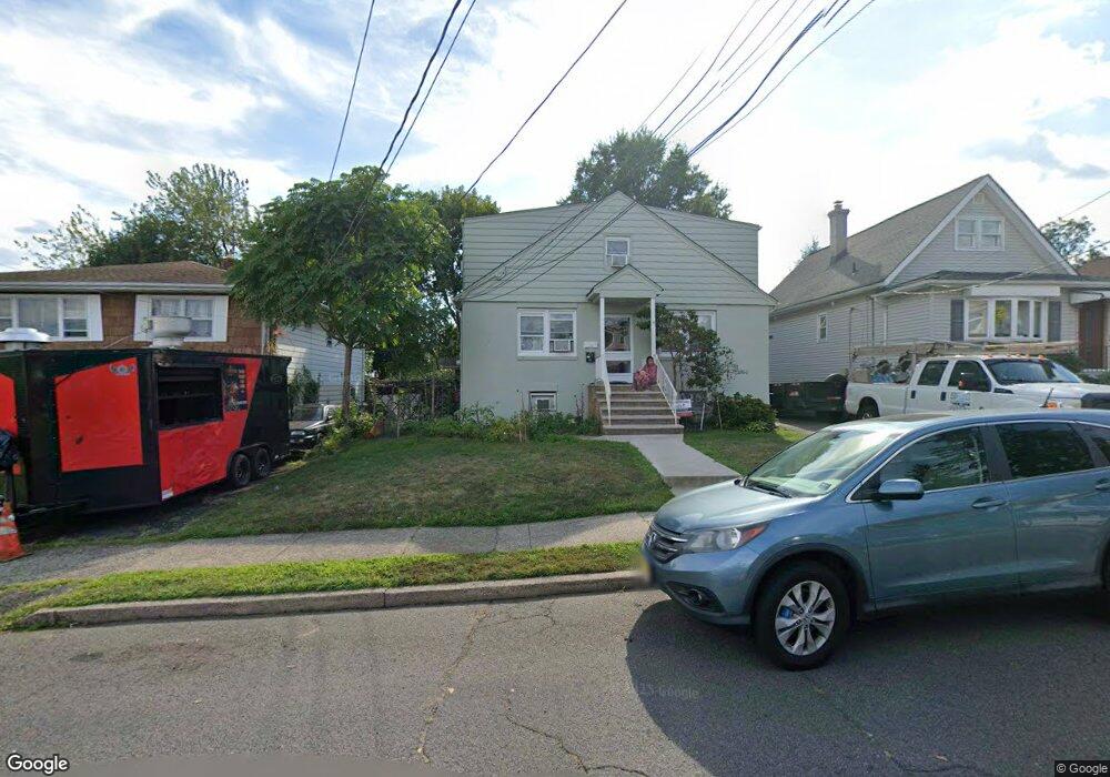
291 Linwood Ave Unit 293 Paterson, NJ 07502
Hillcrest NeighborhoodEstimated Value: $559,000 - $610,000
4
Beds
3
Baths
2,148
Sq Ft
$272/Sq Ft
Est. Value
About This Home
This home is located at 291 Linwood Ave Unit 293, Paterson, NJ 07502 and is currently estimated at $583,552, approximately $271 per square foot. 291 Linwood Ave Unit 293 is a home located in Passaic County with nearby schools including Edward W. Kilpatrick School of Discovery, Dale Avenue Elementary School, and Paterson Public School No. 5.
Ownership History
Date
Name
Owned For
Owner Type
Purchase Details
Closed on
Jun 16, 2017
Sold by
Vanlenten Francesca Van
Bought by
Ahmed Khaleda
Current Estimated Value
Home Financials for this Owner
Home Financials are based on the most recent Mortgage that was taken out on this home.
Original Mortgage
$228,835
Outstanding Balance
$189,556
Interest Rate
3.87%
Mortgage Type
FHA
Estimated Equity
$393,996
Create a Home Valuation Report for This Property
The Home Valuation Report is an in-depth analysis detailing your home's value as well as a comparison with similar homes in the area
Home Values in the Area
Average Home Value in this Area
Purchase History
| Date | Buyer | Sale Price | Title Company |
|---|---|---|---|
| Ahmed Khaleda | $249,900 | Title Agency Of New Jersey I |
Source: Public Records
Mortgage History
| Date | Status | Borrower | Loan Amount |
|---|---|---|---|
| Open | Ahmed Khaleda | $228,835 |
Source: Public Records
Tax History Compared to Growth
Tax History
| Year | Tax Paid | Tax Assessment Tax Assessment Total Assessment is a certain percentage of the fair market value that is determined by local assessors to be the total taxable value of land and additions on the property. | Land | Improvement |
|---|---|---|---|---|
| 2025 | $12,157 | $238,600 | $83,800 | $154,800 |
| 2024 | $11,699 | $238,600 | $83,800 | $154,800 |
| 2022 | $11,076 | $238,600 | $83,800 | $154,800 |
| 2021 | $10,680 | $238,600 | $83,800 | $154,800 |
| 2020 | $9,962 | $238,600 | $83,800 | $154,800 |
| 2019 | $9,645 | $233,300 | $82,100 | $151,200 |
| 2018 | $9,954 | $230,100 | $81,300 | $148,800 |
| 2017 | $9,368 | $225,200 | $80,800 | $144,400 |
| 2016 | $10,309 | $237,600 | $85,000 | $152,600 |
| 2015 | $9,761 | $237,600 | $85,000 | $152,600 |
| 2014 | $11,574 | $399,100 | $198,800 | $200,300 |
Source: Public Records
Map
Nearby Homes
- 295-297 Linwood Ave
- 237 Sherwood Ave Unit 239
- 231 Lenox Ave Unit 233
- 141-143 Crosby Ave
- 262-280 Chamberlain Ave Unit 4
- 120 Sherwood Ave Unit 102
- 306-314 Lenox Ave
- 249 Edmund Ave
- 91 Chatham Ave
- 271-273 Preakness Ave
- 89-91 Chatham Ave
- 2 Colonial Ave
- 512 Preakness Ave
- 255-257 Paterson Ave
- 255 Paterson Ave Unit 257
- 119 Burlington Ave Unit 121
- 119-121 Burlington Ave
- 194-196 Union Ave
- 410 Heights Dr
- 195 Preakness Ave
- 291-293 Linwood Ave
- 295 Linwood Ave Unit 297
- 287 Linwood Ave Unit 289
- 299 Linwood Ave Unit 301
- 303 Linwood Ave Unit 305
- 283 Linwood Ave Unit 285
- 240 Berkshire Ave Unit 242
- 234-238 Berkshire Ave
- 234 Berkshire Ave Unit 238
- 294 Linwood Ave Unit 296
- 230 Berkshire Ave Unit 232
- 279 Linwood Ave Unit 281
- 286 Linwood Ave Unit 288
- 244-246 Berkshire Ave
- 244 Berkshire Ave Unit 246
- 302 Linwood Ave Unit 304
- 226 Berkshire Ave Unit 228
- 248 Berkshire Ave Unit 250
- 306 Linwood Ave Unit 310
- 280 Linwood Ave