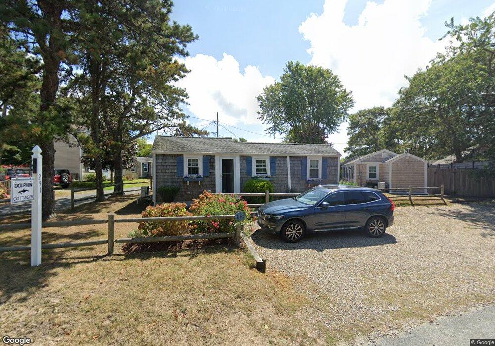
291 Lower County Rd Unit D Dennis Port, MA 02639
Dennis Port NeighborhoodEstimated Value: $315,000 - $383,000
2
Beds
1
Bath
521
Sq Ft
$670/Sq Ft
Est. Value
About This Home
This home is located at 291 Lower County Rd Unit D, Dennis Port, MA 02639 and is currently estimated at $349,047, approximately $669 per square foot. 291 Lower County Rd Unit D is a home located in Barnstable County with nearby schools including Dennis-Yarmouth Regional High School and St. Pius X. School.
Ownership History
Date
Name
Owned For
Owner Type
Purchase Details
Closed on
Jul 25, 2008
Sold by
Jablonski Christopher S
Bought by
Parker James A and Parker Lorraine A
Current Estimated Value
Home Financials for this Owner
Home Financials are based on the most recent Mortgage that was taken out on this home.
Original Mortgage
$115,600
Outstanding Balance
$75,309
Interest Rate
6.35%
Mortgage Type
Purchase Money Mortgage
Estimated Equity
$273,738
Purchase Details
Closed on
Aug 3, 1998
Sold by
Dauphinee Raymond and Dauphinee Marilyn E
Bought by
Jablonski Christopher and Kent Simone E
Home Financials for this Owner
Home Financials are based on the most recent Mortgage that was taken out on this home.
Original Mortgage
$36,000
Interest Rate
6.92%
Mortgage Type
Purchase Money Mortgage
Create a Home Valuation Report for This Property
The Home Valuation Report is an in-depth analysis detailing your home's value as well as a comparison with similar homes in the area
Home Values in the Area
Average Home Value in this Area
Purchase History
| Date | Buyer | Sale Price | Title Company |
|---|---|---|---|
| Parker James A | $144,500 | -- | |
| Parker James A | $144,500 | -- | |
| Jablonski Christopher | $40,000 | -- | |
| Jablonski Christopher | $40,000 | -- |
Source: Public Records
Mortgage History
| Date | Status | Borrower | Loan Amount |
|---|---|---|---|
| Open | Parker James A | $115,600 | |
| Closed | Jablonski Christopher | $115,600 | |
| Previous Owner | Jablonski Christopher | $36,000 |
Source: Public Records
Tax History Compared to Growth
Tax History
| Year | Tax Paid | Tax Assessment Tax Assessment Total Assessment is a certain percentage of the fair market value that is determined by local assessors to be the total taxable value of land and additions on the property. | Land | Improvement |
|---|---|---|---|---|
| 2025 | $1,379 | $318,400 | $0 | $318,400 |
| 2024 | $1,314 | $299,400 | $0 | $299,400 |
| 2023 | $1,146 | $245,500 | $0 | $245,500 |
| 2022 | $1,109 | $198,000 | $0 | $198,000 |
| 2021 | $1,075 | $178,300 | $0 | $178,300 |
| 2020 | $1,057 | $173,200 | $0 | $173,200 |
| 2019 | $1,029 | $166,700 | $0 | $166,700 |
| 2018 | $1,007 | $158,900 | $0 | $158,900 |
| 2017 | $977 | $158,900 | $0 | $158,900 |
| 2016 | $738 | $113,000 | $0 | $113,000 |
| 2015 | $723 | $113,000 | $0 | $113,000 |
| 2014 | $718 | $113,000 | $0 | $113,000 |
Source: Public Records
Map
Nearby Homes
- 22 Ferncliff Rd
- 102 Sea St
- 37-A Beach Hills Rd
- 37 Beach Hills Rd
- 31 Easy St
- 262 Old Wharf Rd Unit 67
- 262 Old Wharf Rd Unit 5
- 262 Old Wharf Rd Unit 5
- 262 Old Wharf Rd Unit 20
- 262 Old Wharf Rd Unit 87
- 402 Old Wharf Rd
- 402 Old Wharf Rd
- 405 Old Wharf Rd Unit B204
- 405 Old Wharf Rd Unit B204
- 22 Wixon Rd
- 12 Cross St
- 241 Old Wharf Rd Unit 82
- 241 Old Wharf Rd Unit 127
- 241 Old Wharf Rd Unit 90
- 11 Ocean Park W
- 291 Lower County Rd Unit G
- 291 Lower County Rd Unit F
- 291 Lower County Rd Unit E
- 291 Lower County Rd Unit C
- 291 Lower County Rd Unit B
- 291 Lower County Rd Unit A
- 291 Lower County Rd Unit UN-A
- 291 Lower County Rd
- 2 Laurel Rd
- 291 Lower County Rd
- 6 Myrtle Rd
- 8 Myrtle Rd
- 6 Myrtle Rd
- 10 Myrtle Rd
- 4 Myrtle Rd
- 10 Laurel Rd
- 3 Laurel Rd
- 1 Laurel Rd
- 1 Laurel Rd Unit 1
- 1 Laurel Rd Unit U3