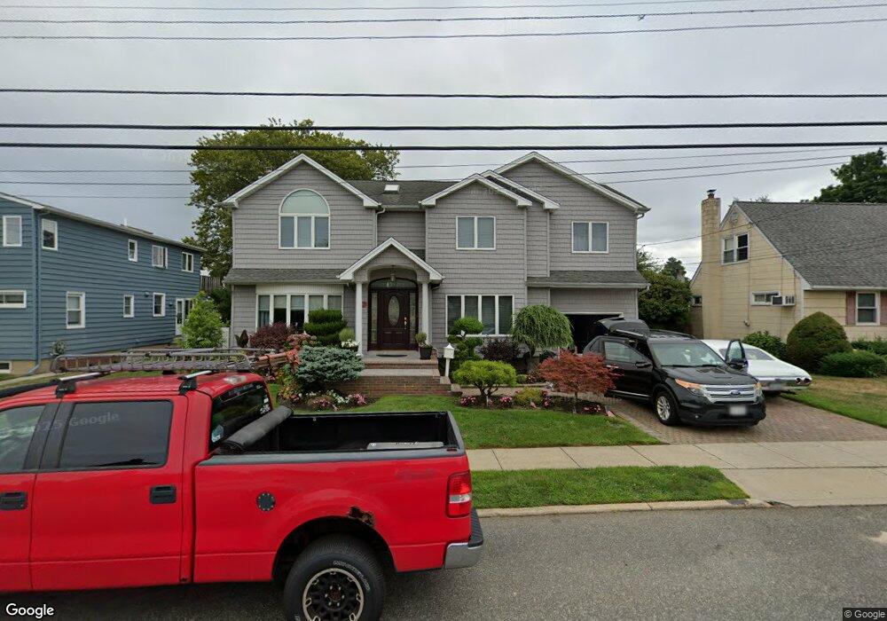
291 Pacific St Massapequa Park, NY 11762
Estimated Value: $770,177 - $943,000
--
Bed
3
Baths
2,094
Sq Ft
$409/Sq Ft
Est. Value
About This Home
This home is located at 291 Pacific St, Massapequa Park, NY 11762 and is currently estimated at $856,589, approximately $409 per square foot. 291 Pacific St is a home located in Nassau County with nearby schools including Berner Middle School, Massapequa High School - Ames Campus, and Massapequa High School.
Ownership History
Date
Name
Owned For
Owner Type
Purchase Details
Closed on
May 31, 1996
Sold by
Demuria Angelina
Bought by
Damato Ronald and Damato Debra
Current Estimated Value
Home Financials for this Owner
Home Financials are based on the most recent Mortgage that was taken out on this home.
Original Mortgage
$116,500
Outstanding Balance
$7,423
Interest Rate
7.97%
Estimated Equity
$849,166
Create a Home Valuation Report for This Property
The Home Valuation Report is an in-depth analysis detailing your home's value as well as a comparison with similar homes in the area
Home Values in the Area
Average Home Value in this Area
Purchase History
| Date | Buyer | Sale Price | Title Company |
|---|---|---|---|
| Damato Ronald | $166,500 | -- |
Source: Public Records
Mortgage History
| Date | Status | Borrower | Loan Amount |
|---|---|---|---|
| Open | Damato Ronald | $116,500 |
Source: Public Records
Tax History Compared to Growth
Tax History
| Year | Tax Paid | Tax Assessment Tax Assessment Total Assessment is a certain percentage of the fair market value that is determined by local assessors to be the total taxable value of land and additions on the property. | Land | Improvement |
|---|---|---|---|---|
| 2025 | $14,624 | $546 | $184 | $362 |
| 2024 | $3,873 | $563 | $190 | $373 |
| 2023 | $12,922 | $563 | $190 | $373 |
| 2022 | $12,922 | $563 | $190 | $373 |
| 2021 | $12,591 | $543 | $183 | $360 |
| 2020 | $12,143 | $762 | $501 | $261 |
| 2019 | $11,347 | $762 | $491 | $271 |
| 2018 | $10,395 | $777 | $0 | $0 |
| 2017 | $6,324 | $777 | $448 | $329 |
| 2016 | $9,293 | $822 | $461 | $361 |
| 2015 | $2,930 | $868 | $487 | $381 |
| 2014 | $2,930 | $868 | $487 | $381 |
| 2013 | $2,821 | $893 | $501 | $392 |
Source: Public Records
Map
Nearby Homes
- 312 Ocean Ave
- 332 Eastlake Ave
- 366 Broadway
- 395 Pacific St
- 229 Philadelphia Ave
- 204 Broadway
- 251 Roosevelt Ave
- 208 Oak St
- 208 Eastlake Ave
- 201 Cypress St
- 52 Westwood Rd S
- 179 Park Ln
- 1 Oakdale Place
- 384 Connecticut Ave
- 118 Broadway
- 46 Ford Dr W
- 6 Ford Dr W
- 117 Ocean Ave
- 138 Eastgate Rd
- 358 Martin Place
- 314 Pittsburg Ave
- 287 Pacific St
- 294 Grand Blvd
- 320 Pittsburg Ave
- 290 Grand Blvd
- 0 Pacific St
- 290 Pacific St
- 304 Pittsburg Ave
- 304 Pittsburg Ave
- 317 Pittsburg Ave
- 286 Pacific St
- 283 Pacific St
- 280 Grand Blvd
- 327 Pittsburg Ave
- 282 Pacific St
- 313 Pittsburg Ave
- 305 Pacific St
- 278 Grand Blvd
- 279 Pacific St
- 278 Pacific St