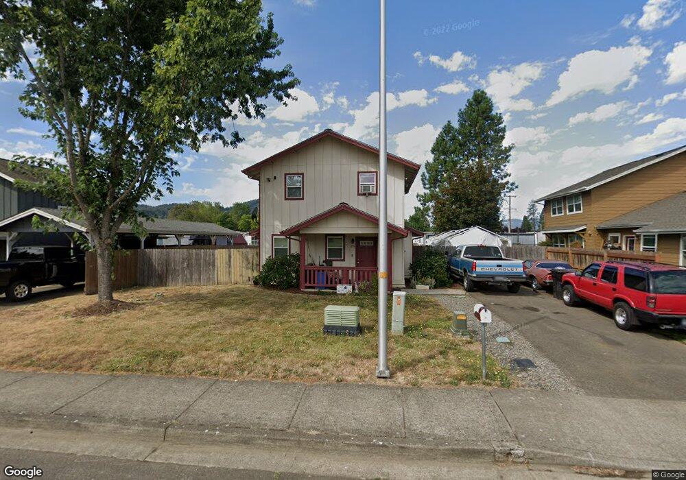
291 Taylor Rd Sutherlin, OR 97479
Estimated Value: $299,000 - $320,000
3
Beds
2
Baths
1,284
Sq Ft
$241/Sq Ft
Est. Value
About This Home
This home is located at 291 Taylor Rd, Sutherlin, OR 97479 and is currently estimated at $309,656, approximately $241 per square foot. 291 Taylor Rd is a home located in Douglas County with nearby schools including East Sutherlin Primary School, West Sutherlin Intermediate School, and Sutherlin Middle School.
Ownership History
Date
Name
Owned For
Owner Type
Purchase Details
Closed on
Aug 7, 2020
Sold by
Ormhp 1050 Llc
Bought by
Sutherlin Estates Mhc Llc
Current Estimated Value
Purchase Details
Closed on
Jun 2, 2014
Sold by
Fisher Steven
Bought by
Diaz Carmela
Home Financials for this Owner
Home Financials are based on the most recent Mortgage that was taken out on this home.
Original Mortgage
$127,000
Interest Rate
4.23%
Mortgage Type
New Conventional
Purchase Details
Closed on
Jan 3, 2014
Sold by
Chamberlain Amber S and United States Department Of Ag
Bought by
Fisher Steven
Purchase Details
Closed on
Apr 26, 2004
Sold by
Umpqua Community Development Corp
Bought by
Chamberlain Amber S
Home Financials for this Owner
Home Financials are based on the most recent Mortgage that was taken out on this home.
Original Mortgage
$105,500
Interest Rate
5.39%
Mortgage Type
Purchase Money Mortgage
Create a Home Valuation Report for This Property
The Home Valuation Report is an in-depth analysis detailing your home's value as well as a comparison with similar homes in the area
Home Values in the Area
Average Home Value in this Area
Purchase History
| Date | Buyer | Sale Price | Title Company |
|---|---|---|---|
| Sutherlin Estates Mhc Llc | $2,570,000 | Western Title | |
| Diaz Carmela | $125,000 | First American Title | |
| Fisher Steven | $104,654 | None Available | |
| Chamberlain Amber S | $108,000 | Douglas County Title Company |
Source: Public Records
Mortgage History
| Date | Status | Borrower | Loan Amount |
|---|---|---|---|
| Previous Owner | Diaz Carmela | $127,000 | |
| Previous Owner | Chamberlain Amber S | $105,500 | |
| Closed | Chamberlain Amber S | $2,500 |
Source: Public Records
Tax History Compared to Growth
Tax History
| Year | Tax Paid | Tax Assessment Tax Assessment Total Assessment is a certain percentage of the fair market value that is determined by local assessors to be the total taxable value of land and additions on the property. | Land | Improvement |
|---|---|---|---|---|
| 2024 | $2,080 | $166,822 | -- | -- |
| 2023 | $2,021 | $161,964 | $0 | $0 |
| 2022 | $1,963 | $157,247 | $0 | $0 |
| 2021 | $1,906 | $152,667 | $0 | $0 |
| 2020 | $1,850 | $148,221 | $0 | $0 |
| 2019 | $1,797 | $143,904 | $0 | $0 |
| 2018 | $1,744 | $139,713 | $0 | $0 |
| 2017 | $1,783 | $135,644 | $0 | $0 |
| 2016 | $1,732 | $131,694 | $0 | $0 |
| 2015 | $1,686 | $127,859 | $0 | $0 |
| 2014 | $1,636 | $124,135 | $0 | $0 |
| 2013 | -- | $120,520 | $0 | $0 |
Source: Public Records
Map
Nearby Homes
- 226 Miller St
- 220 Miller St
- 165 Robinson St
- 279 Grant St
- 1223 Duke Ave
- 1386 Airway Ave
- 819 S Comstock Ave Unit 13
- 530 Tanglewood St
- 0 Dakota St Unit B 500248401
- 181 SW Hutchins St
- 0 N Fourth St Unit 24557651
- 1688 W Central Ave
- 427 S State St
- 851 S Comstock Rd
- 409 S State St
- 420 Backwater Loop
- 788 Schoon Mountain Rd
- 1660 Scardi Blvd
- 892 Fir Grove Ln
- 908 Fir Grove Ln
- 303 Taylor Rd
- 303 Taylor St
- 279 Taylor Rd
- 315 Taylor Rd
- 244 Taylor Rd
- 227 Miller St
- 225 Miller St
- 212 Taylor St
- 213 Miller St
- 212 Taylor Rd
- 209 Miller St
- 143 Miller St
- 184 Taylor Rd
- 248 Johnson St
- 226 S Johnson
- 1050 W Central Ave Unit 60
- 1050 W Central Ave Unit 63
- 1050 W Central Ave Unit 50
- 1050 W Central Ave Unit 12
- 1050 W Central Ave Unit 15