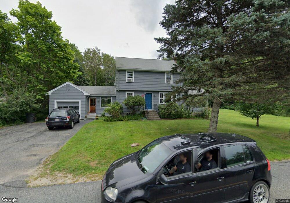
291 Western Ave Sherborn, MA 01770
Estimated Value: $1,060,000 - $1,170,000
4
Beds
3
Baths
2,388
Sq Ft
$468/Sq Ft
Est. Value
About This Home
This home is located at 291 Western Ave, Sherborn, MA 01770 and is currently estimated at $1,117,368, approximately $467 per square foot. 291 Western Ave is a home located in Middlesex County with nearby schools including Pine Hill Elementary School, Dover-Sherborn Regional Middle School, and Dover-Sherborn Regional High School.
Ownership History
Date
Name
Owned For
Owner Type
Purchase Details
Closed on
May 4, 2001
Sold by
Fischer Charles and Fischer Edith H
Bought by
Campe Lisa J and Yount David
Current Estimated Value
Home Financials for this Owner
Home Financials are based on the most recent Mortgage that was taken out on this home.
Original Mortgage
$265,000
Outstanding Balance
$97,631
Interest Rate
6.85%
Mortgage Type
Purchase Money Mortgage
Estimated Equity
$1,019,737
Create a Home Valuation Report for This Property
The Home Valuation Report is an in-depth analysis detailing your home's value as well as a comparison with similar homes in the area
Home Values in the Area
Average Home Value in this Area
Purchase History
| Date | Buyer | Sale Price | Title Company |
|---|---|---|---|
| Campe Lisa J | $454,300 | -- |
Source: Public Records
Mortgage History
| Date | Status | Borrower | Loan Amount |
|---|---|---|---|
| Open | Campe Lisa J | $265,000 | |
| Previous Owner | Campe Lisa J | $30,000 |
Source: Public Records
Tax History Compared to Growth
Tax History
| Year | Tax Paid | Tax Assessment Tax Assessment Total Assessment is a certain percentage of the fair market value that is determined by local assessors to be the total taxable value of land and additions on the property. | Land | Improvement |
|---|---|---|---|---|
| 2025 | $15,988 | $964,300 | $445,700 | $518,600 |
| 2024 | $13,687 | $807,500 | $359,600 | $447,900 |
| 2023 | $12,539 | $696,200 | $359,600 | $336,600 |
| 2022 | $11,656 | $612,500 | $348,900 | $263,600 |
| 2021 | $11,625 | $592,200 | $348,900 | $243,300 |
| 2020 | $11,524 | $592,200 | $348,900 | $243,300 |
| 2019 | $11,558 | $589,100 | $348,900 | $240,200 |
| 2018 | $11,219 | $581,300 | $348,900 | $232,400 |
| 2017 | $7,620 | $547,500 | $348,900 | $198,600 |
| 2016 | $10,723 | $521,300 | $327,400 | $193,900 |
| 2015 | $10,357 | $509,700 | $317,800 | $191,900 |
| 2014 | $8,545 | $420,100 | $236,200 | $183,900 |
Source: Public Records
Map
Nearby Homes
- 6 Brook St
- 61 Old Orchard Rd
- 151 Mohawk Path
- 195 High St
- 131 Jennings Rd
- 20 Nason Hill Rd
- 18 Wildwood Dr
- 121 Bullard St
- 133 Brooksmont Dr Unit 43
- 95 Brooksmont Dr Unit 26
- 2 Surrey Ln
- 56 Roy Ave
- 32 Colonial Way
- 30 Powderhorn Ln
- 11 Francine Dr
- 54 Westfield Dr
- 160 Winter St
- 59 Turner Rd
- 150 Westfield Dr
- 156 Mitchell Rd
- 237 Washington St
- 300 Western Ave
- 221 Washington St
- 311 Western Ave
- 319 Western Ave
- 320 Western Ave
- 241 Washington St
- 215 Washington St
- 8 Southfield Ln Unit 8
- 7 Southfield Ln Unit 7
- 6 Southfield Ln Unit 6
- 4 Southfield Ln
- 4 Southfield Ln Unit 4
- 205 Woodland St
- 10 Southfield Ln Unit 10
- 247 Washington St
- 247 Washington St Unit 247
- 272 Western Ave
- 13 Southfield Ln Unit 13
- 15 Southfield Ln Unit 15