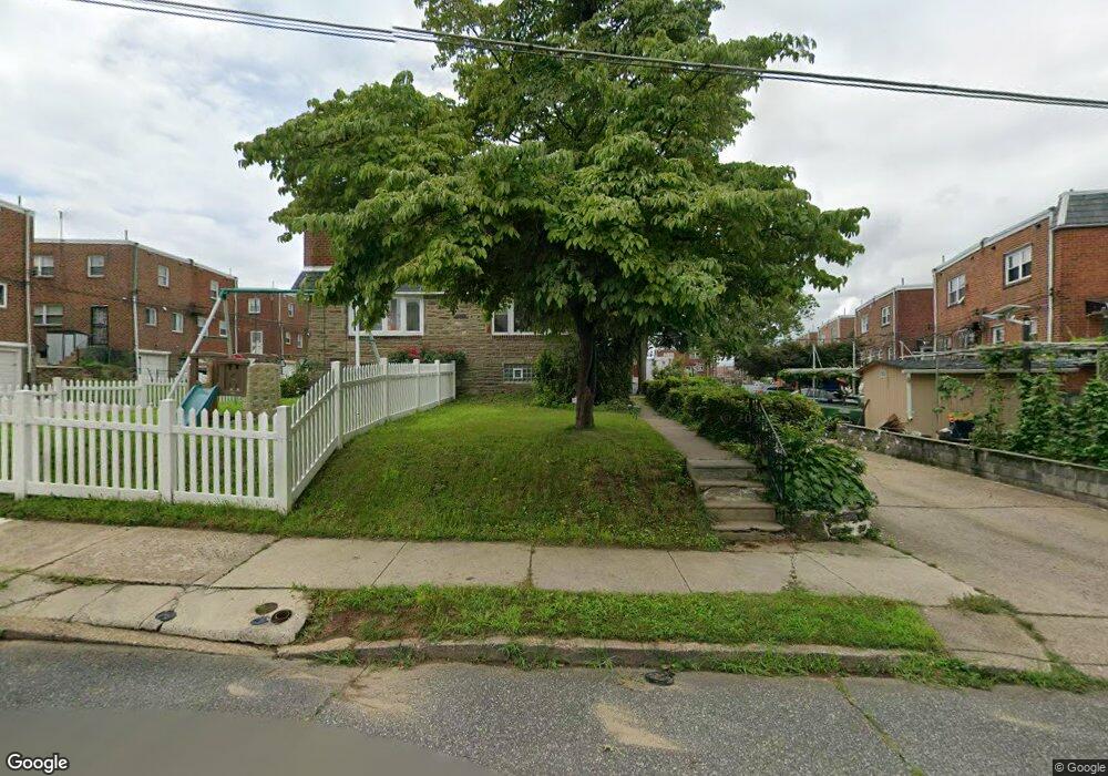
2910 Nesper St Philadelphia, PA 19152
Mayfair NeighborhoodEstimated Value: $365,000 - $378,000
--
Bed
--
Bath
1,472
Sq Ft
$254/Sq Ft
Est. Value
About This Home
This home is located at 2910 Nesper St, Philadelphia, PA 19152 and is currently estimated at $373,351, approximately $253 per square foot. 2910 Nesper St is a home with nearby schools including Lincoln High School, Northeast Community Propel Academy, and St. Matthew School.
Ownership History
Date
Name
Owned For
Owner Type
Purchase Details
Closed on
Aug 31, 2006
Sold by
Hirshmann Henry J and Hirshmann Elizabeth M
Bought by
Moultrie Nathaniel F and Moultrie Cynthia R
Current Estimated Value
Home Financials for this Owner
Home Financials are based on the most recent Mortgage that was taken out on this home.
Original Mortgage
$185,520
Outstanding Balance
$111,654
Interest Rate
6.71%
Mortgage Type
Purchase Money Mortgage
Estimated Equity
$261,697
Create a Home Valuation Report for This Property
The Home Valuation Report is an in-depth analysis detailing your home's value as well as a comparison with similar homes in the area
Home Values in the Area
Average Home Value in this Area
Purchase History
| Date | Buyer | Sale Price | Title Company |
|---|---|---|---|
| Moultrie Nathaniel F | $231,900 | None Available |
Source: Public Records
Mortgage History
| Date | Status | Borrower | Loan Amount |
|---|---|---|---|
| Open | Moultrie Nathaniel F | $185,520 |
Source: Public Records
Tax History Compared to Growth
Tax History
| Year | Tax Paid | Tax Assessment Tax Assessment Total Assessment is a certain percentage of the fair market value that is determined by local assessors to be the total taxable value of land and additions on the property. | Land | Improvement |
|---|---|---|---|---|
| 2025 | $4,573 | $406,500 | $81,300 | $325,200 |
| 2024 | $4,573 | $406,500 | $81,300 | $325,200 |
| 2023 | $4,573 | $326,700 | $65,340 | $261,360 |
| 2022 | $3,007 | $281,700 | $65,340 | $216,360 |
| 2021 | $3,637 | $0 | $0 | $0 |
| 2020 | $3,637 | $0 | $0 | $0 |
| 2019 | $3,311 | $0 | $0 | $0 |
| 2018 | $2,195 | $0 | $0 | $0 |
| 2017 | $2,615 | $0 | $0 | $0 |
| 2016 | $2,195 | $0 | $0 | $0 |
| 2015 | $2,101 | $0 | $0 | $0 |
| 2014 | -- | $186,800 | $78,523 | $108,277 |
| 2012 | -- | $24,928 | $4,631 | $20,297 |
Source: Public Records
Map
Nearby Homes
- 7416 Revere St
- 7418 Revere St
- 3036 Nesper St
- 3011 Teesdale St
- 3114 Nesper St
- 3034 Teesdale St
- 7233 Barnard Ave
- 2547 Shelmire Ave
- 3118 Cottman Ave
- 3219 Teesdale St
- 7703 Brous Ave
- 3222 Guilford St
- 7521 Calvert St
- 7525 Calvert St
- 3227 Cottman Ave
- 3243 Teesdale St
- 3136 Wellington St
- 3252 Cottman Ave
- 7246 Calvert St
- 7249 Rupert St
- 2912 Nesper St
- 7429 Brous Ave
- 7432 Battersby St
- 7430 Battersby St
- 7428 Battersby St
- 7427 Brous Ave
- 7424 Battersby St
- 7426 Battersby St
- 7425 Brous Ave
- 7423 Brous Ave
- 7421 Brous Ave
- 7419 Brous Ave
- 7501 Brous Ave
- 7500 Battersby St
- 7503 Brous Ave
- 7420 Battersby St
- 7418 Battersby St
- 7417 Brous Ave
- 7416 Battersby St
- 7415 Brous Ave