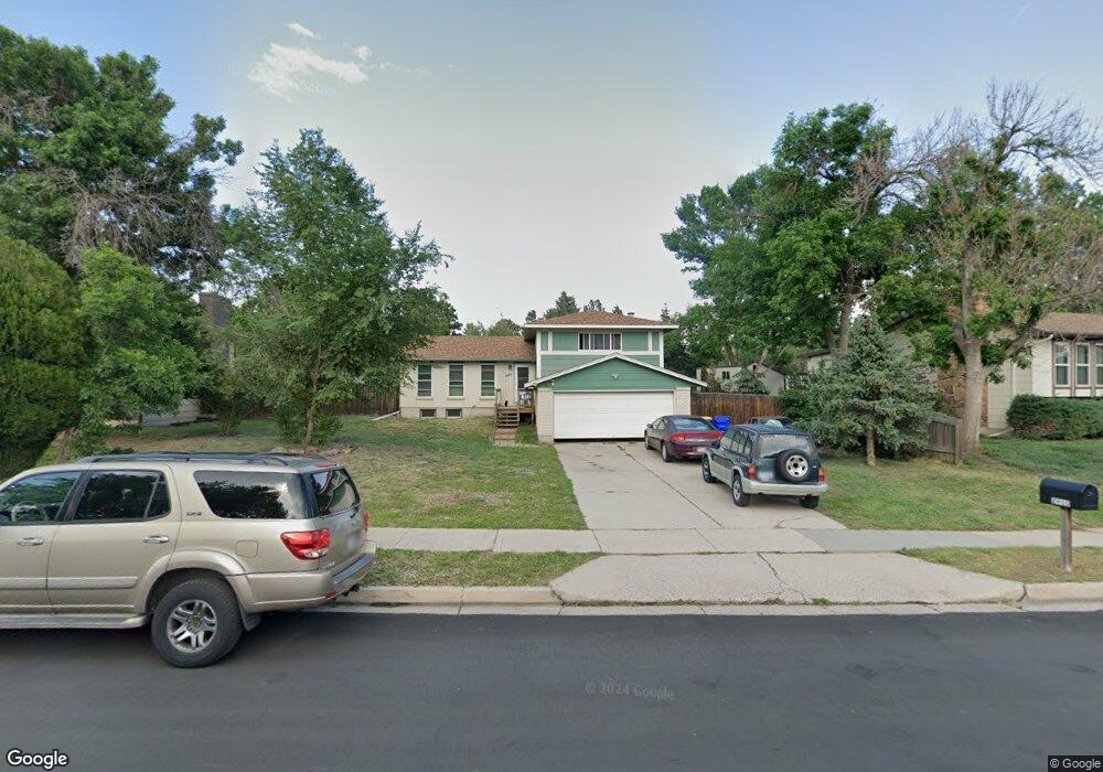
2910 Westwood Blvd Colorado Springs, CO 80918
Garden Ranch NeighborhoodEstimated Value: $425,811 - $508,000
4
Beds
3
Baths
1,403
Sq Ft
$342/Sq Ft
Est. Value
About This Home
This home is located at 2910 Westwood Blvd, Colorado Springs, CO 80918 and is currently estimated at $479,703, approximately $341 per square foot. 2910 Westwood Blvd is a home located in El Paso County with nearby schools including Grant Elementary School, Mann Middle School, and Mitchell High School.
Ownership History
Date
Name
Owned For
Owner Type
Purchase Details
Closed on
Oct 31, 1997
Sold by
Trujillo Richard E and Trujillo Yvette P
Bought by
Andrews Joseph Mitchell and Andrews Desirre Cathrine Sarozek
Current Estimated Value
Home Financials for this Owner
Home Financials are based on the most recent Mortgage that was taken out on this home.
Original Mortgage
$144,200
Outstanding Balance
$23,645
Interest Rate
7.27%
Mortgage Type
VA
Estimated Equity
$456,058
Purchase Details
Closed on
Aug 30, 1991
Bought by
Andrews Joseph M and Andrews Desirre C
Purchase Details
Closed on
Mar 9, 1989
Bought by
Andrews Joseph M and Andrews Desirre C
Purchase Details
Closed on
Oct 1, 1988
Bought by
Andrews Joseph M and Andrews Desirre C
Purchase Details
Closed on
Oct 1, 1983
Bought by
Andrews Joseph M and Andrews Desirre C
Create a Home Valuation Report for This Property
The Home Valuation Report is an in-depth analysis detailing your home's value as well as a comparison with similar homes in the area
Home Values in the Area
Average Home Value in this Area
Purchase History
| Date | Buyer | Sale Price | Title Company |
|---|---|---|---|
| Andrews Joseph Mitchell | $140,000 | Stewart Title | |
| Andrews Joseph M | $90,000 | -- | |
| Andrews Joseph M | -- | -- | |
| Andrews Joseph M | -- | -- | |
| Andrews Joseph M | -- | -- |
Source: Public Records
Mortgage History
| Date | Status | Borrower | Loan Amount |
|---|---|---|---|
| Open | Andrews Joseph Mitchell | $144,200 |
Source: Public Records
Tax History Compared to Growth
Tax History
| Year | Tax Paid | Tax Assessment Tax Assessment Total Assessment is a certain percentage of the fair market value that is determined by local assessors to be the total taxable value of land and additions on the property. | Land | Improvement |
|---|---|---|---|---|
| 2025 | $1,591 | $33,950 | -- | -- |
| 2024 | $1,109 | $33,060 | $6,270 | $26,790 |
| 2022 | $961 | $24,130 | $4,700 | $19,430 |
| 2021 | $1,043 | $24,820 | $4,830 | $19,990 |
| 2020 | $1,433 | $21,120 | $4,180 | $16,940 |
| 2019 | $1,426 | $21,120 | $4,180 | $16,940 |
| 2018 | $1,200 | $16,360 | $2,810 | $13,550 |
| 2017 | $1,137 | $16,360 | $2,810 | $13,550 |
| 2016 | $929 | $16,020 | $2,900 | $13,120 |
| 2015 | $925 | $16,020 | $2,900 | $13,120 |
| 2014 | $868 | $14,430 | $2,900 | $11,530 |
Source: Public Records
Map
Nearby Homes
- 4454 Ranch Cir
- 4410 Moonlight Dr
- 4434 Misty Dr
- 2832 Ridgeglen Way
- 4506 Ridgecrest Dr
- 4518 Misty Dr
- 4623 Ranch Cir
- 2727 Flintridge Dr
- 5034 El Camino Dr Unit 36
- 5034 El Camino Dr Unit 31
- 5034 El Camino Dr Unit 42
- 5030 El Camino Dr Unit 8
- 5030 El Camino Dr Unit 1
- 4140 Anitra Cir
- 4016 Goldenrod Dr
- 2520 Hamlet Ln Unit A
- 3010 Fireweed Dr
- 4886 Sonata Dr Unit C
- 4858 Sonata Dr Unit D
- 3710 Windflower Cir
- 2914 Westwood Blvd
- 2906 Westwood Blvd
- 2915 Flintridge Place
- 2919 Flintridge Place
- 2918 Westwood Blvd
- 2911 Flintridge Place
- 2902 Westwood Blvd
- 4408 Flintridge Dr
- 2907 Flintridge Place
- 2911 Westwood Blvd
- 2909 Westwood Blvd
- 2915 Westwood Blvd
- 2818 Westwood Blvd
- 2905 Westwood Blvd
- 2918 Flintridge Place
- 2919 Westwood Blvd
- 2903 Flintridge Place
- 2817 Westwood Blvd
- 2914 Flintridge Place
- 2923 Westwood Blvd