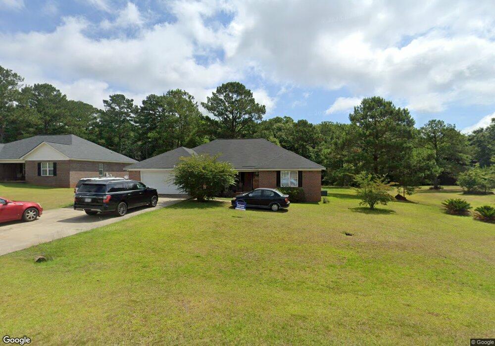
2911 Harvest Ln Albany, GA 31721
Estimated Value: $224,000 - $274,000
4
Beds
2
Baths
2,095
Sq Ft
$116/Sq Ft
Est. Value
About This Home
This home is located at 2911 Harvest Ln, Albany, GA 31721 and is currently estimated at $244,003, approximately $116 per square foot. 2911 Harvest Ln is a home located in Dougherty County with nearby schools including Live Oak Elementary School, Merry Acres Middle School, and Westover High School.
Ownership History
Date
Name
Owned For
Owner Type
Purchase Details
Closed on
Feb 13, 2006
Sold by
Miller Kennedy W
Bought by
Miller Melissa J
Current Estimated Value
Home Financials for this Owner
Home Financials are based on the most recent Mortgage that was taken out on this home.
Original Mortgage
$163,706
Outstanding Balance
$91,832
Interest Rate
6.14%
Mortgage Type
FHA
Estimated Equity
$152,171
Purchase Details
Closed on
Jan 26, 2006
Sold by
Tim Coley Construction Inc
Bought by
Miller Kennedy W
Home Financials for this Owner
Home Financials are based on the most recent Mortgage that was taken out on this home.
Original Mortgage
$163,706
Outstanding Balance
$91,832
Interest Rate
6.14%
Mortgage Type
FHA
Estimated Equity
$152,171
Purchase Details
Closed on
Sep 19, 2005
Sold by
Musgrove & Burnsed Llp
Bought by
Tim Coley Construction Inc
Purchase Details
Closed on
May 17, 2004
Sold by
Burnsed Musgrove S and Burnsed Malcom
Bought by
Musgrove And Burnsed Llc
Create a Home Valuation Report for This Property
The Home Valuation Report is an in-depth analysis detailing your home's value as well as a comparison with similar homes in the area
Home Values in the Area
Average Home Value in this Area
Purchase History
| Date | Buyer | Sale Price | Title Company |
|---|---|---|---|
| Miller Melissa J | -- | -- | |
| Miller Kennedy W | $165,000 | -- | |
| Tim Coley Construction Inc | -- | -- | |
| Musgrove And Burnsed Llc | -- | -- |
Source: Public Records
Mortgage History
| Date | Status | Borrower | Loan Amount |
|---|---|---|---|
| Open | Miller Kennedy W | $163,706 |
Source: Public Records
Tax History Compared to Growth
Tax History
| Year | Tax Paid | Tax Assessment Tax Assessment Total Assessment is a certain percentage of the fair market value that is determined by local assessors to be the total taxable value of land and additions on the property. | Land | Improvement |
|---|---|---|---|---|
| 2024 | $3,135 | $67,720 | $7,200 | $60,520 |
| 2023 | $2,223 | $67,720 | $7,200 | $60,520 |
| 2022 | $3,073 | $67,720 | $7,200 | $60,520 |
| 2021 | $2,849 | $67,720 | $7,200 | $60,520 |
| 2020 | $2,856 | $67,720 | $7,200 | $60,520 |
| 2019 | $2,867 | $67,720 | $7,200 | $60,520 |
| 2018 | $2,879 | $67,720 | $7,200 | $60,520 |
| 2017 | $2,682 | $67,720 | $7,200 | $60,520 |
| 2016 | $2,683 | $67,720 | $7,200 | $60,520 |
| 2015 | $2,691 | $67,720 | $7,200 | $60,520 |
| 2014 | $2,657 | $67,720 | $7,200 | $60,520 |
Source: Public Records
Map
Nearby Homes
- 3006 Harvest Ln
- 2915 Autumn Ave
- 604 Shamrock Dr
- 3019 Winterwood Ave
- 219 Lockett Station Rd
- 502 Navajo Ct
- 512 Longbow Dr
- 627 Longbow Dr
- 3524 Moss Island Ct
- 834 Lockett Station Rd
- 838 Lockett Station Rd
- 902 Lockett Station Rd
- 906 Lockett Station Rd
- 611 Bison Ln
- 3108 Wax Myrtle Ln
- 1900 Covey Rd
- 3104 Fernridge Dr
- 4428 Gillionville Rd
- 120 Mossydale Ln
- 2802 Stonewater Dr
- 2913 Harvest Ln
- 2909 Harvest Ln
- 2915 Harvest Ln
- 2907 Harvest Ln
- 2910 Harvest Ln
- 2912 Harvest Ln
- 2908 Harvest Ln
- 2914 Harvest Ln
- 2905 Harvest Ln
- 2917 Harvest Ln
- 2906 Harvest Ln
- 2904 Harvest Ln
- 2903 Harvest Ln
- 3000 Phillips Dr
- 3002 Phillips Dr
- 2920 Phillips Dr
- 739 Shamrock Dr
- 2902 Harvest Ln
- 737 Shamrock Dr
- 701 Center Ridge Ct