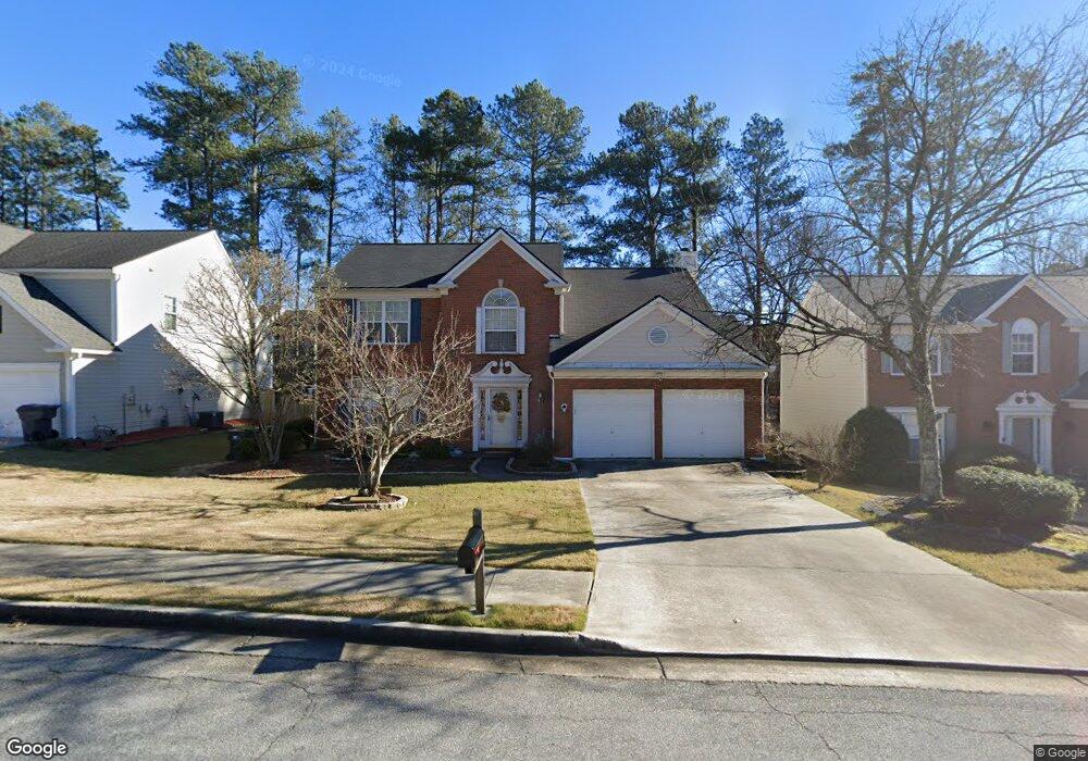
2911 Stanstead Cir Unit 50 Norcross, GA 30071
Estimated Value: $448,735 - $539,000
4
Beds
3
Baths
2,177
Sq Ft
$228/Sq Ft
Est. Value
About This Home
This home is located at 2911 Stanstead Cir Unit 50, Norcross, GA 30071 and is currently estimated at $495,684, approximately $227 per square foot. 2911 Stanstead Cir Unit 50 is a home located in Gwinnett County with nearby schools including Norcross Elementary School, Summerour Middle School, and Norcross High School.
Ownership History
Date
Name
Owned For
Owner Type
Purchase Details
Closed on
Jan 26, 2018
Sold by
Le
Bought by
Ly Kevin
Current Estimated Value
Purchase Details
Closed on
Jul 31, 1997
Sold by
Pulte Home Corp
Bought by
Le Tap and Le Dung P
Home Financials for this Owner
Home Financials are based on the most recent Mortgage that was taken out on this home.
Original Mortgage
$82,000
Interest Rate
7.61%
Mortgage Type
New Conventional
Create a Home Valuation Report for This Property
The Home Valuation Report is an in-depth analysis detailing your home's value as well as a comparison with similar homes in the area
Home Values in the Area
Average Home Value in this Area
Purchase History
| Date | Buyer | Sale Price | Title Company |
|---|---|---|---|
| Ly Kevin | $269,750 | -- | |
| Le Tap | $155,600 | -- |
Source: Public Records
Mortgage History
| Date | Status | Borrower | Loan Amount |
|---|---|---|---|
| Previous Owner | Le Tap | $82,000 |
Source: Public Records
Tax History
| Year | Tax Paid | Tax Assessment Tax Assessment Total Assessment is a certain percentage of the fair market value that is determined by local assessors to be the total taxable value of land and additions on the property. | Land | Improvement |
|---|---|---|---|---|
| 2025 | $4,727 | $186,920 | $38,000 | $148,920 |
| 2024 | $4,649 | $175,920 | $39,600 | $136,320 |
| 2023 | $4,649 | $175,920 | $39,600 | $136,320 |
| 2022 | $4,229 | $154,760 | $33,680 | $121,080 |
| 2021 | $3,461 | $113,800 | $22,400 | $91,400 |
| 2020 | $3,362 | $107,880 | $22,400 | $85,480 |
| 2019 | $4,242 | $107,880 | $22,400 | $85,480 |
| 2018 | $3,533 | $106,720 | $22,400 | $84,320 |
| 2016 | $3,065 | $92,680 | $20,000 | $72,680 |
| 2015 | $3,585 | $86,320 | $16,400 | $69,920 |
| 2014 | -- | $86,320 | $16,400 | $69,920 |
Source: Public Records
Map
Nearby Homes
- 3118 Stanstead Ct
- 916 Bishops Crossing
- 746 Oak Terrace
- 3192 Monarch Pine Dr
- 1963 Shetley Creek Dr
- 2714 Shetley Creek Dr
- 2897 Smith Ridge Trace
- 3360 Smith Ridge Trace NW
- 5250 Reps Trace
- 5750 Reps Trace
- 3105 Delachaise Way Unit 22
- 5764 Reps Trace Unit 1
- 505 Cochran Dr
- 5587 Trace Views Dr Unit 8
- 5589 Trace Views Dr
- 467 Lawrenceville St
- 2468 Whistle Stop Dr
- 435 Webb Dr
- 616 Summer Place Unit 616
- 231 Sunset Hills Dr
- 2911 Stanstead Cir
- 2915 Stanstead Cir
- 2907 Stanstead Cir
- 2919 Stanstead Cir
- 2824 Langford Commons Dr Unit 2824
- 2822 Langford Commons Dr Unit 9
- 2820 Langford Commons Dr
- 2826 Langford Commons Dr
- 2828 Langford Commons Dr
- 2830 Langford Commons Dr Unit 13
- 2903 Stanstead Cir
- 2832 Langford Commons Dr Unit 14
- 2814 Langford Commons Dr Unit 2814
- 2814 Langford Commons Dr
- 2814 Langford Commons Dr Unit 7
- 2814 Langford Commons Dr NW
- 2814 Langford Commons Dr NW Unit 2814
- 2904 Stanstead Cir
- 2812 Langford Commons Dr
- 2908 Stanstead Cir
Your Personal Tour Guide
Ask me questions while you tour the home.