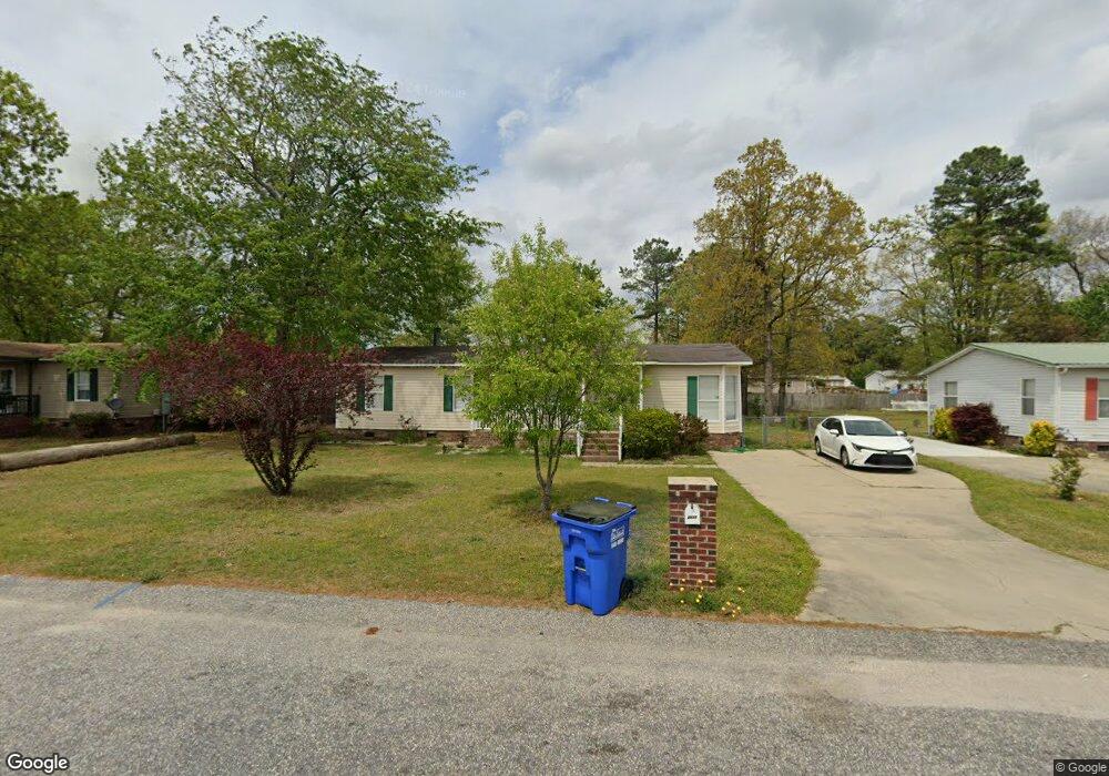
2912 Donegal Dr Raeford, NC 28376
Estimated Value: $52,713 - $167,000
3
Beds
2
Baths
1,404
Sq Ft
$95/Sq Ft
Est. Value
About This Home
This home is located at 2912 Donegal Dr, Raeford, NC 28376 and is currently estimated at $133,178, approximately $94 per square foot. 2912 Donegal Dr is a home located in Hoke County with nearby schools including Upchurch Elementary School, East Hoke Middle, and Hoke County High.
Ownership History
Date
Name
Owned For
Owner Type
Purchase Details
Closed on
Jan 11, 2020
Sold by
Santos Omar and Santos Jeannette
Bought by
Mora Abigail
Current Estimated Value
Purchase Details
Closed on
Feb 14, 2007
Sold by
Secretary Of Veterans Affairs
Bought by
Santos Omar
Home Financials for this Owner
Home Financials are based on the most recent Mortgage that was taken out on this home.
Original Mortgage
$48,450
Interest Rate
6.19%
Purchase Details
Closed on
Jan 20, 2006
Sold by
Diaz Luis F and Diaz Elynet T
Bought by
Secretary Of Veterans Affairs
Create a Home Valuation Report for This Property
The Home Valuation Report is an in-depth analysis detailing your home's value as well as a comparison with similar homes in the area
Home Values in the Area
Average Home Value in this Area
Purchase History
| Date | Buyer | Sale Price | Title Company |
|---|---|---|---|
| Mora Abigail | $36,000 | None Available | |
| Santos Omar | -- | None Available | |
| Secretary Of Veterans Affairs | -- | None Available |
Source: Public Records
Mortgage History
| Date | Status | Borrower | Loan Amount |
|---|---|---|---|
| Previous Owner | Santos Omar | $48,450 |
Source: Public Records
Tax History Compared to Growth
Tax History
| Year | Tax Paid | Tax Assessment Tax Assessment Total Assessment is a certain percentage of the fair market value that is determined by local assessors to be the total taxable value of land and additions on the property. | Land | Improvement |
|---|---|---|---|---|
| 2024 | $702 | $70,560 | $20,000 | $50,560 |
| 2023 | $702 | $70,560 | $20,000 | $50,560 |
| 2022 | $690 | $70,560 | $20,000 | $50,560 |
| 2021 | $0 | $56,300 | $10,000 | $46,300 |
| 2020 | $595 | $56,300 | $10,000 | $46,300 |
| 2019 | $595 | $56,300 | $10,000 | $46,300 |
| 2018 | $595 | $56,300 | $10,000 | $46,300 |
| 2017 | $595 | $56,300 | $10,000 | $46,300 |
| 2016 | $586 | $56,300 | $10,000 | $46,300 |
| 2015 | $586 | $56,300 | $10,000 | $46,300 |
| 2014 | $566 | $56,300 | $10,000 | $46,300 |
| 2013 | -- | $67,720 | $19,000 | $48,720 |
Source: Public Records
Map
Nearby Homes
- 2910 Donegal Dr
- 2913 Donegal Dr
- 2464 O'Hara Dr
- 2803 Kilkenny Dr
- 701 McDougald Dr
- 562 Southerland Peak Dr
- 340 Marlborough (Lot 434) St
- 594 Southerland Peak Dr
- 328 Marlborough (Lot 435) St
- 578 Southerland Peak Dr
- 1013 Dunvegan Dr
- 289 Brickhill Dr
- 102 Washington Ct
- 634 Southerland Peak Dr
- 662 Southerland Peak Dr
- 270 Marlborough (Lot 440) St
- 548 Southerland Peak Dr
- 260 Marlborough (Lot 441) St
- 620 Southerland Peak Dr
- 2914 Donegal Dr
- 2908 Donegal Dr
- 2916 Donegal Dr
- 2445 Ohara Dr
- 2443 Ohara Dr
- 2447 Ohara Dr
- 2911 Donegal Dr
- 2441 Ohara Dr
- 2449 Ohara Dr
- 2909 Donegal Dr
- 2906 Donegal Dr
- 2915 Donegal Dr
- 2907 Donegal Dr
- 2918 Donegal Dr
- 2439 Ohara Dr
- 2451 Ohara Dr
- 2439 O'Hara Dr
- 2917 Donegal Dr
- 2451 O'Hara Dr
- 2904 Donegal Dr