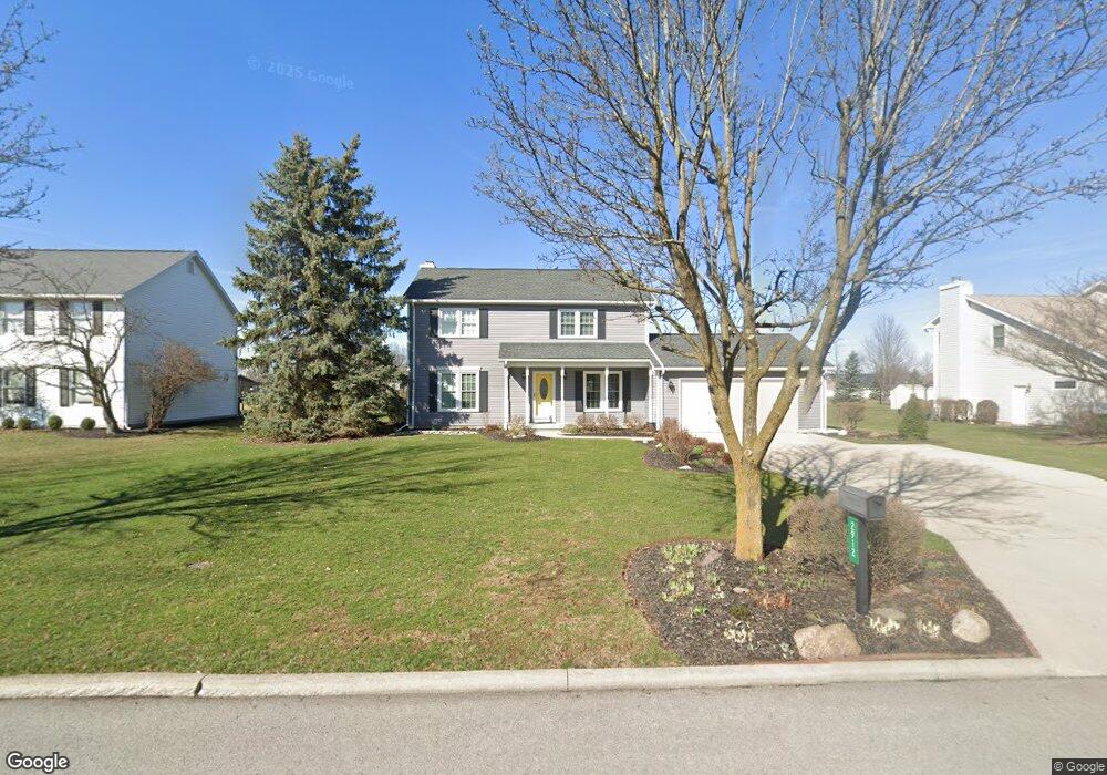
2912 Innisbrook Dr Findlay, OH 45840
Estimated Value: $366,794 - $417,000
4
Beds
3
Baths
2,038
Sq Ft
$193/Sq Ft
Est. Value
About This Home
This home is located at 2912 Innisbrook Dr, Findlay, OH 45840 and is currently estimated at $393,949, approximately $193 per square foot. 2912 Innisbrook Dr is a home located in Hancock County with nearby schools including Liberty-Benton Elementary School, Liberty-Benton Middle School, and Liberty-Benton High School.
Ownership History
Date
Name
Owned For
Owner Type
Purchase Details
Closed on
Sep 4, 2019
Sold by
Budde Richard P and Budde Danie L
Bought by
Budde Richard P and Budde Danie L
Current Estimated Value
Purchase Details
Closed on
May 6, 1994
Bought by
Budde Richard P and Budde Danie L
Purchase Details
Closed on
Sep 21, 1990
Bought by
Wysmierski Raymond S
Purchase Details
Closed on
Nov 21, 1989
Bought by
Findlay Hillcrest Golf Crs
Create a Home Valuation Report for This Property
The Home Valuation Report is an in-depth analysis detailing your home's value as well as a comparison with similar homes in the area
Purchase History
| Date | Buyer | Sale Price | Title Company |
|---|---|---|---|
| Budde Richard P | -- | None Available | |
| Budde Richard P | $172,500 | -- | |
| Wysmierski Raymond S | $23,500 | -- | |
| Findlay Hillcrest Golf Crs | -- | -- |
Source: Public Records
Tax History
| Year | Tax Paid | Tax Assessment Tax Assessment Total Assessment is a certain percentage of the fair market value that is determined by local assessors to be the total taxable value of land and additions on the property. | Land | Improvement |
|---|---|---|---|---|
| 2024 | $3,698 | $97,340 | $18,520 | $78,820 |
| 2023 | $3,613 | $97,340 | $18,520 | $78,820 |
| 2022 | $3,579 | $97,340 | $18,520 | $78,820 |
| 2021 | $3,345 | $80,420 | $18,520 | $61,900 |
| 2020 | $3,373 | $80,420 | $18,520 | $61,900 |
| 2019 | $3,239 | $80,420 | $18,520 | $61,900 |
| 2018 | $2,681 | $75,130 | $13,230 | $61,900 |
| 2017 | $1,383 | $75,130 | $13,230 | $61,900 |
| 2016 | $2,685 | $75,130 | $13,230 | $61,900 |
| 2015 | $2,190 | $59,800 | $12,500 | $47,300 |
| 2014 | $2,210 | $59,800 | $12,500 | $47,300 |
| 2012 | $2,308 | $59,800 | $12,500 | $47,300 |
Source: Public Records
Map
Nearby Homes
- 3106 Saddlebrook
- 3018 Gleneagle Dr
- 6535 Silver Lake Dr
- 10321 Wheatfield Dr
- 3237 Gleneagle Dr
- 0 County Road 95 Unit 6097574
- 925 W Melrose Ave
- 9894 Smokies Way
- 3815 Forest Trail Dr
- 0 County Road 140
- 0 Bushwillow Dr Or Rock Candy Rd Unit Lot 157
- 724 Edith Ave
- 0 Rock Candy Rd Or Bushwillow Dr Unit Lot 173
- 701 W Melrose Ave
- 0 Rock Candy Rd Unit Lot 159
- 0 Rock Candy Rd Unit Lot 170
- 0 Rock Candy Rd Unit Lot 172 206819
- 0 Rock Candy Rd Unit Lot 162
- 0 Rock Candy Rd Unit Lot 171
- 0 Rock Candy Rd Unit Lot 168
- 2906 Innisbrook Dr
- 2918 Innisbrook Dr
- 2907 Turnberry Dr
- 2915 Turnberry Dr
- 2900 Innisbrook Dr
- 2924 Innisbrook Dr
- 2909 Innisbrook Dr
- 2915 Innisbrook Dr
- 2901 Innisbrook Dr
- 2921 Innisbrook Dr
- 2901 Turnberry Dr
- 2812 Innisbrook Dr
- 2921 Turnberry Dr
- 2932 Innisbrook Dr
- 2927 Innisbrook Dr
- 2906 Saddlebrook
- 2806 Innisbrook Dr
- 2934 Saddlebrook
- 2940 Saddlebrook
- 2809 Innisbrook Dr
Your Personal Tour Guide
Ask me questions while you tour the home.