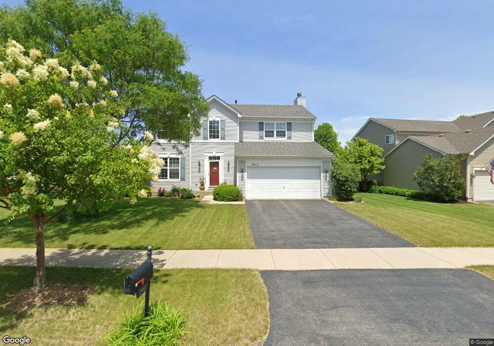
2912 Lundquist Dr Aurora, IL 60503
Far Southeast NeighborhoodEstimated Value: $466,000 - $501,000
3
Beds
3
Baths
2,055
Sq Ft
$232/Sq Ft
Est. Value
About This Home
This home is located at 2912 Lundquist Dr, Aurora, IL 60503 and is currently estimated at $476,858, approximately $232 per square foot. 2912 Lundquist Dr is a home located in Kendall County with nearby schools including Wolfs Crossing Elementary School, Bednarcik Jr. High School, and Oswego East High School.
Ownership History
Date
Name
Owned For
Owner Type
Purchase Details
Closed on
May 30, 2008
Sold by
Schuette Jason and Schuette Heather
Bought by
Daguinsin Thomas and Daguinsin Janice
Current Estimated Value
Home Financials for this Owner
Home Financials are based on the most recent Mortgage that was taken out on this home.
Original Mortgage
$187,950
Outstanding Balance
$120,853
Interest Rate
6.09%
Mortgage Type
Purchase Money Mortgage
Estimated Equity
$356,005
Purchase Details
Closed on
Mar 18, 2005
Sold by
The Ryland Group Inc
Bought by
Schuette Jason and Schuette Heather
Home Financials for this Owner
Home Financials are based on the most recent Mortgage that was taken out on this home.
Original Mortgage
$219,928
Interest Rate
6.13%
Mortgage Type
Fannie Mae Freddie Mac
Create a Home Valuation Report for This Property
The Home Valuation Report is an in-depth analysis detailing your home's value as well as a comparison with similar homes in the area
Home Values in the Area
Average Home Value in this Area
Purchase History
| Date | Buyer | Sale Price | Title Company |
|---|---|---|---|
| Daguinsin Thomas | $273,000 | Chicago Title Insurance Co | |
| Schuette Jason | $275,000 | Ryland Title Company |
Source: Public Records
Mortgage History
| Date | Status | Borrower | Loan Amount |
|---|---|---|---|
| Open | Daguinsin Thomas | $187,950 | |
| Previous Owner | Schuette Jason | $219,928 | |
| Closed | Schuette Jason | $54,982 |
Source: Public Records
Tax History
| Year | Tax Paid | Tax Assessment Tax Assessment Total Assessment is a certain percentage of the fair market value that is determined by local assessors to be the total taxable value of land and additions on the property. | Land | Improvement |
|---|---|---|---|---|
| 2024 | $10,903 | $128,720 | $30,348 | $98,372 |
| 2023 | $9,821 | $113,912 | $26,857 | $87,055 |
| 2022 | $9,821 | $103,556 | $24,415 | $79,141 |
| 2021 | $9,587 | $97,694 | $23,033 | $74,661 |
| 2020 | $9,304 | $93,936 | $22,147 | $71,789 |
| 2019 | $9,082 | $89,872 | $22,147 | $67,725 |
| 2018 | $8,356 | $83,307 | $20,529 | $62,778 |
| 2017 | $8,120 | $77,136 | $19,008 | $58,128 |
| 2016 | $7,901 | $74,169 | $18,277 | $55,892 |
| 2015 | $8,022 | $72,009 | $17,745 | $54,264 |
| 2014 | -- | $67,933 | $16,741 | $51,192 |
| 2013 | -- | $68,619 | $16,910 | $51,709 |
Source: Public Records
Map
Nearby Homes
- 3017 Lundquist Dr
- 2413 Dickens Dr
- 2566 Rourke Dr
- 2263 Shiloh Dr Unit 2
- 2812 Stuart Kaplan Ct
- 2197 Wilson Creek Cir Unit 3
- 3146 Peyton Cir
- 3144 Peyton Cir
- 1851 Indian Hill Ln Unit 4083
- 115 Henderson St
- 1823 Indian Hill Ln Unit 4102
- Meadowlark Plan at Hudson Pointe - II - Horizon Series
- Starling Plan at Hudson Pointe - II - Horizon Series
- Townsend Plan at Hudson Pointe - II - Horizon Series
- Marianne Plan at Hudson Pointe - II - Townhome Series
- Darcy Plan at Hudson Pointe - II - Townhome Series
- Charlotte Plan at Hudson Pointe - II - Townhome Series
- Brighton Plan at Hudson Pointe - II - Horizon Series
- Hawthorne Plan at Hudson Pointe - II - Horizon Series
- Glenwood Plan at Hudson Pointe - II - Horizon Series
- 2902 Lundquist Dr
- 2922 Lundquist Dr
- 2892 Lundquist Dr
- 2893 Rourke Dr
- 2883 Rourke Dr
- 2882 Lundquist Dr Unit 574
- 2872 Lundquist Dr
- 2863 Rourke Dr
- 2853 Rourke Dr
- 2862 Lundquist Dr
- 2884 Rourke Dr
- 2874 Rourke Dr
- 2843 Rourke Dr
- 2852 Lundquist Dr
- 2864 Rourke Dr
- 2854 Rourke Dr
- 2833 Rourke Dr
- 2842 Lundquist Dr
- 2844 Rourke Dr
- 2823 Rourke Dr