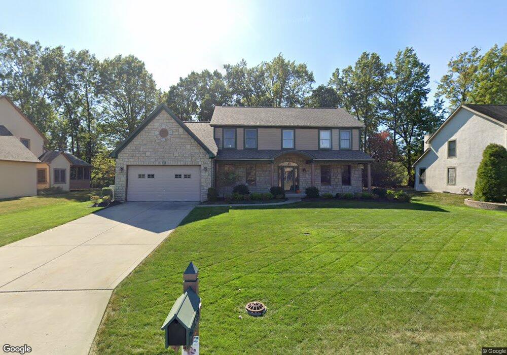
2912 Nantucket Dr Lewis Center, OH 43035
Orange NeighborhoodEstimated Value: $610,000 - $676,000
4
Beds
4
Baths
4,267
Sq Ft
$152/Sq Ft
Est. Value
About This Home
This home is located at 2912 Nantucket Dr, Lewis Center, OH 43035 and is currently estimated at $647,579, approximately $151 per square foot. 2912 Nantucket Dr is a home located in Delaware County with nearby schools including Alum Creek Elementary School, Olentangy Shanahan Middle School, and Olentangy High School.
Ownership History
Date
Name
Owned For
Owner Type
Purchase Details
Closed on
Aug 2, 2024
Sold by
Rhoades Ellen M
Bought by
Holt Phillip and Holt Lisa
Current Estimated Value
Home Financials for this Owner
Home Financials are based on the most recent Mortgage that was taken out on this home.
Original Mortgage
$359,600
Outstanding Balance
$355,523
Interest Rate
6.86%
Mortgage Type
New Conventional
Estimated Equity
$292,056
Purchase Details
Closed on
Sep 11, 2004
Sold by
Rhoades Patrick L and Rhoades Ellen M
Bought by
Rhoades Ellen M
Purchase Details
Closed on
Mar 9, 2004
Sold by
Davenport Caleb Thomas and Davenport Susan A
Bought by
Rhoades Patrick L and Rhoades Ellen M
Home Financials for this Owner
Home Financials are based on the most recent Mortgage that was taken out on this home.
Original Mortgage
$345,800
Interest Rate
5.78%
Mortgage Type
Purchase Money Mortgage
Purchase Details
Closed on
Oct 15, 1997
Sold by
Evergreen Land Co
Bought by
Musgrave Const Co Inc
Home Financials for this Owner
Home Financials are based on the most recent Mortgage that was taken out on this home.
Original Mortgage
$220,000
Interest Rate
7.65%
Mortgage Type
New Conventional
Create a Home Valuation Report for This Property
The Home Valuation Report is an in-depth analysis detailing your home's value as well as a comparison with similar homes in the area
Home Values in the Area
Average Home Value in this Area
Purchase History
| Date | Buyer | Sale Price | Title Company |
|---|---|---|---|
| Holt Phillip | $630,000 | Title Connect | |
| Rhoades Ellen M | -- | -- | |
| Rhoades Patrick L | $364,000 | -- | |
| Musgrave Const Co Inc | $55,000 | -- |
Source: Public Records
Mortgage History
| Date | Status | Borrower | Loan Amount |
|---|---|---|---|
| Open | Holt Phillip | $359,600 | |
| Previous Owner | Rhoades Patrick L | $345,800 | |
| Previous Owner | Musgrave Const Co Inc | $220,000 |
Source: Public Records
Tax History Compared to Growth
Tax History
| Year | Tax Paid | Tax Assessment Tax Assessment Total Assessment is a certain percentage of the fair market value that is determined by local assessors to be the total taxable value of land and additions on the property. | Land | Improvement |
|---|---|---|---|---|
| 2024 | $9,417 | $170,770 | $35,350 | $135,420 |
| 2023 | $9,451 | $170,770 | $35,350 | $135,420 |
| 2022 | $9,049 | $132,970 | $24,500 | $108,470 |
| 2021 | $9,100 | $132,970 | $24,500 | $108,470 |
| 2020 | $9,143 | $132,970 | $24,500 | $108,470 |
| 2019 | $8,163 | $123,100 | $24,500 | $98,600 |
| 2018 | $8,200 | $123,100 | $24,500 | $98,600 |
| 2017 | $7,835 | $116,700 | $21,880 | $94,820 |
| 2016 | $8,281 | $116,700 | $21,880 | $94,820 |
| 2015 | $7,555 | $116,700 | $21,880 | $94,820 |
| 2014 | $7,663 | $116,700 | $21,880 | $94,820 |
| 2013 | $7,840 | $116,700 | $21,880 | $94,820 |
Source: Public Records
Map
Nearby Homes
- 2567 Carmel Dr
- 2840 Waukeegan Ave
- 3177 Shoreline Dr
- 2946 Lewis Center Rd
- 2868 Lewis Center Rd
- 5669 Maplewood Ct
- 2515 Coltsbridge Dr
- 6440 Morningside Dr
- 6566 Morningside Dr
- 1915 Myrtle St
- 5491 Sandy Dr
- 2070 Alum Village Dr
- 2771 Abbey Knoll Dr
- 1929 Rocklake Ct
- 2948 Prairie Dr
- 1811 Ivy St
- 2241 Red Oak St
- 5737 Butternut Dr
- 3144 Abbey Knoll Dr
- 1654 Sunflower St
- 2890 Nantucket Dr
- 2934 Nantucket Dr
- 2870 Nantucket Dr
- 2954 Nantucket Dr
- 5964 Windward Ct
- 2930 Waterford Dr
- 2863 Barharbor Ct
- 5955 Windward Ct
- 2900 Waterford Dr
- 2850 Nantucket Dr
- 2976 Nantucket Dr
- 2851 Barharbor Ct
- 2960 Waterford Dr
- 2873 Nantucket Dr
- 5959 Windward Ct
- 2880 Waterford Dr
- 2979 Nantucket Dr
- 2849 Nantucket Dr
- 2828 Nantucket Dr
- 3004 Nantucket Dr