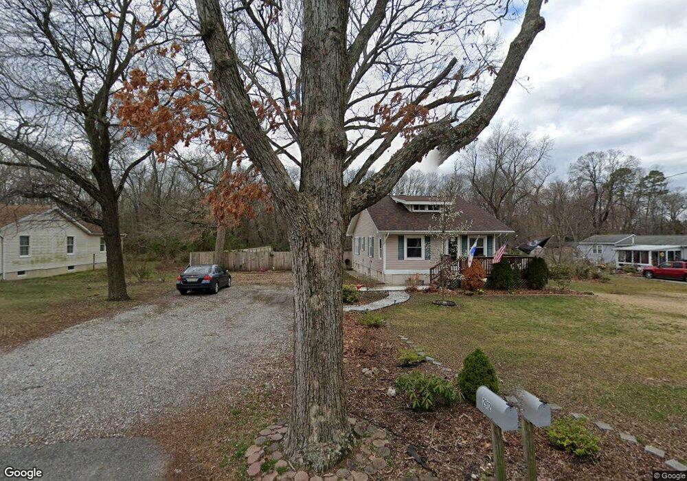
2912 Wilson Ave Vineland, NJ 08360
Estimated Value: $222,354 - $318,000
--
Bed
--
Bath
1,464
Sq Ft
$192/Sq Ft
Est. Value
About This Home
This home is located at 2912 Wilson Ave, Vineland, NJ 08360 and is currently estimated at $281,589, approximately $192 per square foot. 2912 Wilson Ave is a home located in Cumberland County with nearby schools including Dr. William Mennies School, Landis Middle School, and Vineland Senior High School.
Ownership History
Date
Name
Owned For
Owner Type
Purchase Details
Closed on
Jun 29, 2001
Sold by
Heffner John P
Bought by
Jones Lisa M
Current Estimated Value
Home Financials for this Owner
Home Financials are based on the most recent Mortgage that was taken out on this home.
Original Mortgage
$73,892
Outstanding Balance
$28,600
Interest Rate
7.2%
Mortgage Type
FHA
Estimated Equity
$252,989
Create a Home Valuation Report for This Property
The Home Valuation Report is an in-depth analysis detailing your home's value as well as a comparison with similar homes in the area
Home Values in the Area
Average Home Value in this Area
Purchase History
| Date | Buyer | Sale Price | Title Company |
|---|---|---|---|
| Jones Lisa M | $74,500 | -- |
Source: Public Records
Mortgage History
| Date | Status | Borrower | Loan Amount |
|---|---|---|---|
| Open | Jones Lisa M | $73,892 |
Source: Public Records
Tax History Compared to Growth
Tax History
| Year | Tax Paid | Tax Assessment Tax Assessment Total Assessment is a certain percentage of the fair market value that is determined by local assessors to be the total taxable value of land and additions on the property. | Land | Improvement |
|---|---|---|---|---|
| 2025 | $4,060 | $127,500 | $38,700 | $88,800 |
| 2024 | $4,060 | $127,500 | $38,700 | $88,800 |
| 2023 | $4,033 | $127,500 | $38,700 | $88,800 |
| 2022 | $3,913 | $127,500 | $38,700 | $88,800 |
| 2021 | $3,614 | $127,500 | $38,700 | $88,800 |
| 2020 | $3,732 | $127,500 | $38,700 | $88,800 |
| 2019 | $3,681 | $127,500 | $38,700 | $88,800 |
| 2018 | $3,584 | $127,500 | $38,700 | $88,800 |
| 2017 | $3,404 | $127,500 | $38,700 | $88,800 |
| 2016 | $3,284 | $127,500 | $38,700 | $88,800 |
| 2015 | $3,163 | $127,500 | $38,700 | $88,800 |
| 2014 | $2,991 | $127,500 | $38,700 | $88,800 |
Source: Public Records
Map
Nearby Homes
- 2919 S Delsea Dr
- 2943 S Delsea Dr
- 2640 Brunetta Dr
- 3111 S East Blvd
- 997 W Sherman Ave
- 800 College Dr
- 800 College Dr Unit 42
- 1011 W Sherman Ave
- 2280 Delsea
- 500 Jennifer Ln
- 1291 W Sherman Ave Unit UPPER
- 1291 W Sherman Ave Unit LOWER
- 3226 S Main Rd
- 2291 Delmar Ave
- 5100 S Delsea Dr
- 668 W Elmer Rd
- 0 W Sherman Ave
- 2652 S Main Rd
- 1920 S Delsea Dr Unit 21
- 3715 S Main Rd
- 2936 Wilson Ave
- 2894 Wilson Ave
- 2921 Wilson Ave
- 2952 Wilson Ave
- 2879 Wilson Ave
- 2870 Wilson Ave
- 2963 Wilson Ave
- 2974 Wilson Ave
- 2878 Wilson Ave
- 276 Hendricks Rd
- 367 W Sherman Ave
- 387 W Sherman Ave
- 238 Hendricks Rd
- 363 W Sherman Ave
- 315 W Sherman Ave
- 247 Hendricks Rd
- 295 W Sherman Ave
- 425 W Sherman Ave
- 265 W Sherman Ave
- 231 Hendricks Rd